Property Record
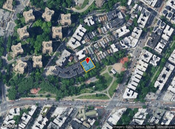
143 Father Zeiser Pl, Bronx, NY 10468


NEARBY LISTINGS FOR SALE OR LEASE
Property Detail
143 Father Zeiser Pl
03219-0228
Map 112 Lots Estate Moses Devoe Deceased
Apartment
Bronx
X
New York
3604970082F
228
2024
0.28 AC
2025
Fordham Manor
026500
Westchester/So Connecticut
49,248 SF
New York-Jersey City-White Plains, NY-NJ
DEMOGRAPHICS near 143 Father Zeiser Pl
1 mile
3 mile
5 mile
2024 Total Population
220,140
1,097,427
1,985,289
2029 Population
206,017
1,023,445
1,850,720
Pop Growth 2024-2029
(6.42%)
(6.74%)
(6.78%)
Average Age
37
38
39
2024 Total Households
75,406
392,561
729,934
HH Growth 2024-2029
(7.09%)
(7.35%)
(7.24%)
Median Household Inc
$41,644
$43,683
$47,249
Avg Household Size
2.80
2.60
2.60
2024 Avg HH Vehicles
.00
.00
1.00
Median Home Value
$402,530
$497,997
$524,347
Median Year Built
1947
1949
1952
Nearby Places
Map Layers
Map Styles
 Street
 Aerial
Transit
 Traffic
 Biking
Places
Listings with unknown addresses are not visible on the map
- Restaurants
- Banks
- Shops
- Fitness
- Groceries
PUBLIC TRANSPORTATION
TRANSIT/SUBWAY
Fordham Road (4 Line) (4 - New York MTA Subway (The Subway))
Drive
Walk
Distance
Fordham Road (4 Line) (4 - New York MTA Subway (The Subway))
1 min
7 min
0.4 mi
Kingsbridge Road (4 Line) (4 - New York MTA Subway (The Subway))
Drive
Walk
Distance
Kingsbridge Road (4 Line) (4 - New York MTA Subway (The Subway))
1 min
12 min
0.6 mi
Fordham Road (B,D Line) (B - New York MTA Subway (The Subway), D - New York MTA Subway (The Subway))
Drive
Walk
Distance
Fordham Road (B,D Line) (B - New York MTA Subway (The Subway), D - New York MTA Subway (The Subway))
2 min
12 min
0.7 mi
183 Street (4 - New York MTA Subway (The Subway))
Drive
Walk
Distance
183 Street (4 - New York MTA Subway (The Subway))
2 min
13 min
0.7 mi
182-183 Streets (B - New York MTA Subway (The Subway), D - New York MTA Subway (The Subway))
Drive
Walk
Distance
182-183 Streets (B - New York MTA Subway (The Subway), D - New York MTA Subway (The Subway))
3 min
18 min
1.0 mi
COMMUTER RAIL
University Heights Station (Hudson Line - Metro-North Commuter Railroad Company (Metro-North))
Drive
Walk
Distance
University Heights Station (Hudson Line - Metro-North Commuter Railroad Company (Metro-North))
3 min
10 min
0.6 mi
Marble Hill Station (Hudson Line - Metro-North Commuter Railroad Company (Metro-North))
Drive
Walk
Distance
Marble Hill Station (Hudson Line - Metro-North Commuter Railroad Company (Metro-North))
5 min
1.7 mi
AIRPORT
LaGuardia
Drive
Walk
Distance
LaGuardia
20 min
10.7 mi
John F Kennedy International
Drive
Walk
Distance
John F Kennedy International
32 min
21.2 mi
Westchester County
Drive
Walk
Distance
Westchester County
36 min
23.2 mi
Freight Ports
NY - Red Hook Container Terminal
Drive
Walk
Distance
NY - Red Hook Container Terminal
33 min
18.9 mi
Nearby Properties
Address
Land Use
TOTAL SIZE
Lot Size
Zoning
Address
Land Use
TOTAL SIZE
Lot Size
Zoning
3,693,539 SF
8.37 AC
R8
Address
Land Use
TOTAL SIZE
Lot Size
Zoning
1,299,700 SF
29.82 AC
R6
Address
Land Use
TOTAL SIZE
Lot Size
Zoning
1,743,584 SF
77.87 AC
R6
Address
Land Use
TOTAL SIZE
Lot Size
Zoning
111.37 AC
P1
Address
Land Use
TOTAL SIZE
Lot Size
Zoning
24.08 AC
B2-A
Address
Land Use
TOTAL SIZE
Lot Size
Zoning
1,651,267 SF
1.23 AC
R8
Address
Land Use
TOTAL SIZE
Lot Size
Zoning
72 AC
P1
Address
Land Use
TOTAL SIZE
Lot Size
Zoning
481,172 SF
205.58 AC
PARK
Address
Land Use
TOTAL SIZE
Lot Size
Zoning
895,256 SF
8.32 AC
R7-1
Address
Land Use
TOTAL SIZE
Lot Size
Zoning
0.36 AC
R8
Address
Land Use
TOTAL SIZE
Lot Size
Zoning
891,040 SF
5.63 AC
R8
Address
Land Use
TOTAL SIZE
Lot Size
Zoning
23.12 AC
PARK
Address
Land Use
TOTAL SIZE
Lot Size
Zoning
1,237,424 SF
21.25 AC
R6
Address
Land Use
TOTAL SIZE
Lot Size
Zoning
204,200 SF
1.68 AC
R7-1
Address
Land Use
TOTAL SIZE
Lot Size
Zoning
42.68 AC
P1
Address
Land Use
TOTAL SIZE
Lot Size
Zoning
100,151 SF
22.13 AC
B2
Address
Land Use
TOTAL SIZE
Lot Size
Zoning
807,327 SF
0.60 AC
R8
Address
Land Use
TOTAL SIZE
Lot Size
Zoning
39 AC
P1
Address
Land Use
TOTAL SIZE
Lot Size
Zoning
2,531,670 SF
17.15 AC
R7-2
Address
Land Use
TOTAL SIZE
Lot Size
Zoning
390,750 SF
265 AC
PARK
Address
Land Use
TOTAL SIZE
Lot Size
Zoning
890,134 SF
8.79 AC
R7-2
Address
Land Use
TOTAL SIZE
Lot Size
Zoning
317,485 SF
1.57 AC
R8
Address
Land Use
TOTAL SIZE
Lot Size
Zoning
380,920 SF
0.72 AC
R10A
Address
Land Use
TOTAL SIZE
Lot Size
Zoning
43.65 AC
PARK
Address
Land Use
TOTAL SIZE
Lot Size
Zoning
890,134 SF
8.79 AC
R7-2
Address
Land Use
TOTAL SIZE
Lot Size
Zoning
890,134 SF
8.79 AC
R7-2
Address
Land Use
TOTAL SIZE
Lot Size
Zoning
890,134 SF
8.79 AC
R7-2
Address
Land Use
TOTAL SIZE
Lot Size
Zoning
890,134 SF
0.54 AC
R7-2
Address
Land Use
TOTAL SIZE
Lot Size
Zoning
890,134 SF
8.79 AC
R7-2
Address
Land Use
TOTAL SIZE
Lot Size
Zoning
890,134 SF
0.54 AC
R7-2
The World's #1 Commercial Real Estate Marketplace
Connect with us
© 2026 CoStar Group
The information above has been obtained from sources believed reliable. While we do not doubt its accuracy we have not verified it and make no guarantee, warranty or representation about it. It is your responsibility to independently confirm its accuracy and completeness. Any projections, opinions, assumptions, or estimates used are for example only and do not represent the current or future performance of the property. The value of this transaction to you depends on tax and other factors which should be evaluated by your tax, financial, and legal advisors. You and your advisors should conduct a careful, independent investigation of the property to determine to your satisfaction the suitability of the property for your needs.