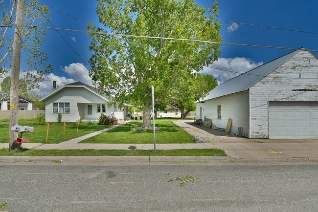
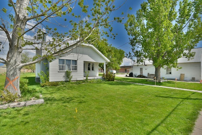
Property Record
1433 S 2000 W, Syracuse, UT 84075
NEARBY LISTINGS FOR SALE OR LEASE
Property Detail
1433 S 2000 W
Ogden-Clearfield, UT
Davis
12-052-0174
Utah
Sfr
0.70 AC
X
Davis/Weber Counties
49011C0205E
Salt Lake City
1,096 SF
DEMOGRAPHICS near 1433 S 2000 W
1 Mile
3 Mile
5 Mile
2024 Total Population
13,999
83,856
160,502
2029 Population
14,845
89,333
171,166
Pop Growth 2024-2029
+ 6.04%
+ 6.53%
+ 6.64%
Average Age
34
33
33
2024 Total Households
3,757
23,979
48,607
HH Growth 2024-2029
+ 6.10%
+ 6.72%
+ 6.74%
Median Household Inc
$116,106
$98,119
$86,451
Avg Household Size
3.70
3.50
3.30
2024 Avg HH Vehicles
3.00
3.00
2.00
Median Home Value
$433,926
$401,607
$389,675
Median Year Built
2001
2001
1997
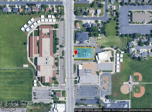
Nearby Places
Map Layers
Map Styles
 Street
 Aerial
- Restaurants
- Banks
- Shops
- Fitness
- Groceries
PUBLIC TRANSPORTATION
COMMUTER RAIL
Clearfield (FrontRunner North - Utah Transit Authority (UTA))
DRIVE
WALK
Distance
Clearfield (FrontRunner North - Utah Transit Authority (UTA))
9 min
4.1 mi
Layton (FrontRunner North - Utah Transit Authority (UTA))
DRIVE
WALK
Distance
Layton (FrontRunner North - Utah Transit Authority (UTA))
12 min
6.6 mi
AIRPORT
Salt Lake City International
DRIVE
WALK
Distance
Salt Lake City International
42 min
32.1 mi
Freight Ports
Port of Stockton
DRIVE
WALK
Distance
Port of Stockton
742 min
722.5 mi
SALE & LEASE HISTORY
LISTING DATE
SALE/LEASE

Sep 25, 2017
For Sale
May 17, 2017
For Sale
Mar 11, 2019
For Sale
Apr 10, 2018
For Sale
Nearby Properties
Address
Land Use
TOTAL SIZE
Lot Size
Zoning
Address
Land Use
TOTAL SIZE
Lot Size
Zoning
399,630 SF
31.55 AC
I
Address
Land Use
TOTAL SIZE
Lot Size
Zoning
664,440 SF
37.07 AC
Address
Land Use
TOTAL SIZE
Lot Size
Zoning
217,412 SF
13.23 AC
RS
Address
Land Use
TOTAL SIZE
Lot Size
Zoning
151,064 SF
48.81 AC
Address
Land Use
TOTAL SIZE
Lot Size
Zoning
86,213 SF
12.27 AC
Address
Land Use
TOTAL SIZE
Lot Size
Zoning
123,824 SF
41.89 AC
M1
Address
Land Use
TOTAL SIZE
Lot Size
Zoning
121,332 SF
44.40 AC
Address
Land Use
TOTAL SIZE
Lot Size
Zoning
123,445 SF
27.94 AC
M1
Address
Land Use
TOTAL SIZE
Lot Size
Zoning
27,763 SF
11.41 AC
Address
Land Use
TOTAL SIZE
Lot Size
Zoning
638,065 SF
33.77 AC
M1
Address
Land Use
TOTAL SIZE
Lot Size
Zoning
91,750 SF
6.76 AC
C2
Address
Land Use
TOTAL SIZE
Lot Size
Zoning
63,828 SF
5.30 AC
PF
Address
Land Use
TOTAL SIZE
Lot Size
Zoning
1,540 SF
11.52 AC
Address
Land Use
TOTAL SIZE
Lot Size
Zoning
453,129 SF
24.72 AC
M1
Address
Land Use
TOTAL SIZE
Lot Size
Zoning
26,058 SF
5.86 AC
Address
Land Use
TOTAL SIZE
Lot Size
Zoning
5,481 SF
15.54 AC
Address
Land Use
TOTAL SIZE
Lot Size
Zoning
503,599 SF
47.71 AC
M1
Address
Land Use
TOTAL SIZE
Lot Size
Zoning
199,214 SF
19.59 AC
C1
Address
Land Use
TOTAL SIZE
Lot Size
Zoning
2,177 SF
14.40 AC
R3
Address
Land Use
TOTAL SIZE
Lot Size
Zoning
57,165 SF
8.50 AC
GC
Address
Land Use
TOTAL SIZE
Lot Size
Zoning
147,184 SF
2.53 AC
Address
Land Use
TOTAL SIZE
Lot Size
Zoning
72,750 SF
11.54 AC
RS
Address
Land Use
TOTAL SIZE
Lot Size
Zoning
46,207 SF
6.09 AC
A1
The World's #1 Commercial Real Estate Marketplace
Connect with us
© 2025 CoStar Group
The information above has been obtained from sources believed reliable. While we do not doubt its accuracy we have not verified it and make no guarantee, warranty or representation about it. It is your responsibility to independently confirm its accuracy and completeness. Any projections, opinions, assumptions, or estimates used are for example only and do not represent the current or future performance of the property. The value of this transaction to you depends on tax and other factors which should be evaluated by your tax, financial, and legal advisors. You and your advisors should conduct a careful, independent investigation of the property to determine to your satisfaction the suitability of the property for your needs.