Property Record
144 Industrial Dr, Birmingham, AL 35211


Current Lease Availabilities
NEARBY LISTINGS FOR SALE OR LEASE
Property Detail
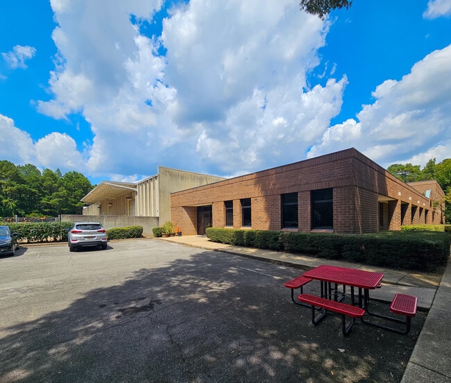
144 Industrial Dr
Birmingham-Hoover, AL
Tieco Sub 29-21-4
29-00-21-4-000-007.000
LOT 1 TIECO SUB 151/74
Heavyindustrial
Jefferson
X
Alabama
01073C0553G
1
2023
7.66 AC
2024
Vulcan/Oxmoor
014304
Birmingham
64,947 SF
DEMOGRAPHICS near 144 Industrial Dr
1 Mile
3 Mile
5 Mile
2024 Total Population
987
55,611
180,032
2029 Population
945
54,860
178,590
Pop Growth 2024-2029
(4.26%)
(1.35%)
(0.80%)
Average Age
36
39
39
2024 Total Households
481
24,936
75,518
HH Growth 2024-2029
(5.20%)
(1.34%)
(0.69%)
Median Household Inc
$22,291
$48,096
$49,657
Avg Household Size
2.00
2.20
2.20
2024 Avg HH Vehicles
1.00
2.00
2.00
Median Home Value
$89,024
$211,067
$233,310
Median Year Built
2002
1972
1969
Nearby Places
Map Layers
Map Styles
 Street
 Aerial
- Restaurants
- Banks
- Shops
- Fitness
- Groceries
PUBLIC TRANSPORTATION
COMMUTER RAIL
Birmingham (Crescent - Amtrak)
DRIVE
WALK
Distance
Birmingham (Crescent - Amtrak)
13 min
6.3 mi
AIRPORT
Birmingham-Shuttlesworth International
DRIVE
WALK
Distance
Birmingham-Shuttlesworth International
22 min
11.4 mi
Freight Ports
Port of Mobile
DRIVE
WALK
Distance
Port of Mobile
280 min
254.0 mi
Nearby Properties
Address
Land Use
TOTAL SIZE
Lot Size
Zoning
Address
Land Use
TOTAL SIZE
Lot Size
Zoning
242,746 SF
20.96 AC
MXDE
Address
Land Use
TOTAL SIZE
Lot Size
Zoning
334,805 SF
32.50 AC
MXD/
Address
Land Use
TOTAL SIZE
Lot Size
Zoning
209,765 SF
19.20 AC
I-3
Address
Land Use
TOTAL SIZE
Lot Size
Zoning
186,070 SF
16.60 AC
QB2
Address
Land Use
TOTAL SIZE
Lot Size
Zoning
311,982 SF
30 AC
R6
Address
Land Use
TOTAL SIZE
Lot Size
Zoning
92,332 SF
8.40 AC
Address
Land Use
TOTAL SIZE
Lot Size
Zoning
265,418 SF
26.55 AC
R2
Address
Land Use
TOTAL SIZE
Lot Size
Zoning
133,396 SF
19 AC
QR6
Address
Land Use
TOTAL SIZE
Lot Size
Zoning
285,719 SF
18 AC
R-4
Address
Land Use
TOTAL SIZE
Lot Size
Zoning
180,412 SF
14.89 AC
R6
Address
Land Use
TOTAL SIZE
Lot Size
Zoning
1.77 AC
QO&I
Address
Land Use
TOTAL SIZE
Lot Size
Zoning
313,404 SF
19 AC
PMUD
Address
Land Use
TOTAL SIZE
Lot Size
Zoning
120,238 SF
10 AC
I3
Address
Land Use
TOTAL SIZE
Lot Size
Zoning
267,289 SF
18.40 AC
L1
Address
Land Use
TOTAL SIZE
Lot Size
Zoning
517,500 SF
29 AC
I1
Address
Land Use
TOTAL SIZE
Lot Size
Zoning
189,182 SF
23.40 AC
PMUD
Address
Land Use
TOTAL SIZE
Lot Size
Zoning
246,696 SF
13.89 AC
R4
Address
Land Use
TOTAL SIZE
Lot Size
Zoning
199,445 SF
27 AC
PMUD
Address
Land Use
TOTAL SIZE
Lot Size
Zoning
224,856 SF
15 AC
R5
Address
Land Use
TOTAL SIZE
Lot Size
Zoning
96,446 SF
10 AC
I3
Address
Land Use
TOTAL SIZE
Lot Size
Zoning
222,131 SF
31 AC
I3
Address
Land Use
TOTAL SIZE
Lot Size
Zoning
136,184 SF
21 AC
B2-B
Address
Land Use
TOTAL SIZE
Lot Size
Zoning
229,230 SF
13.29 AC
R6
Address
Land Use
TOTAL SIZE
Lot Size
Zoning
146,358 SF
13.70 AC
R6
Address
Land Use
TOTAL SIZE
Lot Size
Zoning
51,572 SF
494.91 AC
I3
Address
Land Use
TOTAL SIZE
Lot Size
Zoning
230,308 SF
11 AC
R5
Address
Land Use
TOTAL SIZE
Lot Size
Zoning
98,217 SF
13.20 AC
Address
Land Use
TOTAL SIZE
Lot Size
Zoning
202,775 SF
10.40 AC
I3
The World's #1 Commercial Real Estate Marketplace
Connect with us
© 2026 CoStar Group
The information above has been obtained from sources believed reliable. While we do not doubt its accuracy we have not verified it and make no guarantee, warranty or representation about it. It is your responsibility to independently confirm its accuracy and completeness. Any projections, opinions, assumptions, or estimates used are for example only and do not represent the current or future performance of the property. The value of this transaction to you depends on tax and other factors which should be evaluated by your tax, financial, and legal advisors. You and your advisors should conduct a careful, independent investigation of the property to determine to your satisfaction the suitability of the property for your needs.