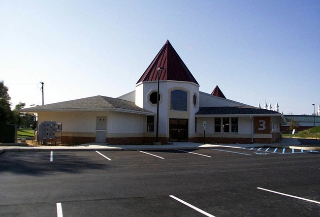
Property Record
1450 E Chestnut Ave, Vineland, NJ 08361

NEARBY LISTINGS FOR SALE OR LEASE
Property Detail
1450 E Chestnut Ave
14-04301-0000-00005
Cumberland
Commercialnec
New Jersey
X
5
34011C0201E
8.77 AC
2024
Vineland/Bridgeton
2025
Philadelphia
040702
Vineland-Bridgeton, NJ
DEMOGRAPHICS near 1450 E Chestnut Ave
1 Mile
3 Mile
5 Mile
2024 Total Population
8,580
46,255
67,705
2029 Population
8,477
45,485
66,741
Pop Growth 2024-2029
(1.20%)
(1.66%)
(1.42%)
Average Age
41
40
40
2024 Total Households
3,384
16,721
24,982
HH Growth 2024-2029
(1.33%)
(1.75%)
(1.56%)
Median Household Inc
$61,296
$59,196
$63,417
Avg Household Size
2.50
2.70
2.60
2024 Avg HH Vehicles
2.00
2.00
2.00
Median Home Value
$200,279
$202,079
$206,885
Median Year Built
1962
1968
1970
Nearby Places
Map Layers
Map Styles
 Street
 Aerial
- Restaurants
- Banks
- Shops
- Fitness
- Groceries
PUBLIC TRANSPORTATION
AIRPORT
Atlantic City International
DRIVE
WALK
Distance
Atlantic City International
62 min
28.6 mi
Philadelphia International
DRIVE
WALK
Distance
Philadelphia International
66 min
46.1 mi
Freight Ports
Broadway Terminal - Pier 5
DRIVE
WALK
Distance
Broadway Terminal - Pier 5
50 min
37.5 mi
Nearby Properties
Address
Land Use
TOTAL SIZE
Lot Size
Zoning
Address
Land Use
TOTAL SIZE
Lot Size
Zoning
156.67 AC
R4
Address
Land Use
TOTAL SIZE
Lot Size
Zoning
40 AC
A
Address
Land Use
TOTAL SIZE
Lot Size
Zoning
69.16 AC
R5
Address
Land Use
TOTAL SIZE
Lot Size
Zoning
28.47 AC
RI
Address
Land Use
TOTAL SIZE
Lot Size
Zoning
5 AC
R2
Address
Land Use
TOTAL SIZE
Lot Size
Zoning
29.39 AC
B3
Address
Land Use
TOTAL SIZE
Lot Size
Zoning
8.93 AC
R1
Address
Land Use
TOTAL SIZE
Lot Size
Zoning
25.52 AC
R5
Address
Land Use
TOTAL SIZE
Lot Size
Zoning
40 AC
R5
Address
Land Use
TOTAL SIZE
Lot Size
Zoning
Address
Land Use
TOTAL SIZE
Lot Size
Zoning
17.01 AC
R3
Address
Land Use
TOTAL SIZE
Lot Size
Zoning
33.79 AC
I3
Address
Land Use
TOTAL SIZE
Lot Size
Zoning
11.91 AC
R5
Address
Land Use
TOTAL SIZE
Lot Size
Zoning
11.15 AC
Address
Land Use
TOTAL SIZE
Lot Size
Zoning
32.41 AC
A
Address
Land Use
TOTAL SIZE
Lot Size
Zoning
18.45 AC
R4
Address
Land Use
TOTAL SIZE
Lot Size
Zoning
10.23 AC
I2
Address
Land Use
TOTAL SIZE
Lot Size
Zoning
20.61 AC
R2
Address
Land Use
TOTAL SIZE
Lot Size
Zoning
7.24 AC
R4
Address
Land Use
TOTAL SIZE
Lot Size
Zoning
7.20 AC
R4
Address
Land Use
TOTAL SIZE
Lot Size
Zoning
24,820 SF
15 AC
R3
Address
Land Use
TOTAL SIZE
Lot Size
Zoning
19.82 AC
R5
Address
Land Use
TOTAL SIZE
Lot Size
Zoning
Address
Land Use
TOTAL SIZE
Lot Size
Zoning
7.71 AC
B3
Address
Land Use
TOTAL SIZE
Lot Size
Zoning
18.25 AC
R3
Address
Land Use
TOTAL SIZE
Lot Size
Zoning
21.80 AC
R4
Address
Land Use
TOTAL SIZE
Lot Size
Zoning
11.79 AC
R3
Address
Land Use
TOTAL SIZE
Lot Size
Zoning
13.07 AC
B3
Address
Land Use
TOTAL SIZE
Lot Size
Zoning
10.14 AC
B2
Address
Land Use
TOTAL SIZE
Lot Size
Zoning
87 SF
R2
The World's #1 Commercial Real Estate Marketplace
Connect with us
© 2026 CoStar Group
The information above has been obtained from sources believed reliable. While we do not doubt its accuracy we have not verified it and make no guarantee, warranty or representation about it. It is your responsibility to independently confirm its accuracy and completeness. Any projections, opinions, assumptions, or estimates used are for example only and do not represent the current or future performance of the property. The value of this transaction to you depends on tax and other factors which should be evaluated by your tax, financial, and legal advisors. You and your advisors should conduct a careful, independent investigation of the property to determine to your satisfaction the suitability of the property for your needs.