Property Record
3532 S Concord St, Gilbert, AZ 85297
Current Lease Availabilities
Property Detail
3532 S Concord St
304-54-026J
S 160F OF N2 W2 W2 SE4 NW4 SEC 5
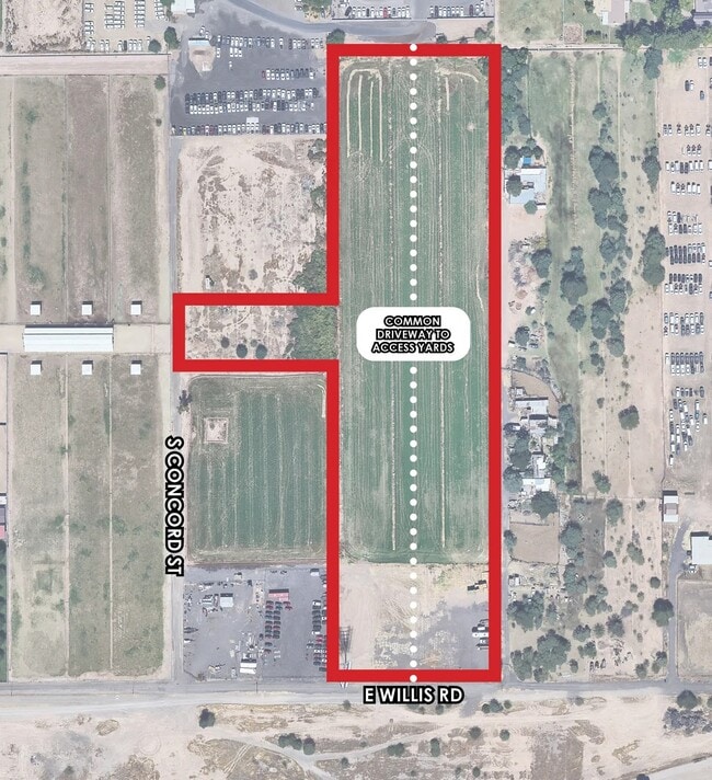
Residentialacreage
MARICOPA
C-BP
Arizona
C and X Area of minimal flood hazard, usually depicted on FIRMs as above the 500-year flood level.
1.21 AC
2025
Gateway Airport/Loop 202
2025
Phoenix
816001
Phoenix-Mesa-Chandler, AZ
NEARBY LISTINGS FOR SALE OR LEASE
DEMOGRAPHICS near 3532 S Concord St
1 mile
3 mile
5 mile
2025 Total Population
7,637
95,404
308,771
2030 Population
8,089
99,411
320,641
Pop Growth 2025-2030
+ 5.92%
+ 4.20%
+ 3.84%
Average Age
36
37
37
2025 Total Households
2,433
31,225
101,769
HH Growth 2025-2030
+ 6.12%
+ 4.26%
+ 3.86%
Median Household Inc
$145,226
$130,794
$122,668
Avg Household Size
3.00
3.00
3.00
2025 Avg HH Vehicles
2.00
2.00
2.00
Median Home Value
$734,558
$654,919
$611,768
Median Year Built
2008
2005
2003
Nearby Places
Map Layers
Map Styles
 Street
 Aerial
Transit
 Traffic
 Biking
Places
Listings with unknown addresses are not visible on the map
- Restaurants
- Banks
- Shops
- Fitness
- Groceries
PUBLIC TRANSPORTATION
AIRPORT
Phoenix-Mesa Gateway
Drive
Walk
Distance
Phoenix-Mesa Gateway
17 min
8.4 mi
Phoenix Sky Harbor International
Drive
Walk
Distance
Phoenix Sky Harbor International
35 min
24.7 mi
Freight Ports
Port of San Diego
Drive
Walk
Distance
Port of San Diego
406 min
369.0 mi
Nearby Properties
Address
Land Use
TOTAL SIZE
Lot Size
Zoning
Address
Land Use
TOTAL SIZE
Lot Size
Zoning
837,332 SF
55.22 AC
PF
Address
Land Use
TOTAL SIZE
Lot Size
Zoning
Address
Land Use
TOTAL SIZE
Lot Size
Zoning
22.83 AC
PF
Address
Land Use
TOTAL SIZE
Lot Size
Zoning
288,023 SF
48.20 AC
PAD
Address
Land Use
TOTAL SIZE
Lot Size
Zoning
498,377 SF
29.12 AC
Address
Land Use
TOTAL SIZE
Lot Size
Zoning
2.91 AC
Address
Land Use
TOTAL SIZE
Lot Size
Zoning
479,727 SF
14.25 AC
MFM
Address
Land Use
TOTAL SIZE
Lot Size
Zoning
445,862 SF
36.70 AC
LI
Address
Land Use
TOTAL SIZE
Lot Size
Zoning
430,700 SF
63.32 AC
PF
Address
Land Use
TOTAL SIZE
Lot Size
Zoning
425,886 SF
19.08 AC
MFM
Address
Land Use
TOTAL SIZE
Lot Size
Zoning
465,645 SF
30.78 AC
PAD
Address
Land Use
TOTAL SIZE
Lot Size
Zoning
300,885 SF
37.63 AC
AG
Address
Land Use
TOTAL SIZE
Lot Size
Zoning
348,668 SF
8.97 AC
R3
Address
Land Use
TOTAL SIZE
Lot Size
Zoning
387,535 SF
15.80 AC
C-G
Address
Land Use
TOTAL SIZE
Lot Size
Zoning
324,283 SF
18.75 AC
PAD
Address
Land Use
TOTAL SIZE
Lot Size
Zoning
380,383 SF
14.79 AC
C-G
Address
Land Use
TOTAL SIZE
Lot Size
Zoning
362,701 SF
9.77 AC
R3
Address
Land Use
TOTAL SIZE
Lot Size
Zoning
335,464 SF
13.41 AC
Address
Land Use
TOTAL SIZE
Lot Size
Zoning
317,959 SF
23.86 AC
Address
Land Use
TOTAL SIZE
Lot Size
Zoning
332,112 SF
15.44 AC
M-M
Address
Land Use
TOTAL SIZE
Lot Size
Zoning
159,419 SF
10.11 AC
RC
Address
Land Use
TOTAL SIZE
Lot Size
Zoning
275,813 SF
24.90 AC
R-CH
Address
Land Use
TOTAL SIZE
Lot Size
Zoning
316,979 SF
17.26 AC
MF/M
Address
Land Use
TOTAL SIZE
Lot Size
Zoning
316,658 SF
47.91 AC
PAD
Address
Land Use
TOTAL SIZE
Lot Size
Zoning
128,416 SF
8.28 AC
C-BP
Address
Land Use
TOTAL SIZE
Lot Size
Zoning
317,739 SF
14.05 AC
MF/M
Address
Land Use
TOTAL SIZE
Lot Size
Zoning
238,856 SF
6.53 AC
R3
Address
Land Use
TOTAL SIZE
Lot Size
Zoning
1.55 AC
Address
Land Use
TOTAL SIZE
Lot Size
Zoning
439,353 SF
17.36 AC
M-M
Address
Land Use
TOTAL SIZE
Lot Size
Zoning
251,332 SF
8.62 AC
R3
The World's #1 Commercial Real Estate Marketplace
Connect with us
© 2026 CoStar Group
The information above has been obtained from sources believed reliable. While we do not doubt its accuracy we have not verified it and make no guarantee, warranty or representation about it. It is your responsibility to independently confirm its accuracy and completeness. Any projections, opinions, assumptions, or estimates used are for example only and do not represent the current or future performance of the property. The value of this transaction to you depends on tax and other factors which should be evaluated by your tax, financial, and legal advisors. You and your advisors should conduct a careful, independent investigation of the property to determine to your satisfaction the suitability of the property for your needs.