Property Record
147 Monroe Ave, Rochester, NY 14607


NEARBY LISTINGS FOR SALE OR LEASE
Property Detail
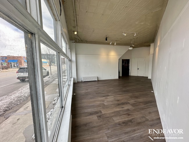
147 Monroe Ave
261400-121-400-0002-009-000-0000
0093.02 315 04 02225 69 WADSWORTH SUB
Commercialofficeresidentialmixeduse
Monroe
X
New York
36055C0212G
9.000
2025
0.15 AC
2024
Greater Rochester
002900
Rochester
4,900 SF
Rochester, NY
DEMOGRAPHICS near 147 Monroe Ave
1 Mile
3 Mile
5 Mile
2024 Total Population
28,781
189,411
294,859
2029 Population
28,462
186,144
290,433
Pop Growth 2024-2029
(1.11%)
(1.72%)
(1.50%)
Average Age
38
37
39
2024 Total Households
17,661
83,720
129,805
HH Growth 2024-2029
(0.92%)
(1.73%)
(1.52%)
Median Household Inc
$50,587
$44,626
$51,144
Avg Household Size
1.60
2.10
2.10
2024 Avg HH Vehicles
1.00
1.00
1.00
Median Home Value
$191,579
$124,670
$144,461
Median Year Built
1948
1947
1949
Nearby Places
Map Layers
Map Styles
 Street
 Aerial
- Restaurants
- Banks
- Shops
- Fitness
- Groceries
PUBLIC TRANSPORTATION
COMMUTER RAIL
DRIVE
WALK
Distance
4 min
1.2 mi
AIRPORT
Frederick Douglass/Greater Rochester International
DRIVE
WALK
Distance
Frederick Douglass/Greater Rochester International
10 min
5.0 mi
SALE & LEASE HISTORY
LISTING DATE
SALE/LEASE

Mar 09, 2023
For Lease
Apr 05, 2022
For Lease
Nearby Properties
Address
Land Use
TOTAL SIZE
Lot Size
Zoning
Address
Land Use
TOTAL SIZE
Lot Size
Zoning
847,728 SF
41.57 AC
Address
Land Use
TOTAL SIZE
Lot Size
Zoning
0.47 AC
Address
Land Use
TOTAL SIZE
Lot Size
Zoning
173,649 SF
85.98 AC
Address
Land Use
TOTAL SIZE
Lot Size
Zoning
1,216,095 SF
22.89 AC
Address
Land Use
TOTAL SIZE
Lot Size
Zoning
Address
Land Use
TOTAL SIZE
Lot Size
Zoning
60,120 SF
12.90 AC
Address
Land Use
TOTAL SIZE
Lot Size
Zoning
7.15 AC
Address
Land Use
TOTAL SIZE
Lot Size
Zoning
1,878,160 SF
4.05 AC
Address
Land Use
TOTAL SIZE
Lot Size
Zoning
0.13 AC
Address
Land Use
TOTAL SIZE
Lot Size
Zoning
51,276 SF
48.95 AC
02 - SINGL
Address
Land Use
TOTAL SIZE
Lot Size
Zoning
01 - NOT Z
Address
Land Use
TOTAL SIZE
Lot Size
Zoning
Address
Land Use
TOTAL SIZE
Lot Size
Zoning
614,053 SF
9.30 AC
Address
Land Use
TOTAL SIZE
Lot Size
Zoning
41,376 SF
59.90 AC
06 - INDUS
Address
Land Use
TOTAL SIZE
Lot Size
Zoning
01 - NOT Z
Address
Land Use
TOTAL SIZE
Lot Size
Zoning
330,090 SF
62.41 AC
Address
Land Use
TOTAL SIZE
Lot Size
Zoning
01 - NOT Z
Address
Land Use
TOTAL SIZE
Lot Size
Zoning
0.01 AC
Address
Land Use
TOTAL SIZE
Lot Size
Zoning
6,056 SF
37.65 AC
Address
Land Use
TOTAL SIZE
Lot Size
Zoning
01 - NOT Z
Address
Land Use
TOTAL SIZE
Lot Size
Zoning
128,539 SF
15.01 AC
Address
Land Use
TOTAL SIZE
Lot Size
Zoning
Address
Land Use
TOTAL SIZE
Lot Size
Zoning
3.09 AC
02 - SINGL
Address
Land Use
TOTAL SIZE
Lot Size
Zoning
13.10 AC
Address
Land Use
TOTAL SIZE
Lot Size
Zoning
373,200 SF
5.42 AC
Address
Land Use
TOTAL SIZE
Lot Size
Zoning
178,321 SF
3.10 AC
Address
Land Use
TOTAL SIZE
Lot Size
Zoning
01 - NOT Z
Address
Land Use
TOTAL SIZE
Lot Size
Zoning
0.01 AC
Address
Land Use
TOTAL SIZE
Lot Size
Zoning
302,484 SF
2.53 AC
Address
Land Use
TOTAL SIZE
Lot Size
Zoning
473,876 SF
1.49 AC
The World's #1 Commercial Real Estate Marketplace
Connect with us
© 2025 CoStar Group
The information above has been obtained from sources believed reliable. While we do not doubt its accuracy we have not verified it and make no guarantee, warranty or representation about it. It is your responsibility to independently confirm its accuracy and completeness. Any projections, opinions, assumptions, or estimates used are for example only and do not represent the current or future performance of the property. The value of this transaction to you depends on tax and other factors which should be evaluated by your tax, financial, and legal advisors. You and your advisors should conduct a careful, independent investigation of the property to determine to your satisfaction the suitability of the property for your needs.