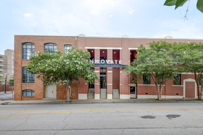
Property Record
148 River St, Greenville, SC 29601

Property Detail
148 River St
Greenville-Anderson-Greer, SC
MAP 0071.00
0071.00-02-001.00
Greenville
Officebuilding
South Carolina
C4
001.00
B and X Area of moderate flood hazard, usually the area between the limits of the 100-year and 500-year floods.
0.83 AC
2025
Greenville CBD
2025
Greenville/Spartanburg
000200
NEARBY LISTINGS FOR SALE OR LEASE
DEMOGRAPHICS near 148 River St
1 mile
3 mile
5 mile
2025 Total Population
13,120
90,023
179,730
2030 Population
14,620
97,989
194,690
Pop Growth 2025-2030
+ 11.43%
+ 8.85%
+ 8.32%
Average Age
42
38
38
2025 Total Households
7,155
38,309
76,834
HH Growth 2025-2030
+ 11.94%
+ 9.27%
+ 8.67%
Median Household Inc
$78,528
$61,253
$62,628
Avg Household Size
1.70
2.20
2.20
2025 Avg HH Vehicles
1.00
2.00
2.00
Median Home Value
$674,749
$394,248
$322,924
Median Year Built
2010
1975
1979
Nearby Places
Map Layers
Map Styles
 Street
 Aerial
Layers
 Traffic
 Biking
Places
Listings with unknown addresses are not visible on the map
- Restaurants
- Banks
- Shops
- Fitness
- Groceries
PUBLIC TRANSPORTATION
COMMUTER RAIL
Greenville Amtrak Station (Crescent - Amtrak)
Drive
Walk
Distance
Greenville Amtrak Station (Crescent - Amtrak)
3 min
1.1 mi
AIRPORT
Greenville Spartanburg International
Drive
Walk
Distance
Greenville Spartanburg International
24 min
14.7 mi
Freight Ports
North Charleston Terminal
Drive
Walk
Distance
North Charleston Terminal
231 min
205.3 mi
SALE & LEASE HISTORY
LISTING DATE
SALE/LEASE

Nov 17, 2017
For Lease
Jun 26, 2020
For Lease
Jun 04, 2025
For Lease
Jan 25, 2024
For Lease
Aug 07, 2020
For Lease
Nearby Properties
Address
Land Use
TOTAL SIZE
Lot Size
Zoning
Address
Land Use
TOTAL SIZE
Lot Size
Zoning
114.75 AC
0D
Address
Land Use
TOTAL SIZE
Lot Size
Zoning
330.98 AC
S1
Address
Land Use
TOTAL SIZE
Lot Size
Zoning
6.30 AC
C3
Address
Land Use
TOTAL SIZE
Lot Size
Zoning
2,945 SF
1.83 AC
S1
Address
Land Use
TOTAL SIZE
Lot Size
Zoning
47.63 AC
R6
Address
Land Use
TOTAL SIZE
Lot Size
Zoning
14.85 AC
S1
Address
Land Use
TOTAL SIZE
Lot Size
Zoning
29.53 AC
RM1
Address
Land Use
TOTAL SIZE
Lot Size
Zoning
123.10 AC
0D
Address
Land Use
TOTAL SIZE
Lot Size
Zoning
0.45 AC
OD
Address
Land Use
TOTAL SIZE
Lot Size
Zoning
20.21 AC
Address
Land Use
TOTAL SIZE
Lot Size
Zoning
14.41 AC
RM2
Address
Land Use
TOTAL SIZE
Lot Size
Zoning
11.13 AC
OD
Address
Land Use
TOTAL SIZE
Lot Size
Zoning
97.93 AC
OD
Address
Land Use
TOTAL SIZE
Lot Size
Zoning
1.89 AC
OD
Address
Land Use
TOTAL SIZE
Lot Size
Zoning
14.21 AC
RM2
Address
Land Use
TOTAL SIZE
Lot Size
Zoning
18.65 AC
R6
Address
Land Use
TOTAL SIZE
Lot Size
Zoning
9.91 AC
C3
Address
Land Use
TOTAL SIZE
Lot Size
Zoning
12.01 AC
RM2
Address
Land Use
TOTAL SIZE
Lot Size
Zoning
1 AC
C4
Address
Land Use
TOTAL SIZE
Lot Size
Zoning
15 AC
OD
Address
Land Use
TOTAL SIZE
Lot Size
Zoning
0.47 AC
OD
Address
Land Use
TOTAL SIZE
Lot Size
Zoning
9.57 AC
C3
Address
Land Use
TOTAL SIZE
Lot Size
Zoning
20.04 AC
RM
Address
Land Use
TOTAL SIZE
Lot Size
Zoning
6.21 AC
C3
Address
Land Use
TOTAL SIZE
Lot Size
Zoning
6.03 AC
OD
Address
Land Use
TOTAL SIZE
Lot Size
Zoning
28.88 AC
RM
Address
Land Use
TOTAL SIZE
Lot Size
Zoning
1.92 AC
C4
Address
Land Use
TOTAL SIZE
Lot Size
Zoning
Address
Land Use
TOTAL SIZE
Lot Size
Zoning
15.46 AC
Address
Land Use
TOTAL SIZE
Lot Size
Zoning
0.39 AC
C4
The World's #1 Commercial Real Estate Marketplace
Connect with us
© 2026 CoStar Group
The information above has been obtained from sources believed reliable. While we do not doubt its accuracy we have not verified it and make no guarantee, warranty or representation about it. It is your responsibility to independently confirm its accuracy and completeness. Any projections, opinions, assumptions, or estimates used are for example only and do not represent the current or future performance of the property. The value of this transaction to you depends on tax and other factors which should be evaluated by your tax, financial, and legal advisors. You and your advisors should conduct a careful, independent investigation of the property to determine to your satisfaction the suitability of the property for your needs.