Property Record
14800 Goodman Rd, Olive Branch, MS 38654
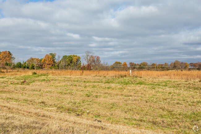

Property Detail
14800 Goodman Rd
Memphis, TN-MS-AR
PT S1/2 SE1/4
1058280000003702
DESOTO
Vacantlandnec
Mississippi
C-4
37
B and X Area of moderate flood hazard, usually the area between the limits of the 100-year and 500-year floods.
2.75 AC
2025
DeSoto County
2025
Memphis
070830
NEARBY LISTINGS FOR SALE OR LEASE
DEMOGRAPHICS near 14800 Goodman Rd
1 mile
3 mile
5 mile
2025 Total Population
1,409
7,320
36,868
2030 Population
1,468
7,627
37,694
Pop Growth 2025-2030
+ 4.19%
+ 4.19%
+ 2.24%
Average Age
37
39
39
2025 Total Households
453
2,453
13,395
HH Growth 2025-2030
+ 4.19%
+ 4.12%
+ 2.12%
Median Household Inc
$120,327
$116,961
$97,891
Avg Household Size
3.10
2.90
2.70
2025 Avg HH Vehicles
2.00
2.00
2.00
Median Home Value
$397,125
$383,040
$341,514
Median Year Built
2006
2004
2001
Nearby Places
Map Layers
Map Styles
 Street
 Aerial
Layers
 Traffic
 Biking
Places
Listings with unknown addresses are not visible on the map
- Restaurants
- Banks
- Shops
- Fitness
- Groceries
PUBLIC TRANSPORTATION
AIRPORT
Memphis International
Drive
Walk
Distance
Memphis International
27 min
19.1 mi
Freight Ports
Port of Shreveport
Drive
Walk
Distance
Port of Shreveport
432 min
392.8 mi
SALE & LEASE HISTORY
LISTING DATE
SALE/LEASE

Nov 26, 2018
For Sale
Nearby Properties
Address
Land Use
TOTAL SIZE
Lot Size
Zoning
Address
Land Use
TOTAL SIZE
Lot Size
Zoning
929,880 SF
41.14 AC
M-1
Address
Land Use
TOTAL SIZE
Lot Size
Zoning
1,150,296 SF
68.41 AC
M-1
Address
Land Use
TOTAL SIZE
Lot Size
Zoning
990,952 SF
60.30 AC
PUD
Address
Land Use
TOTAL SIZE
Lot Size
Zoning
1,299,800 SF
50.22 AC
M-1
Address
Land Use
TOTAL SIZE
Lot Size
Zoning
761,349 SF
57.62 AC
M-1
Address
Land Use
TOTAL SIZE
Lot Size
Zoning
869,020 SF
43.85 AC
M-1
Address
Land Use
TOTAL SIZE
Lot Size
Zoning
616,191 SF
61.92 AC
PUD
Address
Land Use
TOTAL SIZE
Lot Size
Zoning
860,040 SF
43.13 AC
M-1
Address
Land Use
TOTAL SIZE
Lot Size
Zoning
413,028 SF
28.15 AC
M-1
Address
Land Use
TOTAL SIZE
Lot Size
Zoning
342,001 SF
33.28 AC
M-1
Address
Land Use
TOTAL SIZE
Lot Size
Zoning
267,880 SF
12.67 AC
PB
Address
Land Use
TOTAL SIZE
Lot Size
Zoning
239,748 SF
18.19 AC
M-1
Address
Land Use
TOTAL SIZE
Lot Size
Zoning
10,380 SF
17 AC
A-R
Address
Land Use
TOTAL SIZE
Lot Size
Zoning
89.80 AC
AG
Address
Land Use
TOTAL SIZE
Lot Size
Zoning
50 AC
CA
Address
Land Use
TOTAL SIZE
Lot Size
Zoning
3,120 SF
6.60 AC
Address
Land Use
TOTAL SIZE
Lot Size
Zoning
63.50 AC
AG
Address
Land Use
TOTAL SIZE
Lot Size
Zoning
10,692 SF
22.34 AC
A-R
Address
Land Use
TOTAL SIZE
Lot Size
Zoning
10,248 SF
2 AC
C-4
Address
Land Use
TOTAL SIZE
Lot Size
Zoning
15.35 AC
AG
Address
Land Use
TOTAL SIZE
Lot Size
Zoning
10,256 SF
1.80 AC
Address
Land Use
TOTAL SIZE
Lot Size
Zoning
4,999 SF
41.57 AC
A-R
Address
Land Use
TOTAL SIZE
Lot Size
Zoning
7,088 SF
2.50 AC
Address
Land Use
TOTAL SIZE
Lot Size
Zoning
9.54 AC
CA
Address
Land Use
TOTAL SIZE
Lot Size
Zoning
4,984 SF
1.70 AC
C-4
The World's #1 Commercial Real Estate Marketplace
Connect with us
© 2026 CoStar Group
The information above has been obtained from sources believed reliable. While we do not doubt its accuracy we have not verified it and make no guarantee, warranty or representation about it. It is your responsibility to independently confirm its accuracy and completeness. Any projections, opinions, assumptions, or estimates used are for example only and do not represent the current or future performance of the property. The value of this transaction to you depends on tax and other factors which should be evaluated by your tax, financial, and legal advisors. You and your advisors should conduct a careful, independent investigation of the property to determine to your satisfaction the suitability of the property for your needs.