Property Record
149 W Valley Ave, Birmingham, AL 35209


NEARBY LISTINGS FOR SALE OR LEASE
Property Detail
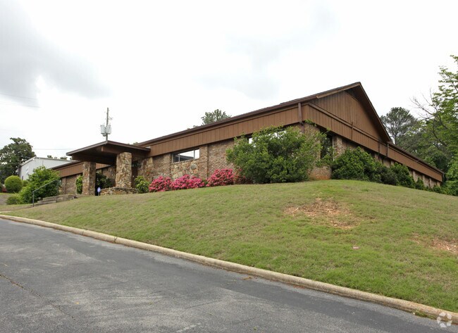
149 W Valley Ave
29-00-22-2-000-002.000
POB 233 FT T OF NE COR OF NW 1/4 SEC 22 TP 18S R 3W TH S 200 FT ALG E/L OF TH NW 1/4 TH W 251.8 FT TO W RW OF VALLEY AVE TH N 200.5 FT TO W RW WEST VALLEY AVE TH E 242.7 FT TO POB LYING IN TH NE 1/4 OF TH NW 1/4 SECT 22 TWSP 18S RANGE 3W
Storebuilding
Jefferson
X
Alabama
01073C0554J
1.14 AC
2023
Vulcan/Oxmoor
2024
Birmingham
010706
Birmingham, AL
6,390 SF
DEMOGRAPHICS near 149 W Valley Ave
1 mile
3 mile
5 mile
2024 Total Population
4,882
69,691
187,767
2029 Population
4,804
69,358
186,430
Pop Growth 2024-2029
(1.60%)
(0.48%)
(0.71%)
Average Age
35
38
39
2024 Total Households
2,400
31,183
80,825
HH Growth 2024-2029
(1.17%)
(0.50%)
(0.63%)
Median Household Inc
$47,217
$44,888
$48,916
Avg Household Size
2.00
2.10
2.10
2024 Avg HH Vehicles
2.00
2.00
2.00
Median Home Value
$252,656
$226,257
$246,525
Median Year Built
1981
1971
1968
Nearby Places
Map Layers
Map Styles
 Street
 Aerial
Transit
 Traffic
 Biking
Places
Listings with unknown addresses are not visible on the map
- Restaurants
- Banks
- Shops
- Fitness
- Groceries
PUBLIC TRANSPORTATION
COMMUTER RAIL
Drive
Walk
Distance
10 min
5.9 mi
AIRPORT
Birmingham-Shuttlesworth International
Drive
Walk
Distance
Birmingham-Shuttlesworth International
18 min
11.0 mi
Nearby Properties
Address
Land Use
TOTAL SIZE
Lot Size
Zoning
Address
Land Use
TOTAL SIZE
Lot Size
Zoning
978,879 SF
43.50 AC
I3
Address
Land Use
TOTAL SIZE
Lot Size
Zoning
203,878 SF
12.58 AC
B6
Address
Land Use
TOTAL SIZE
Lot Size
Zoning
31,980 SF
99.92 AC
I3/P
Address
Land Use
TOTAL SIZE
Lot Size
Zoning
242,746 SF
20.96 AC
MXDE
Address
Land Use
TOTAL SIZE
Lot Size
Zoning
334,805 SF
32.50 AC
MXD/
Address
Land Use
TOTAL SIZE
Lot Size
Zoning
200,927 SF
19 AC
PMUD
Address
Land Use
TOTAL SIZE
Lot Size
Zoning
209,765 SF
19.20 AC
I-3
Address
Land Use
TOTAL SIZE
Lot Size
Zoning
186,070 SF
16.60 AC
QB2
Address
Land Use
TOTAL SIZE
Lot Size
Zoning
311,982 SF
30 AC
R6
Address
Land Use
TOTAL SIZE
Lot Size
Zoning
282,421 SF
24.33 AC
R7
Address
Land Use
TOTAL SIZE
Lot Size
Zoning
92,332 SF
8.40 AC
Address
Land Use
TOTAL SIZE
Lot Size
Zoning
265,418 SF
26.55 AC
R2
Address
Land Use
TOTAL SIZE
Lot Size
Zoning
133,396 SF
19 AC
QR6
Address
Land Use
TOTAL SIZE
Lot Size
Zoning
403,758 SF
22.36 AC
R3
Address
Land Use
TOTAL SIZE
Lot Size
Zoning
285,719 SF
18 AC
R-4
Address
Land Use
TOTAL SIZE
Lot Size
Zoning
180,412 SF
14.89 AC
R6
Address
Land Use
TOTAL SIZE
Lot Size
Zoning
313,404 SF
19 AC
PMUD
Address
Land Use
TOTAL SIZE
Lot Size
Zoning
23,102 SF
5.47 AC
O&I
Address
Land Use
TOTAL SIZE
Lot Size
Zoning
52,239 SF
9 AC
PMUD
Address
Land Use
TOTAL SIZE
Lot Size
Zoning
74,041 SF
O&I
Address
Land Use
TOTAL SIZE
Lot Size
Zoning
267,289 SF
18.40 AC
L1
Address
Land Use
TOTAL SIZE
Lot Size
Zoning
517,500 SF
29 AC
I1
Address
Land Use
TOTAL SIZE
Lot Size
Zoning
189,182 SF
23.40 AC
PMUD
Address
Land Use
TOTAL SIZE
Lot Size
Zoning
199,445 SF
27 AC
PMUD
Address
Land Use
TOTAL SIZE
Lot Size
Zoning
261,834 SF
12.21 AC
R7
Address
Land Use
TOTAL SIZE
Lot Size
Zoning
48,940 SF
O&I
Address
Land Use
TOTAL SIZE
Lot Size
Zoning
182,026 SF
2.80 AC
I2
Address
Land Use
TOTAL SIZE
Lot Size
Zoning
224,856 SF
15 AC
R5
The World's #1 Commercial Real Estate Marketplace
Connect with us
© 2026 CoStar Group
The information above has been obtained from sources believed reliable. While we do not doubt its accuracy we have not verified it and make no guarantee, warranty or representation about it. It is your responsibility to independently confirm its accuracy and completeness. Any projections, opinions, assumptions, or estimates used are for example only and do not represent the current or future performance of the property. The value of this transaction to you depends on tax and other factors which should be evaluated by your tax, financial, and legal advisors. You and your advisors should conduct a careful, independent investigation of the property to determine to your satisfaction the suitability of the property for your needs.