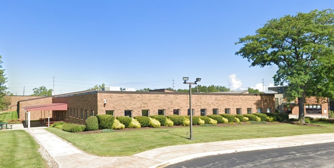
Property Record
1490 E 191St St, Euclid, OH 44117


Current Lease Availabilities
Property Detail
1490 E 191St St
646-20-004
50
Commercialnec
Cuyahoga
U8
Ohio
B and X Area of moderate flood hazard, usually the area between the limits of the 100-year and 500-year floods.
50
2025
5.44 AC
2025
Euclid
152701
Cleveland
45,835 SF
Cleveland-Elyria, OH
NEARBY LISTINGS FOR SALE OR LEASE
DEMOGRAPHICS near 1490 E 191St St
1 mile
3 mile
5 mile
2025 Total Population
12,310
100,523
248,878
2030 Population
12,269
100,854
250,503
Pop Growth 2025-2030
(0.33%)
+ 0.33%
+ 0.65%
Average Age
44
43
41
2025 Total Households
6,225
45,980
111,385
HH Growth 2025-2030
(0.43%)
+ 0.21%
+ 0.67%
Median Household Inc
$31,225
$45,096
$50,454
Avg Household Size
1.90
2.10
2.10
2025 Avg HH Vehicles
1.00
1.00
1.00
Median Home Value
$93,281
$129,775
$155,617
Median Year Built
1953
1950
1951
Nearby Places
Map Layers
Map Styles
 Street
 Aerial
Transit
 Traffic
 Biking
Places
Listings with unknown addresses are not visible on the map
- Restaurants
- Banks
- Shops
- Fitness
- Groceries
PUBLIC TRANSPORTATION
AIRPORT
Cleveland-Hopkins International
Drive
Walk
Distance
Cleveland-Hopkins International
40 min
25.1 mi
Freight Ports
Port of Toledo
Drive
Walk
Distance
Port of Toledo
154 min
125.5 mi
Nearby Properties
Address
Land Use
TOTAL SIZE
Lot Size
Zoning
Address
Land Use
TOTAL SIZE
Lot Size
Zoning
63.59 AC
1F
Address
Land Use
TOTAL SIZE
Lot Size
Zoning
44,577 SF
39.90 AC
SI
Address
Land Use
TOTAL SIZE
Lot Size
Zoning
386,776 SF
14.70 AC
CI
Address
Land Use
TOTAL SIZE
Lot Size
Zoning
112,657 SF
19.88 AC
U3
Address
Land Use
TOTAL SIZE
Lot Size
Zoning
149,685 SF
27.66 AC
R-1
Address
Land Use
TOTAL SIZE
Lot Size
Zoning
450,285 SF
6.02 AC
LR
Address
Land Use
TOTAL SIZE
Lot Size
Zoning
2.53 AC
U6
Address
Land Use
TOTAL SIZE
Lot Size
Zoning
222,426 SF
3.60 AC
U1
Address
Land Use
TOTAL SIZE
Lot Size
Zoning
270,472 SF
5.92 AC
GR
Address
Land Use
TOTAL SIZE
Lot Size
Zoning
39.06 AC
U6
Address
Land Use
TOTAL SIZE
Lot Size
Zoning
197,976 SF
20.43 AC
SI-B3
Address
Land Use
TOTAL SIZE
Lot Size
Zoning
275,040 SF
9.07 AC
U3
Address
Land Use
TOTAL SIZE
Lot Size
Zoning
157,258 SF
22.76 AC
SI
Address
Land Use
TOTAL SIZE
Lot Size
Zoning
10,200 SF
23.91 AC
Address
Land Use
TOTAL SIZE
Lot Size
Zoning
400,985 SF
34.80 AC
CI
Address
Land Use
TOTAL SIZE
Lot Size
Zoning
34.14 AC
U6
Address
Land Use
TOTAL SIZE
Lot Size
Zoning
27,466 SF
13.39 AC
U6
Address
Land Use
TOTAL SIZE
Lot Size
Zoning
61,352 SF
10.79 AC
M-I
Address
Land Use
TOTAL SIZE
Lot Size
Zoning
12,615 SF
7.53 AC
O
Address
Land Use
TOTAL SIZE
Lot Size
Zoning
127,630 SF
3.19 AC
MF-1
Address
Land Use
TOTAL SIZE
Lot Size
Zoning
339,686 SF
5.65 AC
2F
Address
Land Use
TOTAL SIZE
Lot Size
Zoning
70,953 SF
8.66 AC
CI
Address
Land Use
TOTAL SIZE
Lot Size
Zoning
251,689 SF
2.13 AC
LR
Address
Land Use
TOTAL SIZE
Lot Size
Zoning
23.92 AC
U6
Address
Land Use
TOTAL SIZE
Lot Size
Zoning
130,965 SF
11.80 AC
U1
Address
Land Use
TOTAL SIZE
Lot Size
Zoning
57.04 AC
Address
Land Use
TOTAL SIZE
Lot Size
Zoning
70,548 SF
5.97 AC
CI
Address
Land Use
TOTAL SIZE
Lot Size
Zoning
186,125 SF
11.95 AC
U6
Address
Land Use
TOTAL SIZE
Lot Size
Zoning
103,610 SF
4.58 AC
2F
Address
Land Use
TOTAL SIZE
Lot Size
Zoning
76,053 SF
5.03 AC
2F
The World's #1 Commercial Real Estate Marketplace
Connect with us
© 2026 CoStar Group
The information above has been obtained from sources believed reliable. While we do not doubt its accuracy we have not verified it and make no guarantee, warranty or representation about it. It is your responsibility to independently confirm its accuracy and completeness. Any projections, opinions, assumptions, or estimates used are for example only and do not represent the current or future performance of the property. The value of this transaction to you depends on tax and other factors which should be evaluated by your tax, financial, and legal advisors. You and your advisors should conduct a careful, independent investigation of the property to determine to your satisfaction the suitability of the property for your needs.