Property Record
15 Industrial Way, Atkinson, NH 03811

NEARBY LISTINGS FOR SALE OR LEASE
Property Detail
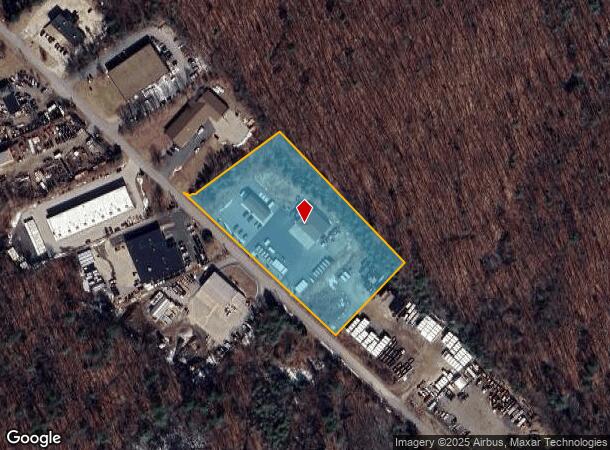
15 Industrial Way
Commercialnec
Rockingham
X
New Hampshire
25009C0075F
3.83 AC
2024
Rockingham
2024
Boston
103100
Boston-Cambridge-Newton, MA-NH
4,736 SF
ATKI-000016-000016
DEMOGRAPHICS near 15 Industrial Way
1 Mile
3 Mile
5 Mile
2024 Total Population
1,361
25,891
72,492
2029 Population
1,418
27,018
74,490
Pop Growth 2024-2029
+ 4.19%
+ 4.35%
+ 2.76%
Average Age
44
44
43
2024 Total Households
493
10,327
27,052
HH Growth 2024-2029
+ 4.26%
+ 4.51%
+ 2.81%
Median Household Inc
$96,874
$111,339
$114,604
Avg Household Size
2.50
2.40
2.60
2024 Avg HH Vehicles
2.00
2.00
2.00
Median Home Value
$401,786
$433,897
$462,175
Median Year Built
1977
1980
1980
Nearby Places
Map Layers
Map Styles
 Street
 Aerial
- Restaurants
- Banks
- Shops
- Fitness
- Groceries
PUBLIC TRANSPORTATION
AIRPORT
Manchester Boston Regional
DRIVE
WALK
Distance
Manchester Boston Regional
39 min
21.8 mi
Portsmouth International at Pease
DRIVE
WALK
Distance
Portsmouth International at Pease
56 min
38.0 mi
Freight Ports
Port of Boston
DRIVE
WALK
Distance
Port of Boston
60 min
41.8 mi
Nearby Properties
Address
Land Use
TOTAL SIZE
Lot Size
Zoning
Address
Land Use
TOTAL SIZE
Lot Size
Zoning
297,592 SF
2.90 AC
CIC
Address
Land Use
TOTAL SIZE
Lot Size
Zoning
82,926 SF
40.38 AC
A-RES
Address
Land Use
TOTAL SIZE
Lot Size
Zoning
55,819 SF
382.76 AC
RR2SCR
Address
Land Use
TOTAL SIZE
Lot Size
Zoning
89,227 SF
89.88 AC
A-RES
Address
Land Use
TOTAL SIZE
Lot Size
Zoning
67,705 SF
10.93 AC
TC- TO
Address
Land Use
TOTAL SIZE
Lot Size
Zoning
12,187 SF
18.51 AC
A-RES
Address
Land Use
TOTAL SIZE
Lot Size
Zoning
58,661 SF
9.53 AC
A-RES
Address
Land Use
TOTAL SIZE
Lot Size
Zoning
863 SF
14.79 AC
B-RES
Address
Land Use
TOTAL SIZE
Lot Size
Zoning
56,632 SF
14.20 AC
RUR
Address
Land Use
TOTAL SIZE
Lot Size
Zoning
231.50 AC
B-RES
Address
Land Use
TOTAL SIZE
Lot Size
Zoning
320 SF
13.40 AC
RUR
Address
Land Use
TOTAL SIZE
Lot Size
Zoning
480 SF
A-RES
Address
Land Use
TOTAL SIZE
Lot Size
Zoning
33,757 SF
6.43 AC
C2 C
Address
Land Use
TOTAL SIZE
Lot Size
Zoning
16,368 SF
7.67 AC
C1 C
Address
Land Use
TOTAL SIZE
Lot Size
Zoning
71,420 SF
18.50 AC
C2 C
Address
Land Use
TOTAL SIZE
Lot Size
Zoning
30.36 AC
GC
Address
Land Use
TOTAL SIZE
Lot Size
Zoning
23,160 SF
2.82 AC
GC
Address
Land Use
TOTAL SIZE
Lot Size
Zoning
10,559 SF
1.52 AC
C1 C
Address
Land Use
TOTAL SIZE
Lot Size
Zoning
12,796 SF
7.09 AC
A-RES
Address
Land Use
TOTAL SIZE
Lot Size
Zoning
3,843 SF
9.37 AC
TC- TO
Address
Land Use
TOTAL SIZE
Lot Size
Zoning
35,870 SF
4.32 AC
LCSD
Address
Land Use
TOTAL SIZE
Lot Size
Zoning
7,463 SF
3.05 AC
A-RES
Address
Land Use
TOTAL SIZE
Lot Size
Zoning
842 SF
13.30 AC
B-RES
Address
Land Use
TOTAL SIZE
Lot Size
Zoning
2,906 SF
20.74 AC
RR2SCR
Address
Land Use
TOTAL SIZE
Lot Size
Zoning
57,938 SF
23.60 AC
RUR
Address
Land Use
TOTAL SIZE
Lot Size
Zoning
5,281 SF
71.16 AC
A-RES
Address
Land Use
TOTAL SIZE
Lot Size
Zoning
61 AC
LDR
Address
Land Use
TOTAL SIZE
Lot Size
Zoning
12,608 SF
8.61 AC
C-I C
Address
Land Use
TOTAL SIZE
Lot Size
Zoning
12,669 SF
5 AC
RUR
Address
Land Use
TOTAL SIZE
Lot Size
Zoning
15,089 SF
5.26 AC
C1 C
The World's #1 Commercial Real Estate Marketplace
Connect with us
© 2025 CoStar Group
The information above has been obtained from sources believed reliable. While we do not doubt its accuracy we have not verified it and make no guarantee, warranty or representation about it. It is your responsibility to independently confirm its accuracy and completeness. Any projections, opinions, assumptions, or estimates used are for example only and do not represent the current or future performance of the property. The value of this transaction to you depends on tax and other factors which should be evaluated by your tax, financial, and legal advisors. You and your advisors should conduct a careful, independent investigation of the property to determine to your satisfaction the suitability of the property for your needs.