Property Record
1501 Circle Dr, Fort Worth, TX 76119
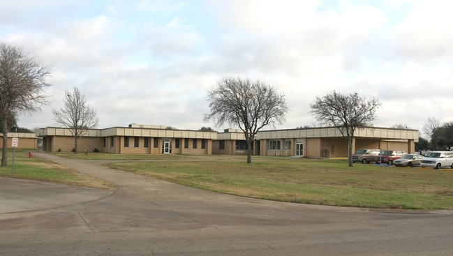

Property Detail
1501 Circle Dr
Dallas-Fort Worth-Arlington, TX
RESOURCE CONNECTION ADDN BLOCK 1 LOT 1A
06976166
TARRANT
Commercialnec
Texas
B and X Area of moderate flood hazard, usually the area between the limits of the 100-year and 500-year floods.
1a
0
101.49 AC
2025
S Cen.Tarrant Cnty
105902
Dallas/Ft Worth
343,416 SF
NEARBY LISTINGS FOR SALE OR LEASE
DEMOGRAPHICS near 1501 Circle Dr
1 mile
3 mile
5 mile
2025 Total Population
12,469
99,243
279,908
2030 Population
13,083
104,338
295,594
Pop Growth 2025-2030
+ 4.92%
+ 5.13%
+ 5.60%
Average Age
34
35
35
2025 Total Households
3,235
29,534
90,487
HH Growth 2025-2030
+ 4.95%
+ 5.31%
+ 5.85%
Median Household Inc
$43,315
$55,591
$62,007
Avg Household Size
3.20
3.20
2.90
2025 Avg HH Vehicles
2.00
2.00
2.00
Median Home Value
$136,483
$175,234
$221,570
Median Year Built
1975
1969
1973
Nearby Places
Map Layers
Map Styles
 Street
 Aerial
Layers
 Traffic
 Biking
Places
Listings with unknown addresses are not visible on the map
- Restaurants
- Banks
- Shops
- Fitness
- Groceries
PUBLIC TRANSPORTATION
COMMUTER RAIL
Fort Worth (Heartland Flyer - Amtrak, Texas Eagle - Amtrak)
Drive
Walk
Distance
Fort Worth (Heartland Flyer - Amtrak, Texas Eagle - Amtrak)
13 min
7.7 mi
Texas And Pacific (T&P) (Trinity Railway Express - Dallas Area Rapid Transit (DART))
Drive
Walk
Distance
Texas And Pacific (T&P) (Trinity Railway Express - Dallas Area Rapid Transit (DART))
15 min
7.8 mi
AIRPORT
Dallas-Fort Worth International
Drive
Walk
Distance
Dallas-Fort Worth International
42 min
31.2 mi
Dallas Love Field
Drive
Walk
Distance
Dallas Love Field
53 min
40.9 mi
Freight Ports
Port of Shreveport
Drive
Walk
Distance
Port of Shreveport
244 min
226.6 mi
Nearby Properties
Address
Land Use
TOTAL SIZE
Lot Size
Zoning
Address
Land Use
TOTAL SIZE
Lot Size
Zoning
661,238 SF
38.80 AC
Address
Land Use
TOTAL SIZE
Lot Size
Zoning
1,623,188 SF
84.13 AC
Address
Land Use
TOTAL SIZE
Lot Size
Zoning
555,914 SF
31.06 AC
Address
Land Use
TOTAL SIZE
Lot Size
Zoning
948,833 SF
64.37 AC
Address
Land Use
TOTAL SIZE
Lot Size
Zoning
1,052,516 SF
102.74 AC
Address
Land Use
TOTAL SIZE
Lot Size
Zoning
1,129,204 SF
74.34 AC
Address
Land Use
TOTAL SIZE
Lot Size
Zoning
1,402,986 SF
68.89 AC
Address
Land Use
TOTAL SIZE
Lot Size
Zoning
1,126,017 SF
76.27 AC
Address
Land Use
TOTAL SIZE
Lot Size
Zoning
593,917 SF
45.85 AC
Address
Land Use
TOTAL SIZE
Lot Size
Zoning
193,098 SF
25 AC
Address
Land Use
TOTAL SIZE
Lot Size
Zoning
295,784 SF
8.87 AC
Address
Land Use
TOTAL SIZE
Lot Size
Zoning
462,777 SF
37.49 AC
Address
Land Use
TOTAL SIZE
Lot Size
Zoning
266,514 SF
14.06 AC
Address
Land Use
TOTAL SIZE
Lot Size
Zoning
615,054 SF
27.49 AC
Address
Land Use
TOTAL SIZE
Lot Size
Zoning
488,564 SF
29.43 AC
Address
Land Use
TOTAL SIZE
Lot Size
Zoning
562,944 SF
35.69 AC
Address
Land Use
TOTAL SIZE
Lot Size
Zoning
147,466 SF
19.19 AC
Address
Land Use
TOTAL SIZE
Lot Size
Zoning
619,649 SF
53.64 AC
Address
Land Use
TOTAL SIZE
Lot Size
Zoning
585,000 SF
28.75 AC
Address
Land Use
TOTAL SIZE
Lot Size
Zoning
224,000 SF
24.35 AC
Address
Land Use
TOTAL SIZE
Lot Size
Zoning
244,871 SF
11.88 AC
Address
Land Use
TOTAL SIZE
Lot Size
Zoning
487,507 SF
145.80 AC
Address
Land Use
TOTAL SIZE
Lot Size
Zoning
391,540 SF
21.17 AC
Address
Land Use
TOTAL SIZE
Lot Size
Zoning
225,567 SF
13.01 AC
Address
Land Use
TOTAL SIZE
Lot Size
Zoning
765,351 SF
40.31 AC
Address
Land Use
TOTAL SIZE
Lot Size
Zoning
353,875 SF
18.48 AC
Address
Land Use
TOTAL SIZE
Lot Size
Zoning
327,530 SF
23.12 AC
Address
Land Use
TOTAL SIZE
Lot Size
Zoning
124,224 SF
20.67 AC
Address
Land Use
TOTAL SIZE
Lot Size
Zoning
543,757 SF
34.46 AC
The World's #1 Commercial Real Estate Marketplace
Connect with us
© 2026 CoStar Group
The information above has been obtained from sources believed reliable. While we do not doubt its accuracy we have not verified it and make no guarantee, warranty or representation about it. It is your responsibility to independently confirm its accuracy and completeness. Any projections, opinions, assumptions, or estimates used are for example only and do not represent the current or future performance of the property. The value of this transaction to you depends on tax and other factors which should be evaluated by your tax, financial, and legal advisors. You and your advisors should conduct a careful, independent investigation of the property to determine to your satisfaction the suitability of the property for your needs.