Property Record
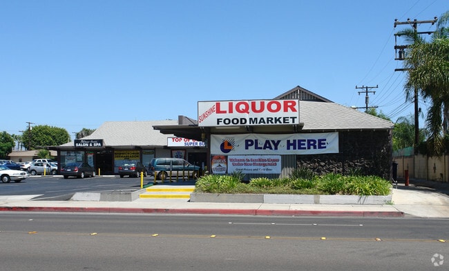
15052 Edwards St, Huntington Beach, CA 92647


NEARBY LISTINGS FOR SALE OR LEASE
Property Detail
15052 Edwards St
145-211-57
Rancho La Bolsa Chica
Commercialnec
S TWP 5 RGE 11 SEC 15 SEC 15 T 5 R 11 IRREG LOT IN NE1/4 AS DESC IN
X
Orange
06059C0232J
California
2024
0.70 AC
2025
Huntington Beach
099605
Orange County (California)
9,327 SF
Anaheim-Santa Ana-Irvine, CA
DEMOGRAPHICS near 15052 Edwards St
1 Mile
3 Mile
5 Mile
2024 Total Population
14,439
198,862
476,920
2029 Population
14,316
196,768
470,943
Pop Growth 2024-2029
(0.85%)
(1.05%)
(1.25%)
Average Age
41
42
42
2024 Total Households
4,804
66,901
158,113
HH Growth 2024-2029
(0.87%)
(1.15%)
(1.37%)
Median Household Inc
$108,700
$90,934
$90,463
Avg Household Size
2.90
2.90
2.90
2024 Avg HH Vehicles
2.00
2.00
2.00
Median Home Value
$797,305
$762,597
$763,037
Median Year Built
1965
1969
1969
Nearby Places
Map Layers
Map Styles
 Street
 Aerial
- Restaurants
- Banks
- Shops
- Fitness
- Groceries
PUBLIC TRANSPORTATION
AIRPORT
John Wayne/Orange County
DRIVE
WALK
Distance
John Wayne/Orange County
15 min
10.2 mi
Long Beach (Daugherty Field)
DRIVE
WALK
Distance
Long Beach (Daugherty Field)
17 min
12.3 mi
Los Angeles International
DRIVE
WALK
Distance
Los Angeles International
41 min
31.1 mi
SALE & LEASE HISTORY
LISTING DATE
SALE/LEASE

Nov 01, 2021
For Lease
Nearby Properties
Address
Land Use
TOTAL SIZE
Lot Size
Zoning
Address
Land Use
TOTAL SIZE
Lot Size
Zoning
Address
Land Use
TOTAL SIZE
Lot Size
Zoning
352,956 SF
16.70 AC
Address
Land Use
TOTAL SIZE
Lot Size
Zoning
Address
Land Use
TOTAL SIZE
Lot Size
Zoning
263,121 SF
14.05 AC
Address
Land Use
TOTAL SIZE
Lot Size
Zoning
Address
Land Use
TOTAL SIZE
Lot Size
Zoning
Address
Land Use
TOTAL SIZE
Lot Size
Zoning
Address
Land Use
TOTAL SIZE
Lot Size
Zoning
292,787 SF
4.95 AC
Address
Land Use
TOTAL SIZE
Lot Size
Zoning
Address
Land Use
TOTAL SIZE
Lot Size
Zoning
1,226.28 AC
Address
Land Use
TOTAL SIZE
Lot Size
Zoning
207,271 SF
9.09 AC
Address
Land Use
TOTAL SIZE
Lot Size
Zoning
Address
Land Use
TOTAL SIZE
Lot Size
Zoning
Address
Land Use
TOTAL SIZE
Lot Size
Zoning
35.40 AC
Address
Land Use
TOTAL SIZE
Lot Size
Zoning
4.86 AC
Address
Land Use
TOTAL SIZE
Lot Size
Zoning
23.41 AC
Address
Land Use
TOTAL SIZE
Lot Size
Zoning
168,744 SF
7.61 AC
Address
Land Use
TOTAL SIZE
Lot Size
Zoning
Address
Land Use
TOTAL SIZE
Lot Size
Zoning
3.77 AC
Address
Land Use
TOTAL SIZE
Lot Size
Zoning
335,101 SF
8.32 AC
Address
Land Use
TOTAL SIZE
Lot Size
Zoning
5.76 AC
Address
Land Use
TOTAL SIZE
Lot Size
Zoning
5,159 SF
17.44 AC
Address
Land Use
TOTAL SIZE
Lot Size
Zoning
203,886 SF
12.32 AC
Address
Land Use
TOTAL SIZE
Lot Size
Zoning
178,964 SF
11.62 AC
Address
Land Use
TOTAL SIZE
Lot Size
Zoning
Address
Land Use
TOTAL SIZE
Lot Size
Zoning
26,960 SF
64.86 AC
Address
Land Use
TOTAL SIZE
Lot Size
Zoning
Address
Land Use
TOTAL SIZE
Lot Size
Zoning
Address
Land Use
TOTAL SIZE
Lot Size
Zoning
Address
Land Use
TOTAL SIZE
Lot Size
Zoning
The World's #1 Commercial Real Estate Marketplace
Connect with us
© 2025 CoStar Group
The information above has been obtained from sources believed reliable. While we do not doubt its accuracy we have not verified it and make no guarantee, warranty or representation about it. It is your responsibility to independently confirm its accuracy and completeness. Any projections, opinions, assumptions, or estimates used are for example only and do not represent the current or future performance of the property. The value of this transaction to you depends on tax and other factors which should be evaluated by your tax, financial, and legal advisors. You and your advisors should conduct a careful, independent investigation of the property to determine to your satisfaction the suitability of the property for your needs.