Property Record
1510 E Front St, Port Angeles, WA 98362
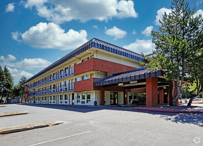


Property Detail
1510 E Front St
62061
PTN LOT 4 AND LOTS 5 THRU 9 AND 11 THRU 15 BL 133 THOMAS W CARTERS SUBDIV AND VAC 1ST ST ABTG SUR V20 P88
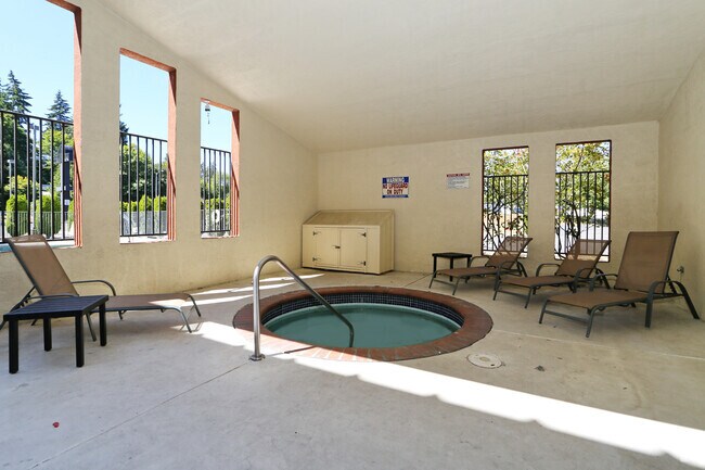
Hotel
CLALLAM
PCA
Washington
AE The base floodplain where base flood elevations are provided. AE Zones are now used on new format FIRMs instead of A1-A30 Zones.
4-9
2025
1.93 AC
2026
Bellingham/Northwest
001200
Other Market Areas
2,391 SF
Port Angeles, WA
NEARBY LISTINGS FOR SALE OR LEASE
-
-
View all Port Angeles listings for sale on LoopNet.com
DEMOGRAPHICS near 1510 E Front St
1 mile
3 mile
5 mile
2025 Total Population
5,136
21,119
28,994
2030 Population
5,128
21,116
29,012
Pop Growth 2025-2030
(0.16%)
(0.01%)
+ 0.06%
Average Age
46
45
45
2025 Total Households
2,405
9,576
12,763
HH Growth 2025-2030
(0.21%)
(0.14%)
(0.03%)
Median Household Inc
$58,485
$64,454
$66,724
Avg Household Size
2.10
2.10
2.20
2025 Avg HH Vehicles
2.00
2.00
2.00
Median Home Value
$368,165
$381,520
$384,945
Median Year Built
1964
1968
1973
Nearby Places
Map Layers
Map Styles
 Street
 Aerial
Layers
 Traffic
 Biking
Places
Listings with unknown addresses are not visible on the map
- Restaurants
- Banks
- Shops
- Fitness
- Groceries
SALE & LEASE HISTORY
LISTING DATE
SALE/LEASE

Apr 10, 2020
For Sale
Nearby Properties
Address
Land Use
TOTAL SIZE
Lot Size
Zoning
Address
Land Use
TOTAL SIZE
Lot Size
Zoning
184,682 SF
18.71 AC
Address
Land Use
TOTAL SIZE
Lot Size
Zoning
15,388 SF
5.90 AC
CBD
Address
Land Use
TOTAL SIZE
Lot Size
Zoning
67,080 SF
3 AC
PIH
Address
Land Use
TOTAL SIZE
Lot Size
Zoning
63,575 SF
2.03 AC
UNC
Address
Land Use
TOTAL SIZE
Lot Size
Zoning
128,380 SF
24.30 AC
URC
Address
Land Use
TOTAL SIZE
Lot Size
Zoning
33,120 SF
2.50 AC
PCSD
Address
Land Use
TOTAL SIZE
Lot Size
Zoning
47,287 SF
4.73 AC
PCSD
Address
Land Use
TOTAL SIZE
Lot Size
Zoning
55,164 SF
4.29 AC
PCSD
Address
Land Use
TOTAL SIZE
Lot Size
Zoning
44,076 SF
3.29 AC
UNC
Address
Land Use
TOTAL SIZE
Lot Size
Zoning
18,410 SF
0.64 AC
CSD
Address
Land Use
TOTAL SIZE
Lot Size
Zoning
16,280 SF
0.81 AC
Address
Land Use
TOTAL SIZE
Lot Size
Zoning
Address
Land Use
TOTAL SIZE
Lot Size
Zoning
61,804 SF
7.60 AC
Address
Land Use
TOTAL SIZE
Lot Size
Zoning
57,305 SF
3.18 AC
VLD
Address
Land Use
TOTAL SIZE
Lot Size
Zoning
32,601 SF
2.36 AC
RMD
Address
Land Use
TOTAL SIZE
Lot Size
Zoning
17,118 SF
0.60 AC
UNC
Address
Land Use
TOTAL SIZE
Lot Size
Zoning
7.60 AC
Address
Land Use
TOTAL SIZE
Lot Size
Zoning
16,693 SF
2.46 AC
PRHD
Address
Land Use
TOTAL SIZE
Lot Size
Zoning
4,835 SF
2.64 AC
Address
Land Use
TOTAL SIZE
Lot Size
Zoning
37,166 SF
1.93 AC
RMD
Address
Land Use
TOTAL SIZE
Lot Size
Zoning
26,796 SF
8.43 AC
GC
Address
Land Use
TOTAL SIZE
Lot Size
Zoning
784 SF
6.14 AC
Address
Land Use
TOTAL SIZE
Lot Size
Zoning
30,189 SF
2.63 AC
PCA
Address
Land Use
TOTAL SIZE
Lot Size
Zoning
26,400 SF
3.03 AC
Address
Land Use
TOTAL SIZE
Lot Size
Zoning
16,434 SF
1.80 AC
Address
Land Use
TOTAL SIZE
Lot Size
Zoning
18,913 SF
0.96 AC
PCN
Address
Land Use
TOTAL SIZE
Lot Size
Zoning
Address
Land Use
TOTAL SIZE
Lot Size
Zoning
22.85 AC
IH
Address
Land Use
TOTAL SIZE
Lot Size
Zoning
The World's #1 Commercial Real Estate Marketplace
Connect with us
© 2026 CoStar Group
The information above has been obtained from sources believed reliable. While we do not doubt its accuracy we have not verified it and make no guarantee, warranty or representation about it. It is your responsibility to independently confirm its accuracy and completeness. Any projections, opinions, assumptions, or estimates used are for example only and do not represent the current or future performance of the property. The value of this transaction to you depends on tax and other factors which should be evaluated by your tax, financial, and legal advisors. You and your advisors should conduct a careful, independent investigation of the property to determine to your satisfaction the suitability of the property for your needs.