Property Record
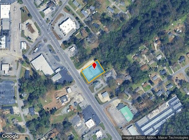
1511 Forestdale Blvd, Birmingham, AL 35214

NEARBY LISTINGS FOR SALE OR LEASE
Property Detail
1511 Forestdale Blvd
22-00-07-3-009-026.002
COM SW COR OF SW 1/4 SEC 7 TP 17 R 3W TH E 935 FT TH SE 50 FT TO POB TH NE 200 FT TH NW 148 FT TH SW 200 FT TH SE 148 FT TO POB
Storebuilding
Jefferson
X
Alabama
01073C0359H
0.68 AC
2023
Bessemer
2024
Birmingham
012401
Birmingham-Hoover, AL
6,734 SF
DEMOGRAPHICS near 1511 Forestdale Blvd
1 Mile
3 Mile
5 Mile
2024 Total Population
4,178
18,013
59,765
2029 Population
4,056
17,704
59,749
Pop Growth 2024-2029
(2.92%)
(1.72%)
(0.03%)
Average Age
41
42
42
2024 Total Households
1,698
7,261
24,708
HH Growth 2024-2029
(2.94%)
(1.79%)
+ 0.08%
Median Household Inc
$57,782
$54,753
$40,631
Avg Household Size
2.40
2.40
2.30
2024 Avg HH Vehicles
2.00
2.00
2.00
Median Home Value
$147,970
$141,969
$103,502
Median Year Built
1967
1973
1965
Nearby Places
Map Layers
Map Styles
 Street
 Aerial
- Restaurants
- Banks
- Shops
- Fitness
- Groceries
PUBLIC TRANSPORTATION
COMMUTER RAIL
Birmingham (Crescent - Amtrak)
DRIVE
WALK
Distance
Birmingham (Crescent - Amtrak)
13 min
7.7 mi
AIRPORT
Birmingham-Shuttlesworth International
DRIVE
WALK
Distance
Birmingham-Shuttlesworth International
19 min
12.5 mi
Freight Ports
Port of Mobile
DRIVE
WALK
Distance
Port of Mobile
288 min
262.1 mi
Nearby Properties
Address
Land Use
TOTAL SIZE
Lot Size
Zoning
Address
Land Use
TOTAL SIZE
Lot Size
Zoning
186,911 SF
12 AC
QM1
Address
Land Use
TOTAL SIZE
Lot Size
Zoning
140,000 SF
4.80 AC
M3
Address
Land Use
TOTAL SIZE
Lot Size
Zoning
32,922 SF
15 AC
I3
Address
Land Use
TOTAL SIZE
Lot Size
Zoning
181,399 SF
20.91 AC
A1
Address
Land Use
TOTAL SIZE
Lot Size
Zoning
137,177 SF
10 AC
INST
Address
Land Use
TOTAL SIZE
Lot Size
Zoning
123,937 SF
7.79 AC
R4
Address
Land Use
TOTAL SIZE
Lot Size
Zoning
31,817 SF
2.17 AC
CP-C
Address
Land Use
TOTAL SIZE
Lot Size
Zoning
109,753 SF
6.18 AC
R5
Address
Land Use
TOTAL SIZE
Lot Size
Zoning
147,113 SF
18.31 AC
M2
Address
Land Use
TOTAL SIZE
Lot Size
Zoning
49,235 SF
9.90 AC
R7/P
Address
Land Use
TOTAL SIZE
Lot Size
Zoning
46,584 SF
14.50 AC
R4
Address
Land Use
TOTAL SIZE
Lot Size
Zoning
45,661 SF
6.40 AC
I3
Address
Land Use
TOTAL SIZE
Lot Size
Zoning
106,501 SF
10.50 AC
I3
Address
Land Use
TOTAL SIZE
Lot Size
Zoning
70,850 SF
7.50 AC
M3
Address
Land Use
TOTAL SIZE
Lot Size
Zoning
24,920 SF
6 AC
I3
Address
Land Use
TOTAL SIZE
Lot Size
Zoning
44,194 SF
3 AC
I
Address
Land Use
TOTAL SIZE
Lot Size
Zoning
115,210 SF
32 AC
M2
Address
Land Use
TOTAL SIZE
Lot Size
Zoning
48,558 SF
20.02 AC
QM1
Address
Land Use
TOTAL SIZE
Lot Size
Zoning
87,260 SF
8.20 AC
A1-C
Address
Land Use
TOTAL SIZE
Lot Size
Zoning
33,516 SF
2.95 AC
R4
Address
Land Use
TOTAL SIZE
Lot Size
Zoning
82,172 SF
4.39 AC
R4
Address
Land Use
TOTAL SIZE
Lot Size
Zoning
46,492 SF
4.62 AC
A1-C
Address
Land Use
TOTAL SIZE
Lot Size
Zoning
40,000 SF
6.01 AC
I3
Address
Land Use
TOTAL SIZE
Lot Size
Zoning
31,438 SF
8 AC
B2
Address
Land Use
TOTAL SIZE
Lot Size
Zoning
26,458 SF
3.88 AC
INST
Address
Land Use
TOTAL SIZE
Lot Size
Zoning
18,700 SF
13.32 AC
M3
Address
Land Use
TOTAL SIZE
Lot Size
Zoning
54,544 SF
30 AC
M3
Address
Land Use
TOTAL SIZE
Lot Size
Zoning
57,685 SF
6.70 AC
I3
Address
Land Use
TOTAL SIZE
Lot Size
Zoning
34,498 SF
4.70 AC
INST
Address
Land Use
TOTAL SIZE
Lot Size
Zoning
37,100 SF
22.70 AC
INST
The World's #1 Commercial Real Estate Marketplace
Connect with us
© 2025 CoStar Group
The information above has been obtained from sources believed reliable. While we do not doubt its accuracy we have not verified it and make no guarantee, warranty or representation about it. It is your responsibility to independently confirm its accuracy and completeness. Any projections, opinions, assumptions, or estimates used are for example only and do not represent the current or future performance of the property. The value of this transaction to you depends on tax and other factors which should be evaluated by your tax, financial, and legal advisors. You and your advisors should conduct a careful, independent investigation of the property to determine to your satisfaction the suitability of the property for your needs.