Property Record
15150 Brighton Rd, Brighton, CO 80601
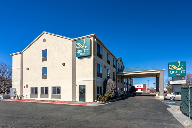


Property Detail
15150 Brighton Rd
Denver-Aurora-Centennial, CO
BROMLEY LANE PUD AMEDED BLK 2 LOT 1 TOG WITH PARC AND VAC RD DESC AS COM AT THE NE COR OF SD SEC 13 TH ALG SD N LN OF THE NE4 N 89D 50M 00S W 190 FT TH S 00D 09M 00S W 128 FT TO THE SW COR OF LJS SUBD RECORDED AT FILE #16 MAP 305 TH ALG THE S LN OF S
1571-13-0-07-005
Adams
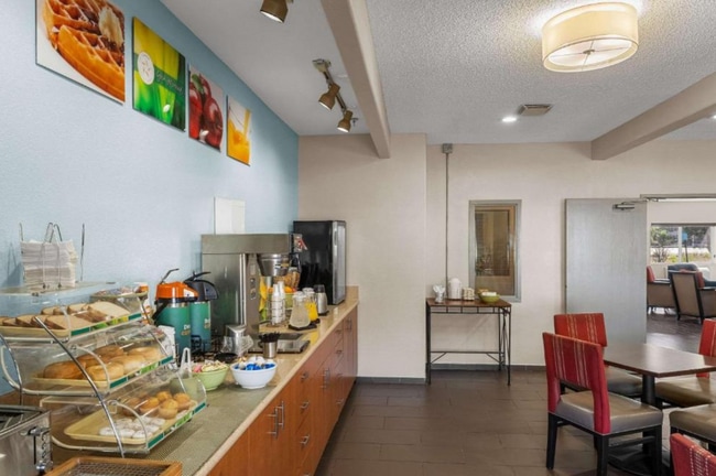
Hotel
Colorado
B and X Area of moderate flood hazard, usually the area between the limits of the 100-year and 500-year floods.
1
2024
0.82 AC
2025
Denver Airport/East
008552
Denver
24,528 SF
NEARBY LISTINGS FOR SALE OR LEASE
-
-
View all Brighton listings for sale on LoopNet.com
DEMOGRAPHICS near 15150 Brighton Rd
1 mile
3 mile
5 mile
2025 Total Population
8,724
33,924
72,822
2030 Population
9,070
35,463
77,003
Pop Growth 2025-2030
+ 3.97%
+ 4.54%
+ 5.74%
Average Age
36
38
38
2025 Total Households
3,141
11,586
24,257
HH Growth 2025-2030
+ 4.36%
+ 4.97%
+ 6.10%
Median Household Inc
$84,299
$94,121
$121,783
Avg Household Size
2.70
2.80
2.90
2025 Avg HH Vehicles
2.00
2.00
2.00
Median Home Value
$462,433
$511,547
$619,654
Median Year Built
1990
1994
2005
Nearby Places
Map Layers
Map Styles
 Street
 Aerial
Layers
 Traffic
 Biking
Places
Listings with unknown addresses are not visible on the map
- Restaurants
- Banks
- Shops
- Fitness
- Groceries
PUBLIC TRANSPORTATION
AIRPORT
Denver International
Drive
Walk
Distance
Denver International
25 min
20.2 mi
Freight Ports
Tulsa Port Of Catoosa
Drive
Walk
Distance
Tulsa Port Of Catoosa
732 min
714.4 mi
SALE & LEASE HISTORY
LISTING DATE
SALE/LEASE

Sep 23, 2016
For Sale
Sep 10, 2025
For Sale
Mar 18, 2019
For Sale
Jun 13, 2018
For Sale
Jan 08, 2025
For Sale
Feb 05, 2021
For Sale
Dec 13, 2016
For Sale
Apr 15, 2018
For Sale
Nearby Properties
Address
Land Use
TOTAL SIZE
Lot Size
Zoning
Address
Land Use
TOTAL SIZE
Lot Size
Zoning
566,409 SF
1.66 AC
Address
Land Use
TOTAL SIZE
Lot Size
Zoning
413,138 SF
20.74 AC
Address
Land Use
TOTAL SIZE
Lot Size
Zoning
113,764 SF
4.24 AC
Address
Land Use
TOTAL SIZE
Lot Size
Zoning
119,714 SF
4.93 AC
Address
Land Use
TOTAL SIZE
Lot Size
Zoning
116,223 SF
7.38 AC
Address
Land Use
TOTAL SIZE
Lot Size
Zoning
71,673 SF
7.59 AC
Address
Land Use
TOTAL SIZE
Lot Size
Zoning
161,096 SF
82.69 AC
Address
Land Use
TOTAL SIZE
Lot Size
Zoning
59,923 SF
1.83 AC
Address
Land Use
TOTAL SIZE
Lot Size
Zoning
223,459 SF
27.46 AC
Address
Land Use
TOTAL SIZE
Lot Size
Zoning
289,524 SF
15 AC
Address
Land Use
TOTAL SIZE
Lot Size
Zoning
281,164 SF
15.57 AC
Address
Land Use
TOTAL SIZE
Lot Size
Zoning
109,032 SF
13.88 AC
Address
Land Use
TOTAL SIZE
Lot Size
Zoning
174.45 AC
Address
Land Use
TOTAL SIZE
Lot Size
Zoning
91,534 SF
23.03 AC
Address
Land Use
TOTAL SIZE
Lot Size
Zoning
85,398 SF
15 AC
Address
Land Use
TOTAL SIZE
Lot Size
Zoning
182,210 SF
17.01 AC
Address
Land Use
TOTAL SIZE
Lot Size
Zoning
174,724 SF
14.75 AC
Address
Land Use
TOTAL SIZE
Lot Size
Zoning
65,492 SF
7.50 AC
Address
Land Use
TOTAL SIZE
Lot Size
Zoning
175,091 SF
9.43 AC
Address
Land Use
TOTAL SIZE
Lot Size
Zoning
260,526 SF
9.17 AC
Address
Land Use
TOTAL SIZE
Lot Size
Zoning
70,573 SF
7.83 AC
Address
Land Use
TOTAL SIZE
Lot Size
Zoning
40,000 SF
4.10 AC
Address
Land Use
TOTAL SIZE
Lot Size
Zoning
34,345 SF
13.11 AC
A1
Address
Land Use
TOTAL SIZE
Lot Size
Zoning
95,310 SF
20.96 AC
A1
Address
Land Use
TOTAL SIZE
Lot Size
Zoning
59,015 SF
9.44 AC
Address
Land Use
TOTAL SIZE
Lot Size
Zoning
168,506 SF
21.67 AC
Address
Land Use
TOTAL SIZE
Lot Size
Zoning
65,892 SF
4.87 AC
Address
Land Use
TOTAL SIZE
Lot Size
Zoning
134,925 SF
3.67 AC
Address
Land Use
TOTAL SIZE
Lot Size
Zoning
67,405 SF
6.96 AC
The World's #1 Commercial Real Estate Marketplace
Connect with us
© 2026 CoStar Group
The information above has been obtained from sources believed reliable. While we do not doubt its accuracy we have not verified it and make no guarantee, warranty or representation about it. It is your responsibility to independently confirm its accuracy and completeness. Any projections, opinions, assumptions, or estimates used are for example only and do not represent the current or future performance of the property. The value of this transaction to you depends on tax and other factors which should be evaluated by your tax, financial, and legal advisors. You and your advisors should conduct a careful, independent investigation of the property to determine to your satisfaction the suitability of the property for your needs.