Property Record
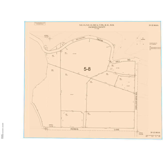
1550 Ashland Mine Rd, Ashland, OR 97520

NEARBY LISTINGS FOR SALE OR LEASE
Property Detail
1550 Ashland Mine Rd
Commercialnec
Jackson
X
Oregon
41029C2203F
6.13 AC
2024
Medford/Grants Pass
2025
Other Market Areas
002300
Medford, OR
4,101 SF
10100953
DEMOGRAPHICS near 1550 Ashland Mine Rd
1 Mile
3 Mile
5 Mile
2024 Total Population
2,053
19,872
33,549
2029 Population
2,046
19,875
33,760
Pop Growth 2024-2029
(0.34%)
+ 0.02%
+ 0.63%
Average Age
47
45
45
2024 Total Households
944
8,892
15,274
HH Growth 2024-2029
(0.53%)
(0.02%)
+ 0.67%
Median Household Inc
$74,613
$65,683
$63,569
Avg Household Size
2.20
2.10
2.10
2024 Avg HH Vehicles
2.00
2.00
2.00
Median Home Value
$643,544
$565,416
$509,560
Median Year Built
1978
1982
1984
Nearby Places
Map Layers
Map Styles
 Street
 Aerial
- Restaurants
- Banks
- Shops
- Fitness
- Groceries
PUBLIC TRANSPORTATION
AIRPORT
Rogue Valley International - Medford
DRIVE
WALK
Distance
Rogue Valley International - Medford
24 min
15.1 mi
Freight Ports
Port of Coos Bay, OR
DRIVE
WALK
Distance
Port of Coos Bay, OR
233 min
176.5 mi
Nearby Properties
Address
Land Use
TOTAL SIZE
Lot Size
Zoning
Address
Land Use
TOTAL SIZE
Lot Size
Zoning
78,000 SF
15.17 AC
SO
Address
Land Use
TOTAL SIZE
Lot Size
Zoning
25,300 SF
14.69 AC
SO
Address
Land Use
TOTAL SIZE
Lot Size
Zoning
21.36 AC
SO
Address
Land Use
TOTAL SIZE
Lot Size
Zoning
25.14 AC
R-1-5
Address
Land Use
TOTAL SIZE
Lot Size
Zoning
142,419 SF
6.33 AC
HC
Address
Land Use
TOTAL SIZE
Lot Size
Zoning
80 AC
WR-20
Address
Land Use
TOTAL SIZE
Lot Size
Zoning
12.05 AC
R-2
Address
Land Use
TOTAL SIZE
Lot Size
Zoning
3.83 AC
R-1-5
Address
Land Use
TOTAL SIZE
Lot Size
Zoning
29.34 AC
SO
Address
Land Use
TOTAL SIZE
Lot Size
Zoning
123,060 SF
7.22 AC
SO
Address
Land Use
TOTAL SIZE
Lot Size
Zoning
31.79 AC
WR-20
Address
Land Use
TOTAL SIZE
Lot Size
Zoning
27.25 AC
WR
Address
Land Use
TOTAL SIZE
Lot Size
Zoning
43,034 SF
0.96 AC
C-1-D
Address
Land Use
TOTAL SIZE
Lot Size
Zoning
26,208 SF
2.85 AC
HC
Address
Land Use
TOTAL SIZE
Lot Size
Zoning
24.96 AC
WR
Address
Land Use
TOTAL SIZE
Lot Size
Zoning
31,000 SF
2.31 AC
RM-22
Address
Land Use
TOTAL SIZE
Lot Size
Zoning
26,175 SF
2.57 AC
GC
Address
Land Use
TOTAL SIZE
Lot Size
Zoning
6,633 SF
1.70 AC
C-1
Address
Land Use
TOTAL SIZE
Lot Size
Zoning
20.03 AC
WR-20
Address
Land Use
TOTAL SIZE
Lot Size
Zoning
0.37 AC
C-1-D
Address
Land Use
TOTAL SIZE
Lot Size
Zoning
18.84 AC
WR-20
Address
Land Use
TOTAL SIZE
Lot Size
Zoning
65,160 SF
4.82 AC
E-1
Address
Land Use
TOTAL SIZE
Lot Size
Zoning
90,048 SF
1.81 AC
HC
Address
Land Use
TOTAL SIZE
Lot Size
Zoning
26,966 SF
3.42 AC
E-1
Address
Land Use
TOTAL SIZE
Lot Size
Zoning
42,033 SF
8.48 AC
E-1
Address
Land Use
TOTAL SIZE
Lot Size
Zoning
71,253 SF
3.34 AC
IL
Address
Land Use
TOTAL SIZE
Lot Size
Zoning
1.38 AC
R-3
Address
Land Use
TOTAL SIZE
Lot Size
Zoning
52,024 SF
3.22 AC
RM-22
Address
Land Use
TOTAL SIZE
Lot Size
Zoning
5.53 AC
RR-.5
Address
Land Use
TOTAL SIZE
Lot Size
Zoning
38,099 SF
2.20 AC
IC
The World's #1 Commercial Real Estate Marketplace
Connect with us
© 2025 CoStar Group
The information above has been obtained from sources believed reliable. While we do not doubt its accuracy we have not verified it and make no guarantee, warranty or representation about it. It is your responsibility to independently confirm its accuracy and completeness. Any projections, opinions, assumptions, or estimates used are for example only and do not represent the current or future performance of the property. The value of this transaction to you depends on tax and other factors which should be evaluated by your tax, financial, and legal advisors. You and your advisors should conduct a careful, independent investigation of the property to determine to your satisfaction the suitability of the property for your needs.