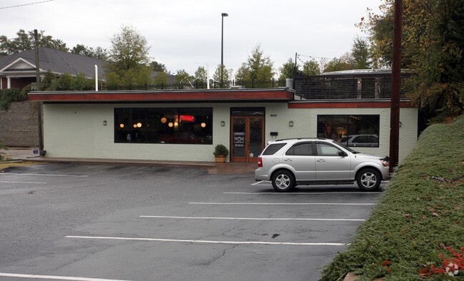
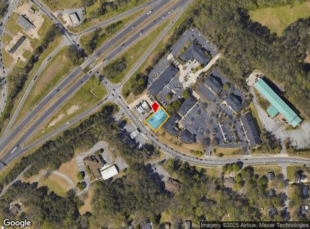
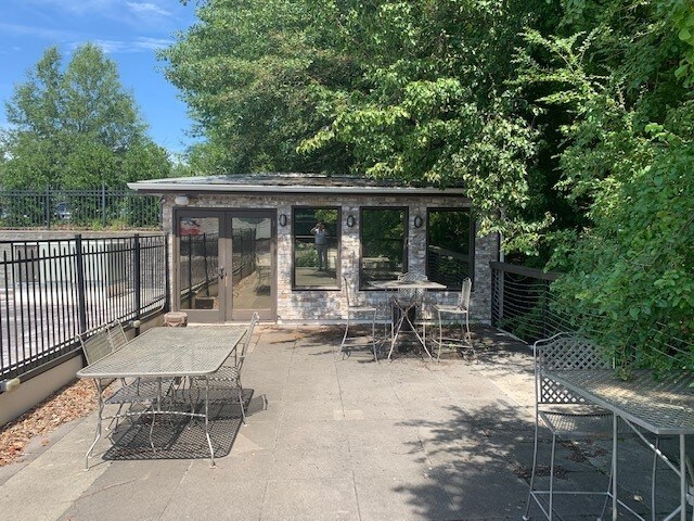
Property Record
1550 Oglethorpe Ave, Athens, GA 30606
NEARBY LISTINGS FOR SALE OR LEASE
Property Detail
1550 Oglethorpe Ave
113-025-A
Com-Sf-040
Restaurantbuilding
Clarke
X
Georgia
13059C0024F
0.25 AC
2025
Westside Athens
2025
Other Market Areas
001700
Athens-Clarke County, GA
3,711 SF
DEMOGRAPHICS near 1550 Oglethorpe Ave
1 Mile
3 Mile
5 Mile
2024 Total Population
5,964
54,541
103,147
2029 Population
5,963
54,664
104,622
Pop Growth 2024-2029
(0.02%)
+ 0.23%
+ 1.43%
Average Age
38
36
34
2024 Total Households
2,454
21,490
40,247
HH Growth 2024-2029
0.00%
+ 0.26%
+ 1.35%
Median Household Inc
$49,069
$55,183
$50,671
Avg Household Size
2.30
2.20
2.30
2024 Avg HH Vehicles
2.00
2.00
2.00
Median Home Value
$225,853
$289,574
$280,373
Median Year Built
1971
1981
1987
Nearby Places
Map Layers
Map Styles
 Street
 Aerial
- Restaurants
- Banks
- Shops
- Fitness
- Groceries
SALE & LEASE HISTORY
LISTING DATE
SALE/LEASE

Sep 24, 2016
For Sale
Feb 06, 2017
For Sale
Dec 05, 2019
For Sale
Apr 27, 2018
For Sale
Nearby Properties
Address
Land Use
TOTAL SIZE
Lot Size
Zoning
Address
Land Use
TOTAL SIZE
Lot Size
Zoning
11.36 AC
G
Address
Land Use
TOTAL SIZE
Lot Size
Zoning
163,904 SF
3.75 AC
C-D
Address
Land Use
TOTAL SIZE
Lot Size
Zoning
21.64 AC
G
Address
Land Use
TOTAL SIZE
Lot Size
Zoning
85,608 SF
63.75 AC
RM-2
Address
Land Use
TOTAL SIZE
Lot Size
Zoning
87,066 SF
36.66 AC
RM-2
Address
Land Use
TOTAL SIZE
Lot Size
Zoning
81,792 SF
30.99 AC
RM-1
Address
Land Use
TOTAL SIZE
Lot Size
Zoning
184,293 SF
1.84 AC
C-D
Address
Land Use
TOTAL SIZE
Lot Size
Zoning
56.15 AC
G
Address
Land Use
TOTAL SIZE
Lot Size
Zoning
20 AC
G
Address
Land Use
TOTAL SIZE
Lot Size
Zoning
17.23 AC
G
Address
Land Use
TOTAL SIZE
Lot Size
Zoning
97,317 SF
24.31 AC
C-G
Address
Land Use
TOTAL SIZE
Lot Size
Zoning
81,973 SF
4.97 AC
G
Address
Land Use
TOTAL SIZE
Lot Size
Zoning
5,501 SF
1.47 AC
C-D
Address
Land Use
TOTAL SIZE
Lot Size
Zoning
4,907 SF
28.35 AC
RM-2
Address
Land Use
TOTAL SIZE
Lot Size
Zoning
18.47 AC
C-G
Address
Land Use
TOTAL SIZE
Lot Size
Zoning
112,071 SF
5.27 AC
E-O
Address
Land Use
TOTAL SIZE
Lot Size
Zoning
136,404 SF
1.72 AC
G
Address
Land Use
TOTAL SIZE
Lot Size
Zoning
66,200 SF
13.35 AC
G
Address
Land Use
TOTAL SIZE
Lot Size
Zoning
2,505 SF
25.03 AC
RM-1
Address
Land Use
TOTAL SIZE
Lot Size
Zoning
36.74 AC
G
Address
Land Use
TOTAL SIZE
Lot Size
Zoning
50,000 SF
14.08 AC
G
Address
Land Use
TOTAL SIZE
Lot Size
Zoning
118,239 SF
2.80 AC
C-D(ND)
Address
Land Use
TOTAL SIZE
Lot Size
Zoning
137,661 SF
1.96 AC
C-D
Address
Land Use
TOTAL SIZE
Lot Size
Zoning
5.74 AC
G
Address
Land Use
TOTAL SIZE
Lot Size
Zoning
113,787 SF
32.92 AC
C-G
Address
Land Use
TOTAL SIZE
Lot Size
Zoning
8,423 SF
1.07 AC
C-D
Address
Land Use
TOTAL SIZE
Lot Size
Zoning
1,511 SF
17.01 AC
RM-1
Address
Land Use
TOTAL SIZE
Lot Size
Zoning
77,919 SF
8 AC
E-I
Address
Land Use
TOTAL SIZE
Lot Size
Zoning
5.91 AC
G
Address
Land Use
TOTAL SIZE
Lot Size
Zoning
64,466 SF
1.08 AC
C-D
The World's #1 Commercial Real Estate Marketplace
Connect with us
© 2025 CoStar Group
The information above has been obtained from sources believed reliable. While we do not doubt its accuracy we have not verified it and make no guarantee, warranty or representation about it. It is your responsibility to independently confirm its accuracy and completeness. Any projections, opinions, assumptions, or estimates used are for example only and do not represent the current or future performance of the property. The value of this transaction to you depends on tax and other factors which should be evaluated by your tax, financial, and legal advisors. You and your advisors should conduct a careful, independent investigation of the property to determine to your satisfaction the suitability of the property for your needs.