Property Record
1551 E Washington Ave, Vinton, VA 24179
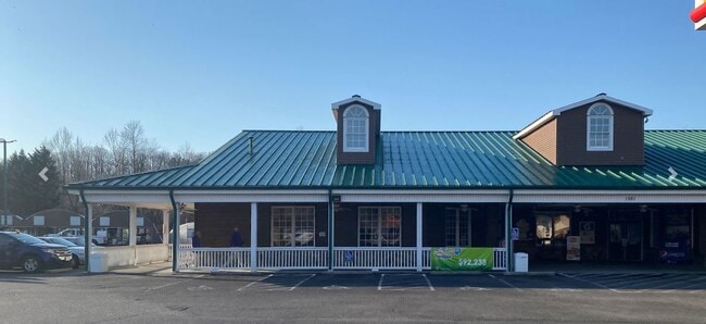

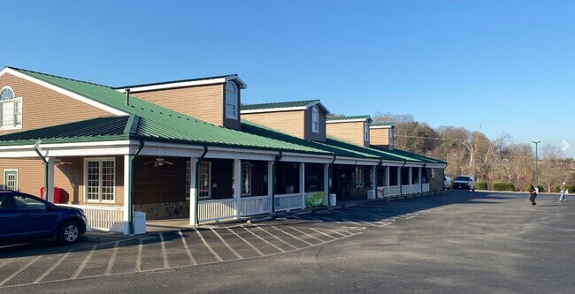
Property Detail
1551 E Washington Ave
061.14-04-04.03-0000
PAR 1A SUBD PLAT FOR FAIRCHILD & W E CUNDIFF CO INC
Conveniencestore
Roanoke
C2CS
Virginia
AE The base floodplain where base flood elevations are provided. AE Zones are now used on new format FIRMs instead of A1-A30 Zones.
3.85 AC
2025
Southeast Roanoke
2025
Roanoke
031101
Roanoke, VA
6,693 SF
NEARBY LISTINGS FOR SALE OR LEASE
DEMOGRAPHICS near 1551 E Washington Ave
1 mile
3 mile
5 mile
2025 Total Population
6,428
28,518
76,599
2030 Population
6,481
28,822
76,784
Pop Growth 2025-2030
+ 0.82%
+ 1.07%
+ 0.24%
Average Age
41
41
41
2025 Total Households
2,567
12,143
33,284
HH Growth 2025-2030
+ 0.74%
+ 1.03%
+ 0.22%
Median Household Inc
$75,625
$59,985
$57,603
Avg Household Size
2.50
2.30
2.20
2025 Avg HH Vehicles
2.00
2.00
2.00
Median Home Value
$250,097
$220,602
$225,775
Median Year Built
1973
1973
1968
Nearby Places
Map Layers
Map Styles
 Street
 Aerial
Layers
 Traffic
 Biking
Places
Listings with unknown addresses are not visible on the map
- Restaurants
- Banks
- Shops
- Fitness
- Groceries
PUBLIC TRANSPORTATION
COMMUTER RAIL
Drive
Walk
Distance
10 min
4.9 mi
AIRPORT
Roanoke/Blacksburg Regional (Woodrum Field)
Drive
Walk
Distance
Roanoke/Blacksburg Regional (Woodrum Field)
18 min
8.5 mi
SALE & LEASE HISTORY
LISTING DATE
SALE/LEASE

Jun 28, 2022
For Lease
Jun 06, 2018
For Lease
Nearby Properties
Address
Land Use
TOTAL SIZE
Lot Size
Zoning
Address
Land Use
TOTAL SIZE
Lot Size
Zoning
370 SF
105.25 AC
I-2
Address
Land Use
TOTAL SIZE
Lot Size
Zoning
214,543 SF
38.29 AC
R1S
Address
Land Use
TOTAL SIZE
Lot Size
Zoning
4,901 SF
17.41 AC
MXPUD
Address
Land Use
TOTAL SIZE
Lot Size
Zoning
71,696 SF
71.64 AC
INPUD/ROS
Address
Land Use
TOTAL SIZE
Lot Size
Zoning
Address
Land Use
TOTAL SIZE
Lot Size
Zoning
402,320 SF
42.13 AC
I1C
Address
Land Use
TOTAL SIZE
Lot Size
Zoning
387,684 SF
27.44 AC
I-1
Address
Land Use
TOTAL SIZE
Lot Size
Zoning
142,048 SF
21.38 AC
I-1
Address
Land Use
TOTAL SIZE
Lot Size
Zoning
2,193 SF
2,914.16 AC
AG3
Address
Land Use
TOTAL SIZE
Lot Size
Zoning
19,594 SF
11.15 AC
RMF
Address
Land Use
TOTAL SIZE
Lot Size
Zoning
11,694 SF
12.05 AC
RMF
Address
Land Use
TOTAL SIZE
Lot Size
Zoning
1,109 SF
13.44 AC
INPUD
Address
Land Use
TOTAL SIZE
Lot Size
Zoning
446,526 SF
28.10 AC
I-1
Address
Land Use
TOTAL SIZE
Lot Size
Zoning
275,300 SF
25.30 AC
PTD
Address
Land Use
TOTAL SIZE
Lot Size
Zoning
87,057 SF
12.79 AC
GB
Address
Land Use
TOTAL SIZE
Lot Size
Zoning
14,418 SF
6.47 AC
RMF
Address
Land Use
TOTAL SIZE
Lot Size
Zoning
333,572 SF
20 AC
I-1
Address
Land Use
TOTAL SIZE
Lot Size
Zoning
39,354 SF
7.37 AC
RMF
Address
Land Use
TOTAL SIZE
Lot Size
Zoning
48.26 AC
I-1
Address
Land Use
TOTAL SIZE
Lot Size
Zoning
63,648 SF
11.51 AC
INPUD
Address
Land Use
TOTAL SIZE
Lot Size
Zoning
123,019 SF
21.84 AC
I-1
Address
Land Use
TOTAL SIZE
Lot Size
Zoning
83,159 SF
15.49 AC
C2S
Address
Land Use
TOTAL SIZE
Lot Size
Zoning
2,406 SF
2.78 AC
RM-2
Address
Land Use
TOTAL SIZE
Lot Size
Zoning
Address
Land Use
TOTAL SIZE
Lot Size
Zoning
184,144 SF
10.90 AC
I-1
Address
Land Use
TOTAL SIZE
Lot Size
Zoning
11,694 SF
5.20 AC
RMF
Address
Land Use
TOTAL SIZE
Lot Size
Zoning
61,759 SF
17.67 AC
RB
Address
Land Use
TOTAL SIZE
Lot Size
Zoning
85,960 SF
18.36 AC
I-1
Address
Land Use
TOTAL SIZE
Lot Size
Zoning
65,710 SF
12 AC
R1
Address
Land Use
TOTAL SIZE
Lot Size
Zoning
23,108 SF
1.96 AC
CB
The World's #1 Commercial Real Estate Marketplace
Connect with us
© 2026 CoStar Group
The information above has been obtained from sources believed reliable. While we do not doubt its accuracy we have not verified it and make no guarantee, warranty or representation about it. It is your responsibility to independently confirm its accuracy and completeness. Any projections, opinions, assumptions, or estimates used are for example only and do not represent the current or future performance of the property. The value of this transaction to you depends on tax and other factors which should be evaluated by your tax, financial, and legal advisors. You and your advisors should conduct a careful, independent investigation of the property to determine to your satisfaction the suitability of the property for your needs.