Property Record
Hazel Dell Rd, Noblesville, IN 46062


This Property Is For Sale
NEARBY LISTINGS FOR SALE OR LEASE
Property Detail
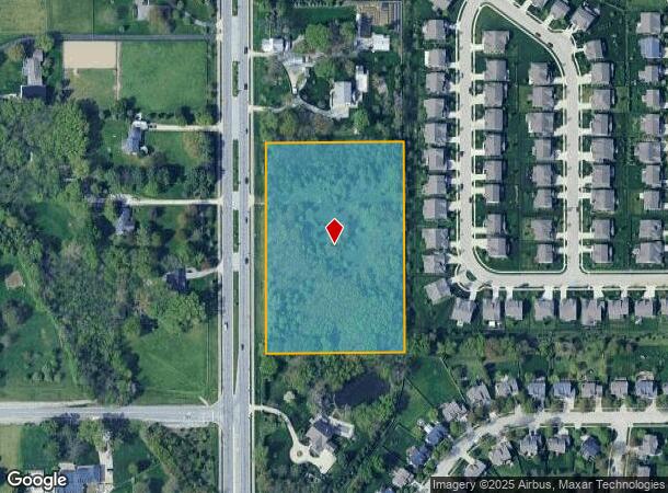
Hazel Dell Rd
29-10-10-000-022.001-013
ACREAGE 5.01, SECTION 10, TOWNSHIP 18, RANGE 4
Recreationalacreage
Hamilton
X
Indiana
18057C0139G
5.01 AC
2023
Carmel
2024
Indianapolis
110518
Indianapolis-Carmel-Anderson, IN
DEMOGRAPHICS near Hazel Dell Rd
1 Mile
3 Mile
5 Mile
2024 Total Population
5,169
50,920
165,735
2029 Population
5,829
57,485
186,690
Pop Growth 2024-2029
+ 12.77%
+ 12.89%
+ 12.64%
Average Age
37
39
39
2024 Total Households
1,753
18,049
63,306
HH Growth 2024-2029
+ 12.89%
+ 12.91%
+ 12.71%
Median Household Inc
$102,434
$121,774
$94,703
Avg Household Size
2.90
2.80
2.60
2024 Avg HH Vehicles
2.00
2.00
2.00
Median Home Value
$371,733
$387,632
$315,531
Median Year Built
2010
2004
1997
Nearby Places
Map Layers
Map Styles
 Street
 Aerial
- Restaurants
- Banks
- Shops
- Fitness
- Groceries
PUBLIC TRANSPORTATION
AIRPORT
Indianapolis International
DRIVE
WALK
Distance
Indianapolis International
46 min
37.0 mi
Freight Ports
Virginia Port Authority - Richmond
DRIVE
WALK
Distance
Virginia Port Authority - Richmond
1 min
498.3 mi
Nearby Properties
Address
Land Use
TOTAL SIZE
Lot Size
Zoning
Address
Land Use
TOTAL SIZE
Lot Size
Zoning
372,542 SF
32.10 AC
Address
Land Use
TOTAL SIZE
Lot Size
Zoning
451,785 SF
13.04 AC
Address
Land Use
TOTAL SIZE
Lot Size
Zoning
357,660 SF
22.37 AC
Address
Land Use
TOTAL SIZE
Lot Size
Zoning
280,736 SF
9.06 AC
Address
Land Use
TOTAL SIZE
Lot Size
Zoning
297,641 SF
70.35 AC
Address
Land Use
TOTAL SIZE
Lot Size
Zoning
239,148 SF
18.56 AC
Address
Land Use
TOTAL SIZE
Lot Size
Zoning
186,668 SF
19.09 AC
Address
Land Use
TOTAL SIZE
Lot Size
Zoning
209,778 SF
24.45 AC
Address
Land Use
TOTAL SIZE
Lot Size
Zoning
141,666 SF
76.66 AC
Address
Land Use
TOTAL SIZE
Lot Size
Zoning
238,722 SF
24.27 AC
Address
Land Use
TOTAL SIZE
Lot Size
Zoning
241,000 SF
15.01 AC
Address
Land Use
TOTAL SIZE
Lot Size
Zoning
151,448 SF
10.58 AC
Address
Land Use
TOTAL SIZE
Lot Size
Zoning
129,634 SF
12.71 AC
Address
Land Use
TOTAL SIZE
Lot Size
Zoning
110,178 SF
18.90 AC
Address
Land Use
TOTAL SIZE
Lot Size
Zoning
116,799 SF
4.63 AC
Address
Land Use
TOTAL SIZE
Lot Size
Zoning
61,290 SF
7.91 AC
Address
Land Use
TOTAL SIZE
Lot Size
Zoning
101,050 SF
62.43 AC
Address
Land Use
TOTAL SIZE
Lot Size
Zoning
228,180 SF
13.05 AC
Address
Land Use
TOTAL SIZE
Lot Size
Zoning
73,774 SF
19.21 AC
Address
Land Use
TOTAL SIZE
Lot Size
Zoning
123,628 SF
10.55 AC
Address
Land Use
TOTAL SIZE
Lot Size
Zoning
19,342 SF
91.88 AC
Address
Land Use
TOTAL SIZE
Lot Size
Zoning
78,126 SF
6.71 AC
Address
Land Use
TOTAL SIZE
Lot Size
Zoning
17,678 SF
53.27 AC
Address
Land Use
TOTAL SIZE
Lot Size
Zoning
47,322 SF
8.67 AC
Address
Land Use
TOTAL SIZE
Lot Size
Zoning
62,977 SF
9.39 AC
Address
Land Use
TOTAL SIZE
Lot Size
Zoning
68,434 SF
12.36 AC
Address
Land Use
TOTAL SIZE
Lot Size
Zoning
58,814 SF
5.41 AC
Address
Land Use
TOTAL SIZE
Lot Size
Zoning
92,650 SF
5.86 AC
Address
Land Use
TOTAL SIZE
Lot Size
Zoning
136,520 SF
13.20 AC
Address
Land Use
TOTAL SIZE
Lot Size
Zoning
53,695 SF
30.25 AC
The World's #1 Commercial Real Estate Marketplace
Connect with us
© 2025 CoStar Group
The information above has been obtained from sources believed reliable. While we do not doubt its accuracy we have not verified it and make no guarantee, warranty or representation about it. It is your responsibility to independently confirm its accuracy and completeness. Any projections, opinions, assumptions, or estimates used are for example only and do not represent the current or future performance of the property. The value of this transaction to you depends on tax and other factors which should be evaluated by your tax, financial, and legal advisors. You and your advisors should conduct a careful, independent investigation of the property to determine to your satisfaction the suitability of the property for your needs.