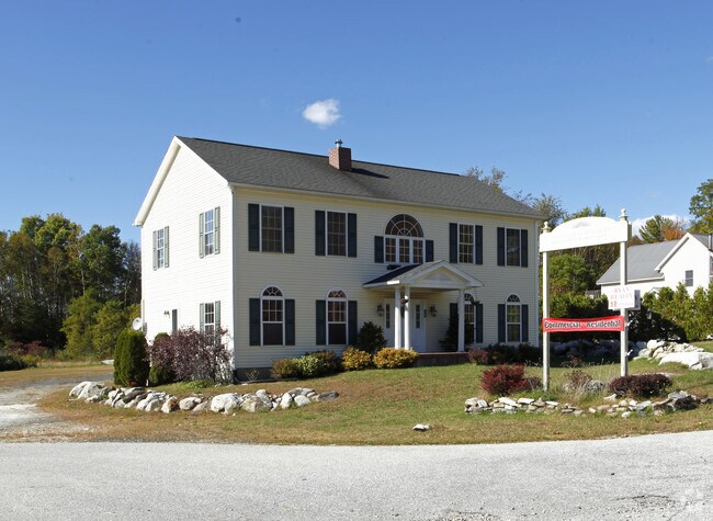
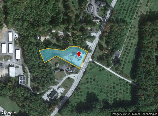
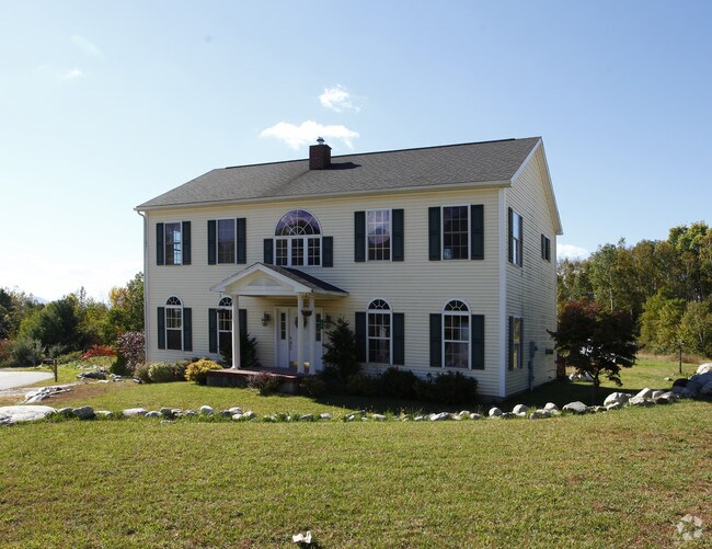
Property Record
1591 Us Route 4, Rutland, VT 05701
NEARBY LISTINGS FOR SALE OR LEASE
Property Detail
1591 Us Route 4
384-119-12532
2.0A ; COMM
Commercialnec
Rutland
X
Vermont
50021C0245D
2 AC
0
Vermont South Area
2024
Other Market Areas
962800
Rutland, VT
DEMOGRAPHICS near 1591 Us Route 4
1 Mile
3 Mile
5 Mile
2024 Total Population
743
12,254
22,280
2029 Population
736
12,108
22,048
Pop Growth 2024-2029
(0.94%)
(1.19%)
(1.04%)
Average Age
48
46
45
2024 Total Households
338
5,765
10,242
HH Growth 2024-2029
(1.18%)
(1.20%)
(1.03%)
Median Household Inc
$84,469
$66,939
$59,992
Avg Household Size
2.20
2.00
2.00
2024 Avg HH Vehicles
2.00
2.00
2.00
Median Home Value
$257,558
$188,468
$185,030
Median Year Built
1978
1964
1963
Nearby Places
- Restaurants
- Banks
- Shops
- Fitness
- Groceries
PUBLIC TRANSPORTATION
COMMUTER RAIL
Rutland (Ethan Allen Express - Amtrak)
DRIVE
WALK
Distance
Rutland (Ethan Allen Express - Amtrak)
8 min
3.5 mi
Freight Ports
Albany, NY Port
DRIVE
WALK
Distance
Albany, NY Port
148 min
95.3 mi
Nearby Properties
Address
Land Use
TOTAL SIZE
Lot Size
Zoning
Address
Land Use
TOTAL SIZE
Lot Size
Zoning
38.14 AC
Address
Land Use
TOTAL SIZE
Lot Size
Zoning
Address
Land Use
TOTAL SIZE
Lot Size
Zoning
Address
Land Use
TOTAL SIZE
Lot Size
Zoning
Address
Land Use
TOTAL SIZE
Lot Size
Zoning
21.42 AC
Address
Land Use
TOTAL SIZE
Lot Size
Zoning
9.48 AC
Address
Land Use
TOTAL SIZE
Lot Size
Zoning
Address
Land Use
TOTAL SIZE
Lot Size
Zoning
38.27 AC
Address
Land Use
TOTAL SIZE
Lot Size
Zoning
1.02 AC
Address
Land Use
TOTAL SIZE
Lot Size
Zoning
8.85 AC
Address
Land Use
TOTAL SIZE
Lot Size
Zoning
Address
Land Use
TOTAL SIZE
Lot Size
Zoning
116,509 SF
13.71 AC
Address
Land Use
TOTAL SIZE
Lot Size
Zoning
Address
Land Use
TOTAL SIZE
Lot Size
Zoning
1.50 AC
Address
Land Use
TOTAL SIZE
Lot Size
Zoning
Address
Land Use
TOTAL SIZE
Lot Size
Zoning
46.13 AC
Address
Land Use
TOTAL SIZE
Lot Size
Zoning
0.51 AC
Address
Land Use
TOTAL SIZE
Lot Size
Zoning
Address
Land Use
TOTAL SIZE
Lot Size
Zoning
0.64 AC
Address
Land Use
TOTAL SIZE
Lot Size
Zoning
0.38 AC
Address
Land Use
TOTAL SIZE
Lot Size
Zoning
9.45 AC
Address
Land Use
TOTAL SIZE
Lot Size
Zoning
19.78 AC
Address
Land Use
TOTAL SIZE
Lot Size
Zoning
13.23 AC
Address
Land Use
TOTAL SIZE
Lot Size
Zoning
5.66 AC
Address
Land Use
TOTAL SIZE
Lot Size
Zoning
0.75 AC
Address
Land Use
TOTAL SIZE
Lot Size
Zoning
0.88 AC
Address
Land Use
TOTAL SIZE
Lot Size
Zoning
1.82 AC
Address
Land Use
TOTAL SIZE
Lot Size
Zoning
2.60 AC
Address
Land Use
TOTAL SIZE
Lot Size
Zoning
8.52 AC
Address
Land Use
TOTAL SIZE
Lot Size
Zoning
16.78 AC
The World's #1 Commercial Real Estate Marketplace
Connect with us
© 2025 CoStar Group
The information above has been obtained from sources believed reliable. While we do not doubt its accuracy we have not verified it and make no guarantee, warranty or representation about it. It is your responsibility to independently confirm its accuracy and completeness. Any projections, opinions, assumptions, or estimates used are for example only and do not represent the current or future performance of the property. The value of this transaction to you depends on tax and other factors which should be evaluated by your tax, financial, and legal advisors. You and your advisors should conduct a careful, independent investigation of the property to determine to your satisfaction the suitability of the property for your needs.