Property Record
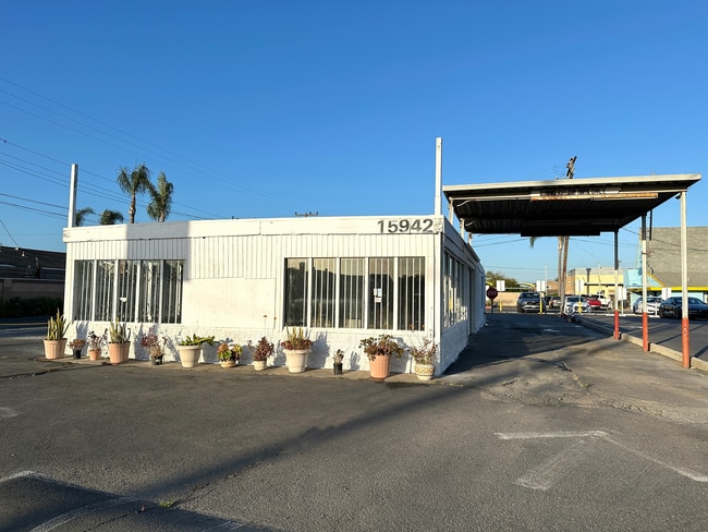
15942 Edwards St, Huntington Beach, CA 92647


NEARBY LISTINGS FOR SALE OR LEASE
Property Detail
15942 Edwards St
145-313-22
N TR 4277 BLK LOT 59 TR 4277 LOT 59 LOT IN LOT
Commercialnec
Orange
X
California
06059C0232J
59
2024
0.32 AC
2025
Huntington Beach
099605
Orange County (California)
730 SF
Anaheim-Santa Ana-Irvine, CA
DEMOGRAPHICS near 15942 Edwards St
1 Mile
3 Mile
5 Mile
2024 Total Population
22,489
186,716
447,922
2029 Population
22,338
184,695
442,500
Pop Growth 2024-2029
(0.67%)
(1.08%)
(1.21%)
Average Age
41
42
43
2024 Total Households
8,311
63,940
152,272
HH Growth 2024-2029
(0.66%)
(1.19%)
(1.32%)
Median Household Inc
$114,013
$95,378
$92,560
Avg Household Size
2.60
2.80
2.80
2024 Avg HH Vehicles
2.00
2.00
2.00
Median Home Value
$790,141
$801,858
$784,184
Median Year Built
1967
1970
1970
Nearby Places
Map Layers
Map Styles
 Street
 Aerial
- Restaurants
- Banks
- Shops
- Fitness
- Groceries
PUBLIC TRANSPORTATION
AIRPORT
John Wayne/Orange County
DRIVE
WALK
Distance
John Wayne/Orange County
15 min
9.8 mi
Long Beach (Daugherty Field)
DRIVE
WALK
Distance
Long Beach (Daugherty Field)
19 min
13.2 mi
Los Angeles International
DRIVE
WALK
Distance
Los Angeles International
43 min
32.0 mi
SALE & LEASE HISTORY
LISTING DATE
SALE/LEASE

Mar 06, 2020
For Sale
Jul 09, 2024
For Lease
Dec 03, 2025
For Lease
Nearby Properties
Address
Land Use
TOTAL SIZE
Lot Size
Zoning
Address
Land Use
TOTAL SIZE
Lot Size
Zoning
Address
Land Use
TOTAL SIZE
Lot Size
Zoning
352,956 SF
16.70 AC
Address
Land Use
TOTAL SIZE
Lot Size
Zoning
Address
Land Use
TOTAL SIZE
Lot Size
Zoning
263,121 SF
14.05 AC
Address
Land Use
TOTAL SIZE
Lot Size
Zoning
Address
Land Use
TOTAL SIZE
Lot Size
Zoning
Address
Land Use
TOTAL SIZE
Lot Size
Zoning
Address
Land Use
TOTAL SIZE
Lot Size
Zoning
292,787 SF
4.95 AC
Address
Land Use
TOTAL SIZE
Lot Size
Zoning
Address
Land Use
TOTAL SIZE
Lot Size
Zoning
207,271 SF
9.09 AC
Address
Land Use
TOTAL SIZE
Lot Size
Zoning
Address
Land Use
TOTAL SIZE
Lot Size
Zoning
Address
Land Use
TOTAL SIZE
Lot Size
Zoning
35.40 AC
Address
Land Use
TOTAL SIZE
Lot Size
Zoning
Address
Land Use
TOTAL SIZE
Lot Size
Zoning
4.86 AC
Address
Land Use
TOTAL SIZE
Lot Size
Zoning
23.41 AC
Address
Land Use
TOTAL SIZE
Lot Size
Zoning
168,744 SF
7.61 AC
Address
Land Use
TOTAL SIZE
Lot Size
Zoning
Address
Land Use
TOTAL SIZE
Lot Size
Zoning
335,101 SF
8.32 AC
Address
Land Use
TOTAL SIZE
Lot Size
Zoning
5.76 AC
Address
Land Use
TOTAL SIZE
Lot Size
Zoning
5,159 SF
17.44 AC
Address
Land Use
TOTAL SIZE
Lot Size
Zoning
203,886 SF
12.32 AC
Address
Land Use
TOTAL SIZE
Lot Size
Zoning
178,964 SF
11.62 AC
Address
Land Use
TOTAL SIZE
Lot Size
Zoning
Address
Land Use
TOTAL SIZE
Lot Size
Zoning
Address
Land Use
TOTAL SIZE
Lot Size
Zoning
Address
Land Use
TOTAL SIZE
Lot Size
Zoning
Address
Land Use
TOTAL SIZE
Lot Size
Zoning
Address
Land Use
TOTAL SIZE
Lot Size
Zoning
Address
Land Use
TOTAL SIZE
Lot Size
Zoning
392.51 AC
The World's #1 Commercial Real Estate Marketplace
Connect with us
© 2025 CoStar Group
The information above has been obtained from sources believed reliable. While we do not doubt its accuracy we have not verified it and make no guarantee, warranty or representation about it. It is your responsibility to independently confirm its accuracy and completeness. Any projections, opinions, assumptions, or estimates used are for example only and do not represent the current or future performance of the property. The value of this transaction to you depends on tax and other factors which should be evaluated by your tax, financial, and legal advisors. You and your advisors should conduct a careful, independent investigation of the property to determine to your satisfaction the suitability of the property for your needs.