Property Record
1600 Cr 240 Rd, Durango, CO 81301

Property Detail
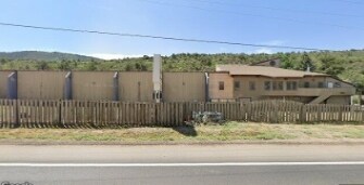
1600 Cr 240 Rd
Durango, CO
SUBDIVISION: CHRISTIANSON S/D BLOCK: 0 LOT: A CHRISTIANSON SUB 1600 CR 240 DURANGO 81301
R000865
LA PLATA
Recreationalentertainmentgeneral
Colorado
B and X Area of moderate flood hazard, usually the area between the limits of the 100-year and 500-year floods.
a
2024
2.40 AC
2025
Colorado Southwest Area
970800
Other Market Areas
24,585 SF
NEARBY LISTINGS FOR SALE OR LEASE
DEMOGRAPHICS near 1600 Cr 240 Rd
1 mile
3 mile
5 mile
2025 Total Population
5,062
18,789
24,326
2030 Population
5,071
18,820
24,451
Pop Growth 2025-2030
+ 0.18%
+ 0.16%
+ 0.51%
Average Age
36
39
40
2025 Total Households
1,830
7,830
10,217
HH Growth 2025-2030
(0.60%)
(0.23%)
+ 0.17%
Median Household Inc
$87,826
$87,839
$89,139
Avg Household Size
2.10
2.10
2.20
2025 Avg HH Vehicles
2.00
2.00
2.00
Median Home Value
$723,491
$722,315
$725,277
Median Year Built
1992
1981
1986
Nearby Places
Map Layers
Map Styles
 Street
 Aerial
Transit
 Traffic
 Biking
Places
Listings with unknown addresses are not visible on the map
- Restaurants
- Banks
- Shops
- Fitness
- Groceries
PUBLIC TRANSPORTATION
AIRPORT
Durango-La Plata County
Drive
Walk
Distance
Durango-La Plata County
30 min
17.6 mi
Nearby Properties
Address
Land Use
TOTAL SIZE
Lot Size
Zoning
Address
Land Use
TOTAL SIZE
Lot Size
Zoning
1,237,361 SF
230.69 AC
Address
Land Use
TOTAL SIZE
Lot Size
Zoning
277,165 SF
16.47 AC
Address
Land Use
TOTAL SIZE
Lot Size
Zoning
174,631 SF
32.10 AC
Address
Land Use
TOTAL SIZE
Lot Size
Zoning
68,857 SF
21.03 AC
Address
Land Use
TOTAL SIZE
Lot Size
Zoning
153,242 SF
11.62 AC
Address
Land Use
TOTAL SIZE
Lot Size
Zoning
112,681 SF
1.12 AC
Address
Land Use
TOTAL SIZE
Lot Size
Zoning
159,163 SF
5.50 AC
Address
Land Use
TOTAL SIZE
Lot Size
Zoning
45,824 SF
4.55 AC
Address
Land Use
TOTAL SIZE
Lot Size
Zoning
51,923 SF
Address
Land Use
TOTAL SIZE
Lot Size
Zoning
45,340 SF
3.74 AC
Address
Land Use
TOTAL SIZE
Lot Size
Zoning
23,667 SF
1.91 AC
Address
Land Use
TOTAL SIZE
Lot Size
Zoning
29,546 SF
4.14 AC
Address
Land Use
TOTAL SIZE
Lot Size
Zoning
72,094 SF
0.57 AC
Address
Land Use
TOTAL SIZE
Lot Size
Zoning
49,001 SF
7.61 AC
Address
Land Use
TOTAL SIZE
Lot Size
Zoning
52,704 SF
1.73 AC
Address
Land Use
TOTAL SIZE
Lot Size
Zoning
37,012 SF
2.06 AC
Address
Land Use
TOTAL SIZE
Lot Size
Zoning
62,356 SF
0.46 AC
Address
Land Use
TOTAL SIZE
Lot Size
Zoning
27,219 SF
2.71 AC
Address
Land Use
TOTAL SIZE
Lot Size
Zoning
40,845 SF
1.69 AC
Address
Land Use
TOTAL SIZE
Lot Size
Zoning
39,070 SF
Address
Land Use
TOTAL SIZE
Lot Size
Zoning
75,799 SF
3.08 AC
Address
Land Use
TOTAL SIZE
Lot Size
Zoning
7,459 SF
1.45 AC
Address
Land Use
TOTAL SIZE
Lot Size
Zoning
28,778 SF
0.48 AC
Address
Land Use
TOTAL SIZE
Lot Size
Zoning
20,877 SF
1.21 AC
Address
Land Use
TOTAL SIZE
Lot Size
Zoning
25,031 SF
3.67 AC
Address
Land Use
TOTAL SIZE
Lot Size
Zoning
2.80 AC
Address
Land Use
TOTAL SIZE
Lot Size
Zoning
43,673 SF
0.35 AC
Address
Land Use
TOTAL SIZE
Lot Size
Zoning
9,499 SF
4.59 AC
Address
Land Use
TOTAL SIZE
Lot Size
Zoning
57,171 SF
2.07 AC
Address
Land Use
TOTAL SIZE
Lot Size
Zoning
47,090 SF
1.64 AC
The World's #1 Commercial Real Estate Marketplace
Connect with us
© 2026 CoStar Group
The information above has been obtained from sources believed reliable. While we do not doubt its accuracy we have not verified it and make no guarantee, warranty or representation about it. It is your responsibility to independently confirm its accuracy and completeness. Any projections, opinions, assumptions, or estimates used are for example only and do not represent the current or future performance of the property. The value of this transaction to you depends on tax and other factors which should be evaluated by your tax, financial, and legal advisors. You and your advisors should conduct a careful, independent investigation of the property to determine to your satisfaction the suitability of the property for your needs.