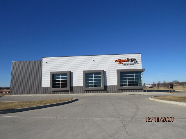
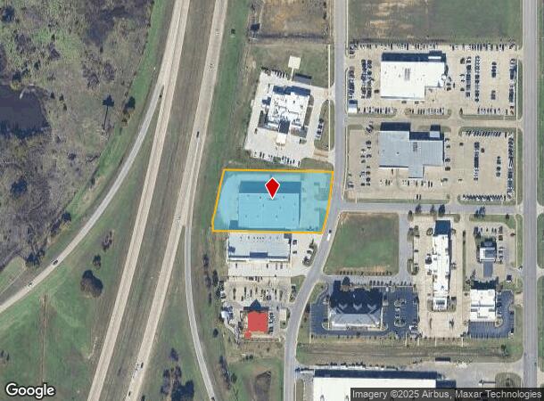
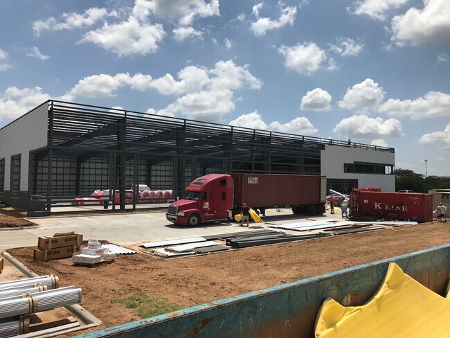
Property Record
1601 Woerz Way, Ardmore, OK 73401
NEARBY LISTINGS FOR SALE OR LEASE
Property Detail
1601 Woerz Way
Ardmore, OK
Rina Park Place Addn
1060-00-001-003-0-001-00
RINA PARK PLACE, BLK 1 LOT 3 (IRREGULAR)23 04S 01E
Publicschool
Carter
X
Oklahoma
40019C0435C
3
2024
2.09 AC
2025
Oklahoma East Area
892602
Other Market Areas
4,730 SF
DEMOGRAPHICS near 1601 Woerz Way
1 Mile
3 Mile
5 Mile
2024 Total Population
2,194
22,542
29,551
2029 Population
2,249
23,270
30,452
Pop Growth 2024-2029
+ 2.51%
+ 3.23%
+ 3.05%
Average Age
42
41
41
2024 Total Households
989
9,138
11,752
HH Growth 2024-2029
+ 2.33%
+ 3.17%
+ 3.02%
Median Household Inc
$44,166
$48,995
$50,971
Avg Household Size
2.10
2.30
2.40
2024 Avg HH Vehicles
2.00
2.00
2.00
Median Home Value
$153,953
$146,174
$151,845
Median Year Built
1983
1968
1972
Nearby Places
Map Layers
Map Styles
 Street
 Aerial
- Restaurants
- Banks
- Shops
- Fitness
- Groceries
PUBLIC TRANSPORTATION
COMMUTER RAIL
Ardmore Amtrak Station (Heartland Flyer - Amtrak)
DRIVE
WALK
Distance
Ardmore Amtrak Station (Heartland Flyer - Amtrak)
7 min
3.4 mi
Freight Ports
Tulsa Port of Inola
DRIVE
WALK
Distance
Tulsa Port of Inola
236 min
203.4 mi
SALE & LEASE HISTORY
LISTING DATE
SALE/LEASE

Dec 20, 2020
For Sale
Nearby Properties
Address
Land Use
TOTAL SIZE
Lot Size
Zoning
Address
Land Use
TOTAL SIZE
Lot Size
Zoning
2,565 SF
5.42 AC
C1
Address
Land Use
TOTAL SIZE
Lot Size
Zoning
3,090 SF
17.88 AC
Address
Land Use
TOTAL SIZE
Lot Size
Zoning
15,336 SF
108.27 AC
C1
Address
Land Use
TOTAL SIZE
Lot Size
Zoning
720 SF
115.99 AC
C1
Address
Land Use
TOTAL SIZE
Lot Size
Zoning
1,134 SF
4.03 AC
C1
Address
Land Use
TOTAL SIZE
Lot Size
Zoning
120 SF
1.80 AC
C1
Address
Land Use
TOTAL SIZE
Lot Size
Zoning
2,859 SF
1.94 AC
C1
Address
Land Use
TOTAL SIZE
Lot Size
Zoning
2,018 SF
12.23 AC
Address
Land Use
TOTAL SIZE
Lot Size
Zoning
1,593 SF
10.52 AC
C1
Address
Land Use
TOTAL SIZE
Lot Size
Zoning
6,148 SF
3.34 AC
C1
Address
Land Use
TOTAL SIZE
Lot Size
Zoning
3,655 SF
4.90 AC
C1
Address
Land Use
TOTAL SIZE
Lot Size
Zoning
6,348 SF
7.69 AC
C1
Address
Land Use
TOTAL SIZE
Lot Size
Zoning
5,290 SF
2.75 AC
C1
Address
Land Use
TOTAL SIZE
Lot Size
Zoning
27,476 SF
12.53 AC
C1
Address
Land Use
TOTAL SIZE
Lot Size
Zoning
44,073 SF
17.07 AC
C1
Address
Land Use
TOTAL SIZE
Lot Size
Zoning
62,600 SF
5.15 AC
Address
Land Use
TOTAL SIZE
Lot Size
Zoning
3,188 SF
2.75 AC
C1
Address
Land Use
TOTAL SIZE
Lot Size
Zoning
1,225 SF
4.36 AC
C1
Address
Land Use
TOTAL SIZE
Lot Size
Zoning
4,294 SF
2.56 AC
C1
Address
Land Use
TOTAL SIZE
Lot Size
Zoning
1,040 SF
38.87 AC
C1
Address
Land Use
TOTAL SIZE
Lot Size
Zoning
264 SF
5.38 AC
C1
Address
Land Use
TOTAL SIZE
Lot Size
Zoning
18,185 SF
3.65 AC
C1
Address
Land Use
TOTAL SIZE
Lot Size
Zoning
1,479 SF
2.33 AC
C1
Address
Land Use
TOTAL SIZE
Lot Size
Zoning
224 SF
6.98 AC
C1
Address
Land Use
TOTAL SIZE
Lot Size
Zoning
11,856 SF
5.63 AC
R1
Address
Land Use
TOTAL SIZE
Lot Size
Zoning
60 SF
10.72 AC
C1
Address
Land Use
TOTAL SIZE
Lot Size
Zoning
41,201 SF
6.96 AC
C1
Address
Land Use
TOTAL SIZE
Lot Size
Zoning
408 SF
2.76 AC
Address
Land Use
TOTAL SIZE
Lot Size
Zoning
3,167 SF
2.73 AC
C1
Address
Land Use
TOTAL SIZE
Lot Size
Zoning
18,153 SF
6.51 AC
The World's #1 Commercial Real Estate Marketplace
Connect with us
© 2026 CoStar Group
The information above has been obtained from sources believed reliable. While we do not doubt its accuracy we have not verified it and make no guarantee, warranty or representation about it. It is your responsibility to independently confirm its accuracy and completeness. Any projections, opinions, assumptions, or estimates used are for example only and do not represent the current or future performance of the property. The value of this transaction to you depends on tax and other factors which should be evaluated by your tax, financial, and legal advisors. You and your advisors should conduct a careful, independent investigation of the property to determine to your satisfaction the suitability of the property for your needs.