Property Record
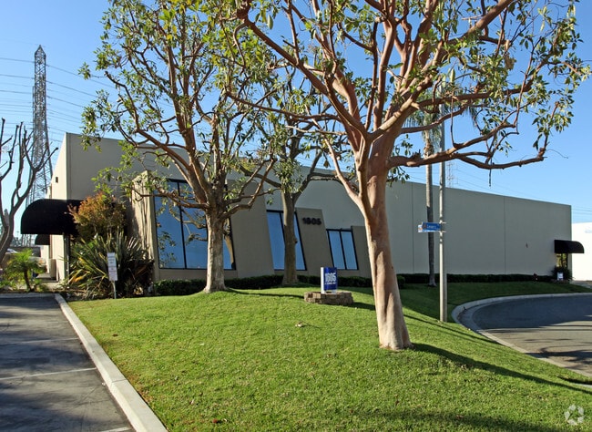
1603 N Odonnell Way, Orange, CA 92867


Property Detail
1603 N Odonnell Way
Anaheim-Santa Ana-Irvine, CA
P BK 100 PG 14 PAR 10
375-251-09
ORANGE
Industrialgeneral
California
B and X Area of moderate flood hazard, usually the area between the limits of the 100-year and 500-year floods.
b
2024
1.94 AC
2025
Orange
075812
Orange County (California)
16,862 SF
NEARBY LISTINGS FOR SALE OR LEASE
DEMOGRAPHICS near 1603 N Odonnell Way
1 mile
3 mile
5 mile
2025 Total Population
11,685
176,896
554,646
2030 Population
11,693
177,210
554,107
Pop Growth 2025-2030
+ 0.07%
+ 0.18%
(0.10%)
Average Age
38
38
38
2025 Total Households
3,602
57,209
166,565
HH Growth 2025-2030
(0.03%)
+ 0.13%
(0.18%)
Median Household Inc
$105,822
$104,212
$99,281
Avg Household Size
3.10
2.90
3.10
2025 Avg HH Vehicles
2.00
2.00
2.00
Median Home Value
$759,909
$815,866
$827,923
Median Year Built
1966
1971
1970
Nearby Places
Map Layers
Map Styles
 Street
 Aerial
Layers
 Traffic
 Biking
Places
Listings with unknown addresses are not visible on the map
- Restaurants
- Banks
- Shops
- Fitness
- Groceries
PUBLIC TRANSPORTATION
COMMUTER RAIL
Anaheim (Pacific Surfliner - Amtrak)
Drive
Walk
Distance
Anaheim (Pacific Surfliner - Amtrak)
5 min
2.1 mi
Anaheim-Artic Metrolink Station (Metrolink Orange County Line - Metrolink Trains)
Drive
Walk
Distance
Anaheim-Artic Metrolink Station (Metrolink Orange County Line - Metrolink Trains)
5 min
2.3 mi
AIRPORT
John Wayne/Orange County
Drive
Walk
Distance
John Wayne/Orange County
17 min
12.2 mi
Long Beach (Daugherty Field)
Drive
Walk
Distance
Long Beach (Daugherty Field)
29 min
23.1 mi
Ontario International
Drive
Walk
Distance
Ontario International
40 min
31.6 mi
Freight Ports
Port of Long Beach
Drive
Walk
Distance
Port of Long Beach
34 min
22.7 mi
Nearby Properties
Address
Land Use
TOTAL SIZE
Lot Size
Zoning
Address
Land Use
TOTAL SIZE
Lot Size
Zoning
26.08 AC
Address
Land Use
TOTAL SIZE
Lot Size
Zoning
31.01 AC
Address
Land Use
TOTAL SIZE
Lot Size
Zoning
2.60 AC
Address
Land Use
TOTAL SIZE
Lot Size
Zoning
5.07 AC
Address
Land Use
TOTAL SIZE
Lot Size
Zoning
4.89 AC
Address
Land Use
TOTAL SIZE
Lot Size
Zoning
4.13 AC
Address
Land Use
TOTAL SIZE
Lot Size
Zoning
12.20 AC
Address
Land Use
TOTAL SIZE
Lot Size
Zoning
6.60 AC
Address
Land Use
TOTAL SIZE
Lot Size
Zoning
Address
Land Use
TOTAL SIZE
Lot Size
Zoning
Address
Land Use
TOTAL SIZE
Lot Size
Zoning
4.71 AC
Address
Land Use
TOTAL SIZE
Lot Size
Zoning
11.61 AC
Address
Land Use
TOTAL SIZE
Lot Size
Zoning
Address
Land Use
TOTAL SIZE
Lot Size
Zoning
Address
Land Use
TOTAL SIZE
Lot Size
Zoning
3.47 AC
Address
Land Use
TOTAL SIZE
Lot Size
Zoning
Address
Land Use
TOTAL SIZE
Lot Size
Zoning
40.76 AC
Address
Land Use
TOTAL SIZE
Lot Size
Zoning
Address
Land Use
TOTAL SIZE
Lot Size
Zoning
Address
Land Use
TOTAL SIZE
Lot Size
Zoning
Address
Land Use
TOTAL SIZE
Lot Size
Zoning
Address
Land Use
TOTAL SIZE
Lot Size
Zoning
126,979 SF
6.42 AC
Address
Land Use
TOTAL SIZE
Lot Size
Zoning
Address
Land Use
TOTAL SIZE
Lot Size
Zoning
4.94 AC
Address
Land Use
TOTAL SIZE
Lot Size
Zoning
Address
Land Use
TOTAL SIZE
Lot Size
Zoning
Address
Land Use
TOTAL SIZE
Lot Size
Zoning
50.72 AC
Address
Land Use
TOTAL SIZE
Lot Size
Zoning
5.63 AC
Address
Land Use
TOTAL SIZE
Lot Size
Zoning
4.25 AC
Address
Land Use
TOTAL SIZE
Lot Size
Zoning
The World's #1 Commercial Real Estate Marketplace
Connect with us
© 2026 CoStar Group
The information above has been obtained from sources believed reliable. While we do not doubt its accuracy we have not verified it and make no guarantee, warranty or representation about it. It is your responsibility to independently confirm its accuracy and completeness. Any projections, opinions, assumptions, or estimates used are for example only and do not represent the current or future performance of the property. The value of this transaction to you depends on tax and other factors which should be evaluated by your tax, financial, and legal advisors. You and your advisors should conduct a careful, independent investigation of the property to determine to your satisfaction the suitability of the property for your needs.