Property Record
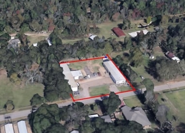
1608 Orval Rd, Conroe, TX 77301

Property Detail
1608 Orval Rd
0822-00-00700
A0822 - WILLIAMS C, TRACT 7 LOT 1, 2, ACRES 0.842
Commercialnec
Montgomery
1
Texas
B and X Area of moderate flood hazard, usually the area between the limits of the 100-year and 500-year floods.
1,2
2024
0.84 AC
2025
The Woodlands/Conroe
693102
Houston
8,160 SF
Houston-Pasadena-The Woodlands, TX
NEARBY LISTINGS FOR SALE OR LEASE
DEMOGRAPHICS near 1608 Orval Rd
1 mile
3 mile
5 mile
2025 Total Population
8,861
54,884
97,284
2030 Population
10,542
64,560
114,613
Pop Growth 2025-2030
+ 18.97%
+ 17.63%
+ 17.81%
Average Age
36
36
37
2025 Total Households
2,955
18,312
34,324
HH Growth 2025-2030
+ 19.66%
+ 18.77%
+ 18.71%
Median Household Inc
$71,695
$70,773
$71,476
Avg Household Size
3.00
2.80
2.70
2025 Avg HH Vehicles
2.00
2.00
2.00
Median Home Value
$225,972
$253,449
$285,249
Median Year Built
2006
2002
2004
Nearby Places
Map Layers
Map Styles
 Street
 Aerial
Transit
 Traffic
 Biking
Places
Listings with unknown addresses are not visible on the map
- Restaurants
- Banks
- Shops
- Fitness
- Groceries
PUBLIC TRANSPORTATION
AIRPORT
George Bush Intcntl/Houston
Drive
Walk
Distance
George Bush Intcntl/Houston
40 min
32.1 mi
Freight Ports
Port of Houston
Drive
Walk
Distance
Port of Houston
63 min
47.9 mi
SALE & LEASE HISTORY
LISTING DATE
SALE/LEASE

Sep 23, 2016
For Sale
Nearby Properties
Address
Land Use
TOTAL SIZE
Lot Size
Zoning
Address
Land Use
TOTAL SIZE
Lot Size
Zoning
322,082 SF
36.56 AC
1
Address
Land Use
TOTAL SIZE
Lot Size
Zoning
398,842 SF
23.75 AC
1
Address
Land Use
TOTAL SIZE
Lot Size
Zoning
470,259 SF
27.98 AC
1
Address
Land Use
TOTAL SIZE
Lot Size
Zoning
619,770 SF
81.76 AC
Address
Land Use
TOTAL SIZE
Lot Size
Zoning
353,247 SF
14.38 AC
Address
Land Use
TOTAL SIZE
Lot Size
Zoning
354,000 SF
13.81 AC
Address
Land Use
TOTAL SIZE
Lot Size
Zoning
274,494 SF
28.96 AC
Address
Land Use
TOTAL SIZE
Lot Size
Zoning
191,700 SF
19.41 AC
1
Address
Land Use
TOTAL SIZE
Lot Size
Zoning
262,925 SF
12.16 AC
Address
Land Use
TOTAL SIZE
Lot Size
Zoning
284,451 SF
13.66 AC
1
Address
Land Use
TOTAL SIZE
Lot Size
Zoning
326,478 SF
20.22 AC
Address
Land Use
TOTAL SIZE
Lot Size
Zoning
159,144 SF
32.27 AC
Address
Land Use
TOTAL SIZE
Lot Size
Zoning
195,956 SF
1.76 AC
1
Address
Land Use
TOTAL SIZE
Lot Size
Zoning
191,006 SF
9.19 AC
Address
Land Use
TOTAL SIZE
Lot Size
Zoning
142,800 SF
7.82 AC
Address
Land Use
TOTAL SIZE
Lot Size
Zoning
136,300 SF
9.08 AC
1
Address
Land Use
TOTAL SIZE
Lot Size
Zoning
197,533 SF
58.31 AC
Address
Land Use
TOTAL SIZE
Lot Size
Zoning
100,800 SF
8.60 AC
Address
Land Use
TOTAL SIZE
Lot Size
Zoning
85,560 SF
8.55 AC
Address
Land Use
TOTAL SIZE
Lot Size
Zoning
175,476 SF
8.03 AC
1
Address
Land Use
TOTAL SIZE
Lot Size
Zoning
242,944 SF
179.58 AC
Address
Land Use
TOTAL SIZE
Lot Size
Zoning
70,010 SF
8.89 AC
Address
Land Use
TOTAL SIZE
Lot Size
Zoning
94,950 SF
7.41 AC
1
Address
Land Use
TOTAL SIZE
Lot Size
Zoning
148,906 SF
7.05 AC
1
Address
Land Use
TOTAL SIZE
Lot Size
Zoning
171,550 SF
25.36 AC
1
Address
Land Use
TOTAL SIZE
Lot Size
Zoning
89,736 SF
26.85 AC
1
Address
Land Use
TOTAL SIZE
Lot Size
Zoning
222,647 SF
11.25 AC
Address
Land Use
TOTAL SIZE
Lot Size
Zoning
11.25 AC
Address
Land Use
TOTAL SIZE
Lot Size
Zoning
186,100 SF
29.68 AC
1
The World's #1 Commercial Real Estate Marketplace
Connect with us
© 2026 CoStar Group
The information above has been obtained from sources believed reliable. While we do not doubt its accuracy we have not verified it and make no guarantee, warranty or representation about it. It is your responsibility to independently confirm its accuracy and completeness. Any projections, opinions, assumptions, or estimates used are for example only and do not represent the current or future performance of the property. The value of this transaction to you depends on tax and other factors which should be evaluated by your tax, financial, and legal advisors. You and your advisors should conduct a careful, independent investigation of the property to determine to your satisfaction the suitability of the property for your needs.