Property Record
1610 E Colorado St, Glendale, CA 91205

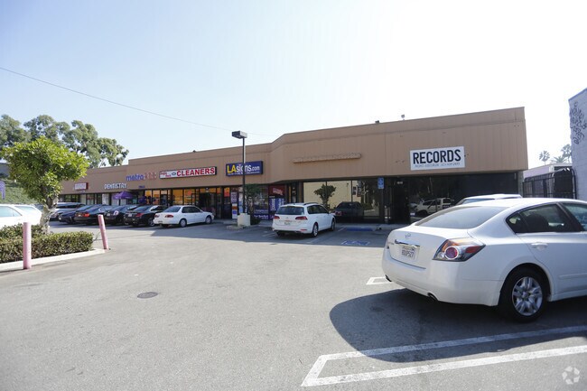

Property Detail
1610 E Colorado St
5680-030-023
EAGLE DALE LOT COM AT SE COR OF LOT 28 TH N ON E LINE OF SD LOT TO S LINE OF COLORADO ST TH W THEREON 45.79 FT TH S 0 0450 E 165 FT TH E ON N LINE OF S 5 FT OF SD LOT 15 FT TH SE TO BEG PART OF LOT 28
Storemultistory
LOS ANGELES
GLCM*
California
B and X Area of moderate flood hazard, usually the area between the limits of the 100-year and 500-year floods.
28
2025
0.18 AC
2025
Glendale
302104
Los Angeles
2,295 SF
Los Angeles-Long Beach-Glendale, CA
NEARBY LISTINGS FOR SALE OR LEASE
DEMOGRAPHICS near 1610 E Colorado St
1 mile
3 mile
5 mile
2025 Total Population
37,710
234,615
520,877
2030 Population
37,115
231,410
514,696
Pop Growth 2025-2030
(1.58%)
(1.37%)
(1.19%)
Average Age
43
42
42
2025 Total Households
14,426
89,201
203,503
HH Growth 2025-2030
(1.84%)
(1.61%)
(1.38%)
Median Household Inc
$79,542
$87,997
$95,693
Avg Household Size
2.50
2.50
2.50
2025 Avg HH Vehicles
2.00
2.00
2.00
Median Home Value
$1,018,982
$1,047,129
$1,055,129
Median Year Built
1960
1961
1958
Nearby Places
Map Layers
Map Styles
 Street
 Aerial
Layers
 Traffic
 Biking
Places
Listings with unknown addresses are not visible on the map
- Restaurants
- Banks
- Shops
- Fitness
- Groceries
PUBLIC TRANSPORTATION
COMMUTER RAIL
Glendale (Antelope Valley Line - Southern California Regional Rail Authority (Metrolink), Ventura County Line - Southern California Regional Rail Authority (Metrolink))
Drive
Walk
Distance
Glendale (Antelope Valley Line - Southern California Regional Rail Authority (Metrolink), Ventura County Line - Southern California Regional Rail Authority (Metrolink))
6 min
3.8 mi
Downtown Burbank (Antelope Valley Line - Amtrak, Pacific Surfliner - Amtrak, Ventura County Line - Amtrak)
Drive
Walk
Distance
Downtown Burbank (Antelope Valley Line - Amtrak, Pacific Surfliner - Amtrak, Ventura County Line - Amtrak)
10 min
6.5 mi
AIRPORT
Bob Hope
Drive
Walk
Distance
Bob Hope
17 min
12.0 mi
Los Angeles International
Drive
Walk
Distance
Los Angeles International
35 min
22.0 mi
Long Beach (Daugherty Field)
Drive
Walk
Distance
Long Beach (Daugherty Field)
40 min
28.4 mi
Freight Ports
Port of Long Beach
Drive
Walk
Distance
Port of Long Beach
41 min
31.2 mi
SALE & LEASE HISTORY
LISTING DATE
SALE/LEASE

Sep 25, 2016
For Lease
Jun 15, 2020
For Lease
Feb 12, 2019
For Lease
Nearby Properties
Address
Land Use
TOTAL SIZE
Lot Size
Zoning
Address
Land Use
TOTAL SIZE
Lot Size
Zoning
272,288 SF
24.26 AC
GLC3-C2-R4
Address
Land Use
TOTAL SIZE
Lot Size
Zoning
590,292 SF
8.21 AC
GLC3*
Address
Land Use
TOTAL SIZE
Lot Size
Zoning
477,885 SF
2.52 AC
GLC3*
Address
Land Use
TOTAL SIZE
Lot Size
Zoning
920,082 SF
2.51 AC
GLC2-R4*
Address
Land Use
TOTAL SIZE
Lot Size
Zoning
320,852 SF
11.91 AC
LAM3
Address
Land Use
TOTAL SIZE
Lot Size
Zoning
251,317 SF
114.56 AC
LAR1
Address
Land Use
TOTAL SIZE
Lot Size
Zoning
985,517 SF
4.08 AC
GLC3
Address
Land Use
TOTAL SIZE
Lot Size
Zoning
349,519 SF
2.16 AC
GLM1*
Address
Land Use
TOTAL SIZE
Lot Size
Zoning
317,292 SF
36.67 AC
LAM3
Address
Land Use
TOTAL SIZE
Lot Size
Zoning
245,031 SF
2.21 AC
GLM2
Address
Land Use
TOTAL SIZE
Lot Size
Zoning
235,936 SF
1.58 AC
GLC2*
Address
Land Use
TOTAL SIZE
Lot Size
Zoning
457,694 SF
1.42 AC
GLC3*
Address
Land Use
TOTAL SIZE
Lot Size
Zoning
265,301 SF
0.17 AC
GLC3*
Address
Land Use
TOTAL SIZE
Lot Size
Zoning
122,988 SF
3.32 AC
GLC3*
Address
Land Use
TOTAL SIZE
Lot Size
Zoning
766,497 SF
2.10 AC
GLC2*
Address
Land Use
TOTAL SIZE
Lot Size
Zoning
220,624 SF
1.50 AC
GLC3-C2*
Address
Land Use
TOTAL SIZE
Lot Size
Zoning
638,414 SF
2.53 AC
GLC3-C2*
Address
Land Use
TOTAL SIZE
Lot Size
Zoning
214,087 SF
1.65 AC
GLC3*
Address
Land Use
TOTAL SIZE
Lot Size
Zoning
223,599 SF
1.43 AC
GLC3*
Address
Land Use
TOTAL SIZE
Lot Size
Zoning
189,663 SF
1.36 AC
GLC2*
Address
Land Use
TOTAL SIZE
Lot Size
Zoning
779,800 SF
5.39 AC
GLC2-C3*
Address
Land Use
TOTAL SIZE
Lot Size
Zoning
126,452 SF
9.27 AC
GLM2*
Address
Land Use
TOTAL SIZE
Lot Size
Zoning
212,943 SF
1.41 AC
GLC3-R4*
Address
Land Use
TOTAL SIZE
Lot Size
Zoning
280,778 SF
2.30 AC
GLC3*
Address
Land Use
TOTAL SIZE
Lot Size
Zoning
302,119 SF
1.41 AC
GLC2
Address
Land Use
TOTAL SIZE
Lot Size
Zoning
154,216 SF
0.81 AC
GLC3*
Address
Land Use
TOTAL SIZE
Lot Size
Zoning
53,760 SF
4.60 AC
LAM1
Address
Land Use
TOTAL SIZE
Lot Size
Zoning
260,091 SF
1.02 AC
GLC2*
Address
Land Use
TOTAL SIZE
Lot Size
Zoning
284,476 SF
1.76 AC
Address
Land Use
TOTAL SIZE
Lot Size
Zoning
178,932 SF
0.88 AC
GLC3*
The World's #1 Commercial Real Estate Marketplace
Connect with us
© 2026 CoStar Group
The information above has been obtained from sources believed reliable. While we do not doubt its accuracy we have not verified it and make no guarantee, warranty or representation about it. It is your responsibility to independently confirm its accuracy and completeness. Any projections, opinions, assumptions, or estimates used are for example only and do not represent the current or future performance of the property. The value of this transaction to you depends on tax and other factors which should be evaluated by your tax, financial, and legal advisors. You and your advisors should conduct a careful, independent investigation of the property to determine to your satisfaction the suitability of the property for your needs.