Property Record
1611 Pond Rd, Allentown, PA 18104
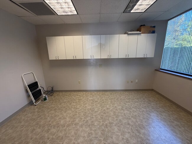
Current Lease Availabilities
NEARBY LISTINGS FOR SALE OR LEASE
Property Detail
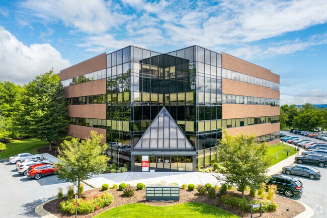
1611 Pond Rd
Allentown-Bethlehem-Easton, PA-NJ
The Paragon Centre
548724614622-11
LOTS: 003
Officebuilding
Lehigh
X
Pennsylvania
42011C0250G
3
2025
3.73 AC
2025
Lehigh Valley
006002
Philadelphia
1,142 SF
DEMOGRAPHICS near 1611 Pond Rd
1 Mile
3 Mile
5 Mile
2024 Total Population
6,257
74,244
207,601
2029 Population
6,360
74,875
209,248
Pop Growth 2024-2029
+ 1.65%
+ 0.85%
+ 0.79%
Average Age
42
41
39
2024 Total Households
2,261
28,165
77,975
HH Growth 2024-2029
+ 1.59%
+ 0.83%
+ 0.84%
Median Household Inc
$92,403
$67,509
$60,821
Avg Household Size
2.60
2.50
2.50
2024 Avg HH Vehicles
2.00
2.00
2.00
Median Home Value
$305,687
$254,382
$232,115
Median Year Built
1972
1965
1963
Nearby Places
- Restaurants
- Banks
- Shops
- Fitness
- Groceries
PUBLIC TRANSPORTATION
AIRPORT
Lehigh Valley International
DRIVE
WALK
Distance
Lehigh Valley International
16 min
8.6 mi
Freight Ports
Port of Philadelphia
DRIVE
WALK
Distance
Port of Philadelphia
81 min
61.2 mi
Nearby Properties
Address
Land Use
TOTAL SIZE
Lot Size
Zoning
Address
Land Use
TOTAL SIZE
Lot Size
Zoning
353,441 SF
4.34 AC
I-G
Address
Land Use
TOTAL SIZE
Lot Size
Zoning
74,985 SF
112.49 AC
RR-2
Address
Land Use
TOTAL SIZE
Lot Size
Zoning
230,853 SF
96.66 AC
R-3
Address
Land Use
TOTAL SIZE
Lot Size
Zoning
58,613 SF
26.22 AC
HC-1
Address
Land Use
TOTAL SIZE
Lot Size
Zoning
356,283 SF
2 AC
I-G
Address
Land Use
TOTAL SIZE
Lot Size
Zoning
225,102 SF
20 AC
HC
Address
Land Use
TOTAL SIZE
Lot Size
Zoning
28,911 SF
35.36 AC
GI
Address
Land Use
TOTAL SIZE
Lot Size
Zoning
175,714 SF
46.35 AC
R-3
Address
Land Use
TOTAL SIZE
Lot Size
Zoning
640,041 SF
155.76 AC
IC-1
Address
Land Use
TOTAL SIZE
Lot Size
Zoning
1,250 SF
80.20 AC
CR
Address
Land Use
TOTAL SIZE
Lot Size
Zoning
113,608 SF
6.43 AC
I-G
Address
Land Use
TOTAL SIZE
Lot Size
Zoning
91,706 SF
17.27 AC
HC-I
Address
Land Use
TOTAL SIZE
Lot Size
Zoning
266,354 SF
2.56 AC
R-H
Address
Land Use
TOTAL SIZE
Lot Size
Zoning
113,162 SF
3.02 AC
B/LI
Address
Land Use
TOTAL SIZE
Lot Size
Zoning
222,783 SF
49.47 AC
R-3
Address
Land Use
TOTAL SIZE
Lot Size
Zoning
214,790 SF
12.09 AC
GC-1
Address
Land Use
TOTAL SIZE
Lot Size
Zoning
28,897 SF
33.79 AC
HC-I
Address
Land Use
TOTAL SIZE
Lot Size
Zoning
11,850 SF
32.34 AC
R-ML
Address
Land Use
TOTAL SIZE
Lot Size
Zoning
123,432 SF
30.70 AC
C-2
Address
Land Use
TOTAL SIZE
Lot Size
Zoning
208,086 SF
3.13 AC
R-H
Address
Land Use
TOTAL SIZE
Lot Size
Zoning
19,850 SF
15.01 AC
R3
Address
Land Use
TOTAL SIZE
Lot Size
Zoning
170,208 SF
41.45 AC
R-3
Address
Land Use
TOTAL SIZE
Lot Size
Zoning
3,245 SF
10.56 AC
R-MP
Address
Land Use
TOTAL SIZE
Lot Size
Zoning
12,233 SF
18.30 AC
R-MP
Address
Land Use
TOTAL SIZE
Lot Size
Zoning
79,400 SF
4.10 AC
GC-1
Address
Land Use
TOTAL SIZE
Lot Size
Zoning
100,752 SF
18.17 AC
GC
Address
Land Use
TOTAL SIZE
Lot Size
Zoning
13,660 SF
11.59 AC
R-MH
Address
Land Use
TOTAL SIZE
Lot Size
Zoning
141,550 SF
32.12 AC
IC-1
Address
Land Use
TOTAL SIZE
Lot Size
Zoning
124,515 SF
8.03 AC
I-G
Address
Land Use
TOTAL SIZE
Lot Size
Zoning
78,437 SF
1.37 AC
I-G
The World's #1 Commercial Real Estate Marketplace
Connect with us
© 2025 CoStar Group
The information above has been obtained from sources believed reliable. While we do not doubt its accuracy we have not verified it and make no guarantee, warranty or representation about it. It is your responsibility to independently confirm its accuracy and completeness. Any projections, opinions, assumptions, or estimates used are for example only and do not represent the current or future performance of the property. The value of this transaction to you depends on tax and other factors which should be evaluated by your tax, financial, and legal advisors. You and your advisors should conduct a careful, independent investigation of the property to determine to your satisfaction the suitability of the property for your needs.