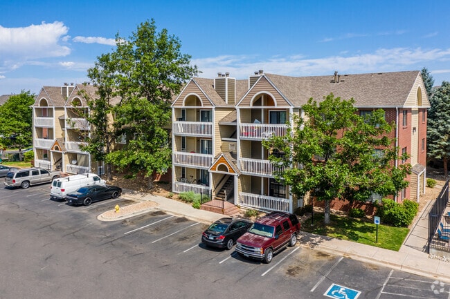
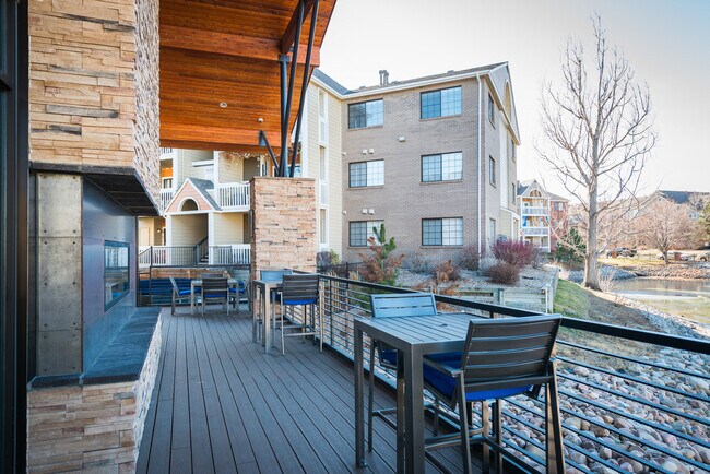
Property Record
1611 S Galena St, Aurora, CO 80247

NEARBY LISTINGS FOR SALE OR LEASE
Property Detail
1611 S Galena St
Denver-Aurora-Lakewood, CO
Buckingham Station Sub 1St Flg
1973-22-4-12-002
LOT 1 BLK 1 BUCKINGHAM STATION SUB 1ST FLG SUBDIVISIONCD 007720 SUBDIVISIONNAME BUCKINGHAM STATION S
Apartment
Arapahoe
X
Colorado
0800460236H
001
2023
7.45 AC
2024
Cherry Creek South
087000
Denver
154,344 SF
DEMOGRAPHICS near 1611 S Galena St
1 Mile
3 Mile
5 Mile
2024 Total Population
27,554
195,978
484,655
2029 Population
28,119
198,591
490,222
Pop Growth 2024-2029
+ 2.05%
+ 1.33%
+ 1.15%
Average Age
38
39
38
2024 Total Households
12,227
85,868
204,990
HH Growth 2024-2029
+ 2.01%
+ 1.32%
+ 1.18%
Median Household Inc
$67,603
$64,525
$70,233
Avg Household Size
2.20
2.20
2.30
2024 Avg HH Vehicles
1.00
2.00
2.00
Median Home Value
$425,646
$412,316
$460,873
Median Year Built
1991
1979
1978
Nearby Places
Map Layers
Map Styles
 Street
 Aerial
- Restaurants
- Banks
- Shops
- Fitness
- Groceries
PUBLIC TRANSPORTATION
COMMUTER RAIL
Peoria Station Track 1 (Union Station to Denver Airport Station - Regional Transportation District)
DRIVE
WALK
Distance
Peoria Station Track 1 (Union Station to Denver Airport Station - Regional Transportation District)
15 min
7.6 mi
Peoria Station Track 2 (Union Station to Denver Airport Station - Regional Transportation District)
DRIVE
WALK
Distance
Peoria Station Track 2 (Union Station to Denver Airport Station - Regional Transportation District)
15 min
7.6 mi
AIRPORT
Denver International
DRIVE
WALK
Distance
Denver International
29 min
21.6 mi
Freight Ports
Tulsa Port Of Catoosa
DRIVE
WALK
Distance
Tulsa Port Of Catoosa
726 min
704.3 mi
Nearby Properties
Address
Land Use
TOTAL SIZE
Lot Size
Zoning
Address
Land Use
TOTAL SIZE
Lot Size
Zoning
496,493 SF
33.45 AC
Address
Land Use
TOTAL SIZE
Lot Size
Zoning
476,186 SF
42.62 AC
Address
Land Use
TOTAL SIZE
Lot Size
Zoning
231,867 SF
19.33 AC
S-MX-3A
Address
Land Use
TOTAL SIZE
Lot Size
Zoning
613,600 SF
29.40 AC
R-3
Address
Land Use
TOTAL SIZE
Lot Size
Zoning
384,886 SF
18.66 AC
R-2-A
Address
Land Use
TOTAL SIZE
Lot Size
Zoning
201,600 SF
44.67 AC
R1
Address
Land Use
TOTAL SIZE
Lot Size
Zoning
380,376 SF
24.52 AC
E-SU-DX
Address
Land Use
TOTAL SIZE
Lot Size
Zoning
368,676 SF
17.71 AC
R-2-A
Address
Land Use
TOTAL SIZE
Lot Size
Zoning
478,994 SF
26.07 AC
Address
Land Use
TOTAL SIZE
Lot Size
Zoning
130,531 SF
3.41 AC
Address
Land Use
TOTAL SIZE
Lot Size
Zoning
540,380 SF
26.03 AC
RR3
Address
Land Use
TOTAL SIZE
Lot Size
Zoning
551,531 SF
5.09 AC
C-MX
Address
Land Use
TOTAL SIZE
Lot Size
Zoning
107,627 SF
1.59 AC
C-MX-5
Address
Land Use
TOTAL SIZE
Lot Size
Zoning
205,250 SF
10 AC
I-A
Address
Land Use
TOTAL SIZE
Lot Size
Zoning
154,808 SF
16.71 AC
S-SU-D
Address
Land Use
TOTAL SIZE
Lot Size
Zoning
138,750 SF
12.17 AC
OS-A
Address
Land Use
TOTAL SIZE
Lot Size
Zoning
244,350 SF
9.59 AC
S-MU-5
Address
Land Use
TOTAL SIZE
Lot Size
Zoning
462,048 SF
5.34 AC
RB3
Address
Land Use
TOTAL SIZE
Lot Size
Zoning
96,953 SF
14.54 AC
R-2-A
Address
Land Use
TOTAL SIZE
Lot Size
Zoning
333,696 SF
17.52 AC
PUD
Address
Land Use
TOTAL SIZE
Lot Size
Zoning
521,364 SF
14.88 AC
PUD
Address
Land Use
TOTAL SIZE
Lot Size
Zoning
506,272 SF
20.38 AC
PUD
Address
Land Use
TOTAL SIZE
Lot Size
Zoning
1,344,255 SF
15.88 AC
AMU
Address
Land Use
TOTAL SIZE
Lot Size
Zoning
209,690 SF
7.21 AC
S-SU-D
Address
Land Use
TOTAL SIZE
Lot Size
Zoning
145,915 SF
11.01 AC
B-3
Address
Land Use
TOTAL SIZE
Lot Size
Zoning
350,692 SF
13.51 AC
R-2-A
Address
Land Use
TOTAL SIZE
Lot Size
Zoning
649,712 SF
47.31 AC
Address
Land Use
TOTAL SIZE
Lot Size
Zoning
58,903 SF
14.19 AC
C-MX
Address
Land Use
TOTAL SIZE
Lot Size
Zoning
238,669 SF
5.58 AC
B-2
Address
Land Use
TOTAL SIZE
Lot Size
Zoning
143,394 SF
8.15 AC
B-3
The World's #1 Commercial Real Estate Marketplace
Connect with us
© 2025 CoStar Group
The information above has been obtained from sources believed reliable. While we do not doubt its accuracy we have not verified it and make no guarantee, warranty or representation about it. It is your responsibility to independently confirm its accuracy and completeness. Any projections, opinions, assumptions, or estimates used are for example only and do not represent the current or future performance of the property. The value of this transaction to you depends on tax and other factors which should be evaluated by your tax, financial, and legal advisors. You and your advisors should conduct a careful, independent investigation of the property to determine to your satisfaction the suitability of the property for your needs.