Property Record
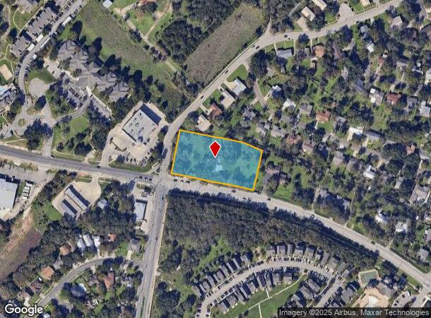
1620 Old Ranch Road 12, San Marcos, TX 78666


Property Detail
1620 Old Ranch Road 12
R13236
Elijah Clark Survey
Sfr
ABS 83 TR 19-20 117-89 E CLARK SURVEY 2.119 AC GEO#90201894
X
Hays
48055C0075F
Texas
2024
2.12 AC
2025
Hays County
010703
Austin
3,355 SF
Austin-Round Rock-San Marcos, TX
NEARBY LISTINGS FOR SALE OR LEASE
DEMOGRAPHICS near 1620 Old Ranch Road 12
1 mile
3 mile
5 mile
2024 Total Population
10,149
46,764
78,315
2029 Population
13,112
60,449
101,597
Pop Growth 2024-2029
+ 29.19%
+ 29.26%
+ 29.73%
Average Age
31
32
32
2024 Total Households
3,941
18,790
31,480
HH Growth 2024-2029
+ 31.82%
+ 31.51%
+ 31.74%
Median Household Inc
$30,862
$30,267
$34,289
Avg Household Size
2.30
2.20
2.20
2024 Avg HH Vehicles
2.00
2.00
2.00
Median Home Value
$302,987
$285,245
$271,483
Median Year Built
1993
1991
1997
Nearby Places
Map Layers
Map Styles
 Street
 Aerial
Transit
 Traffic
 Biking
Places
Listings with unknown addresses are not visible on the map
- Restaurants
- Banks
- Shops
- Fitness
- Groceries
PUBLIC TRANSPORTATION
COMMUTER RAIL
Drive
Walk
Distance
5 min
2.3 mi
AIRPORT
Austin-Bergstrom International
Drive
Walk
Distance
Austin-Bergstrom International
51 min
37.7 mi
San Antonio International
Drive
Walk
Distance
San Antonio International
54 min
45.5 mi
SALE & LEASE HISTORY
LISTING DATE
SALE/LEASE

Jun 14, 2022
For Lease
Nearby Properties
Address
Land Use
TOTAL SIZE
Lot Size
Zoning
Address
Land Use
TOTAL SIZE
Lot Size
Zoning
623,823 SF
1.46 AC
Address
Land Use
TOTAL SIZE
Lot Size
Zoning
215,932 SF
3.67 AC
Address
Land Use
TOTAL SIZE
Lot Size
Zoning
419,973 SF
23.69 AC
Address
Land Use
TOTAL SIZE
Lot Size
Zoning
458,948 SF
35.43 AC
Address
Land Use
TOTAL SIZE
Lot Size
Zoning
402,983 SF
21.31 AC
Address
Land Use
TOTAL SIZE
Lot Size
Zoning
343,094 SF
39.30 AC
Address
Land Use
TOTAL SIZE
Lot Size
Zoning
545,643 SF
2.69 AC
Address
Land Use
TOTAL SIZE
Lot Size
Zoning
279,131 SF
22.46 AC
Address
Land Use
TOTAL SIZE
Lot Size
Zoning
311,146 SF
5.11 AC
Address
Land Use
TOTAL SIZE
Lot Size
Zoning
327,917 SF
10.54 AC
Address
Land Use
TOTAL SIZE
Lot Size
Zoning
266,157 SF
14.70 AC
Address
Land Use
TOTAL SIZE
Lot Size
Zoning
215,688 SF
10.36 AC
Address
Land Use
TOTAL SIZE
Lot Size
Zoning
179,764 SF
3.27 AC
Address
Land Use
TOTAL SIZE
Lot Size
Zoning
145,336 SF
0.87 AC
Address
Land Use
TOTAL SIZE
Lot Size
Zoning
181,400 SF
13.07 AC
Address
Land Use
TOTAL SIZE
Lot Size
Zoning
211,562 SF
2.35 AC
Address
Land Use
TOTAL SIZE
Lot Size
Zoning
140,844 SF
17.05 AC
Address
Land Use
TOTAL SIZE
Lot Size
Zoning
171,536 SF
8.49 AC
Address
Land Use
TOTAL SIZE
Lot Size
Zoning
178,521 SF
1.40 AC
Address
Land Use
TOTAL SIZE
Lot Size
Zoning
141,735 SF
6.62 AC
Address
Land Use
TOTAL SIZE
Lot Size
Zoning
133,096 SF
0.92 AC
Address
Land Use
TOTAL SIZE
Lot Size
Zoning
296,034 SF
7.78 AC
Address
Land Use
TOTAL SIZE
Lot Size
Zoning
247,668 SF
9.08 AC
Address
Land Use
TOTAL SIZE
Lot Size
Zoning
230,979 SF
7.54 AC
Address
Land Use
TOTAL SIZE
Lot Size
Zoning
73,658 SF
13.95 AC
Address
Land Use
TOTAL SIZE
Lot Size
Zoning
181,154 SF
10.64 AC
Address
Land Use
TOTAL SIZE
Lot Size
Zoning
129,189 SF
1.95 AC
Address
Land Use
TOTAL SIZE
Lot Size
Zoning
140,866 SF
10.08 AC
Address
Land Use
TOTAL SIZE
Lot Size
Zoning
75,703 SF
8 AC
Address
Land Use
TOTAL SIZE
Lot Size
Zoning
127,630 SF
1.01 AC
The World's #1 Commercial Real Estate Marketplace
Connect with us
© 2026 CoStar Group
The information above has been obtained from sources believed reliable. While we do not doubt its accuracy we have not verified it and make no guarantee, warranty or representation about it. It is your responsibility to independently confirm its accuracy and completeness. Any projections, opinions, assumptions, or estimates used are for example only and do not represent the current or future performance of the property. The value of this transaction to you depends on tax and other factors which should be evaluated by your tax, financial, and legal advisors. You and your advisors should conduct a careful, independent investigation of the property to determine to your satisfaction the suitability of the property for your needs.