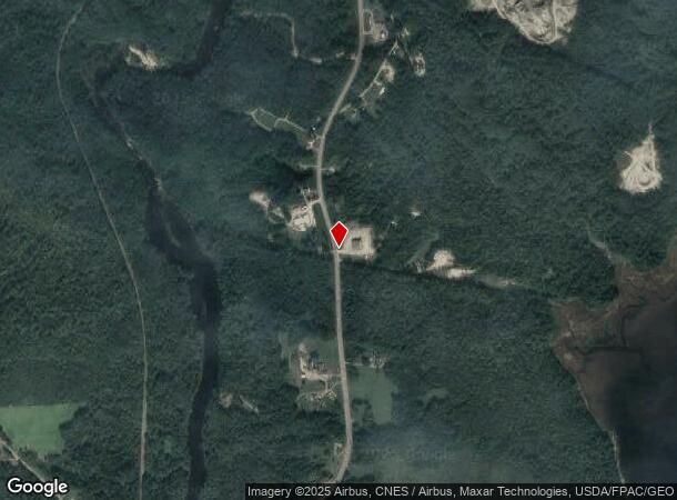
Property Record
163 Main Rd N, Frankfort, ME 04438
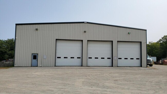
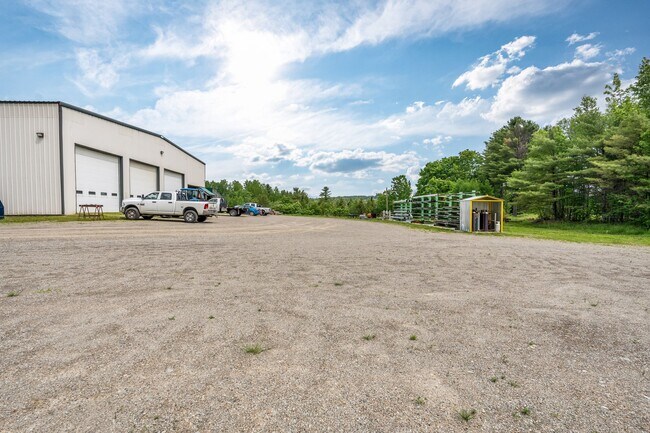
This Property Is For Sale
NEARBY LISTINGS FOR SALE OR LEASE
-
-
View all Frankfort listings for sale on LoopNet.com
Property Detail
163 Main Rd N
Other Market Areas
Town Frankfort
FRAT-000006-000000-000047-000001
Waldo
Singlefamilyresidentialassumed
Maine
X
5.10 AC
23009C0676D
Maine Midcoast
DEMOGRAPHICS near 163 Main Rd N
1 Mile
3 Mile
5 Mile
2024 Total Population
217
2,108
6,026
2029 Population
222
2,137
6,124
Pop Growth 2024-2029
+ 2.30%
+ 1.38%
+ 1.63%
Average Age
43
43
43
2024 Total Households
88
878
2,548
HH Growth 2024-2029
+ 2.27%
+ 1.25%
+ 1.53%
Median Household Inc
$70,714
$70,215
$68,085
Avg Household Size
2.40
2.40
2.30
2024 Avg HH Vehicles
2.00
2.00
2.00
Median Home Value
$212,069
$212,044
$203,234
Median Year Built
1993
1982
1978
Nearby Places
Map Layers
Map Styles
 Street
 Aerial
- Restaurants
- Banks
- Shops
- Fitness
- Groceries
PUBLIC TRANSPORTATION
AIRPORT
Bangor International
DRIVE
WALK
Distance
Bangor International
36 min
18.2 mi
Freight Ports
Searsport, ME
DRIVE
WALK
Distance
Searsport, ME
30 min
13.1 mi
Nearby Properties
Address
Land Use
TOTAL SIZE
Lot Size
Zoning
Address
Land Use
TOTAL SIZE
Lot Size
Zoning
8.73 AC
Address
Land Use
TOTAL SIZE
Lot Size
Zoning
35.60 AC
Address
Land Use
TOTAL SIZE
Lot Size
Zoning
5.48 AC
Address
Land Use
TOTAL SIZE
Lot Size
Zoning
2.40 AC
Address
Land Use
TOTAL SIZE
Lot Size
Zoning
1,720 SF
0.92 AC
RT 15
Address
Land Use
TOTAL SIZE
Lot Size
Zoning
0.13 AC
Address
Land Use
TOTAL SIZE
Lot Size
Zoning
1.60 AC
Address
Land Use
TOTAL SIZE
Lot Size
Zoning
1.17 AC
Address
Land Use
TOTAL SIZE
Lot Size
Zoning
1,872 SF
2.36 AC
RT 15
Address
Land Use
TOTAL SIZE
Lot Size
Zoning
0.25 AC
Address
Land Use
TOTAL SIZE
Lot Size
Zoning
Address
Land Use
TOTAL SIZE
Lot Size
Zoning
7.50 AC
Address
Land Use
TOTAL SIZE
Lot Size
Zoning
0.51 AC
Address
Land Use
TOTAL SIZE
Lot Size
Zoning
200 AC
RT 15
Address
Land Use
TOTAL SIZE
Lot Size
Zoning
63 AC
Address
Land Use
TOTAL SIZE
Lot Size
Zoning
Address
Land Use
TOTAL SIZE
Lot Size
Zoning
22 AC
RT 15
Address
Land Use
TOTAL SIZE
Lot Size
Zoning
11 AC
RT 15
Address
Land Use
TOTAL SIZE
Lot Size
Zoning
0.32 AC
Address
Land Use
TOTAL SIZE
Lot Size
Zoning
2.50 AC
Address
Land Use
TOTAL SIZE
Lot Size
Zoning
88 AC
RURAL
Address
Land Use
TOTAL SIZE
Lot Size
Zoning
44 AC
Address
Land Use
TOTAL SIZE
Lot Size
Zoning
43.50 AC
Address
Land Use
TOTAL SIZE
Lot Size
Zoning
1,608 SF
48 AC
RT 15
Address
Land Use
TOTAL SIZE
Lot Size
Zoning
76.62 AC
RT 15
Address
Land Use
TOTAL SIZE
Lot Size
Zoning
40.06 AC
Address
Land Use
TOTAL SIZE
Lot Size
Zoning
39.11 AC
Address
Land Use
TOTAL SIZE
Lot Size
Zoning
63.90 AC
R2-COB
Address
Land Use
TOTAL SIZE
Lot Size
Zoning
Address
Land Use
TOTAL SIZE
Lot Size
Zoning
58 AC
R2-COB
The World's #1 Commercial Real Estate Marketplace
Connect with us
© 2025 CoStar Group
The information above has been obtained from sources believed reliable. While we do not doubt its accuracy we have not verified it and make no guarantee, warranty or representation about it. It is your responsibility to independently confirm its accuracy and completeness. Any projections, opinions, assumptions, or estimates used are for example only and do not represent the current or future performance of the property. The value of this transaction to you depends on tax and other factors which should be evaluated by your tax, financial, and legal advisors. You and your advisors should conduct a careful, independent investigation of the property to determine to your satisfaction the suitability of the property for your needs.