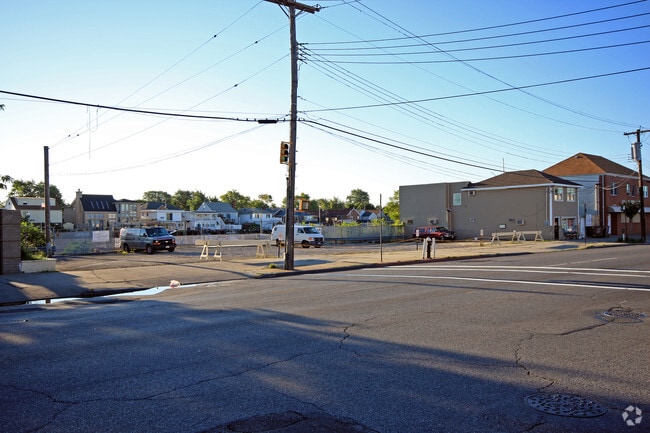
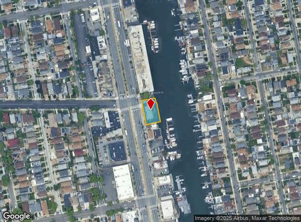
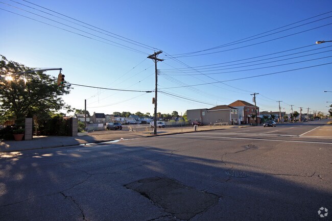
Property Record
16301 Crossbay Blvd, Howard Beach, NY 11414

NEARBY LISTINGS FOR SALE OR LEASE
Property Detail
16301 Crossbay Blvd
14201-0063
Queens
Miscellaneous
New York
AE
63
3604970239F
0.29 AC
2024
South Queens
2025
Long Island (New York)
089201
New York-Jersey City-White Plains, NY-NJ
1,680 SF
DEMOGRAPHICS near 16301 Crossbay Blvd
1 Mile
3 Mile
5 Mile
2024 Total Population
14,019
326,470
1,169,647
2029 Population
13,041
296,934
1,078,505
Pop Growth 2024-2029
(6.98%)
(9.05%)
(7.79%)
Average Age
46
40
40
2024 Total Households
4,965
104,565
398,158
HH Growth 2024-2029
(7.61%)
(9.32%)
(8.02%)
Median Household Inc
$102,781
$63,360
$64,637
Avg Household Size
2.70
3.00
2.80
2024 Avg HH Vehicles
2.00
1.00
1.00
Median Home Value
$761,471
$663,118
$658,951
Median Year Built
1958
1952
1951
Nearby Places
- Restaurants
- Banks
- Shops
- Fitness
- Groceries
PUBLIC TRANSPORTATION
COMMUTER RAIL
Kew Gardens Station (Babylon Branch - Long Island Rail Road, Hempstead Branch - Long Island Rail Road, Long Beach Branch - Long Island Rail Road, Port Jefferson Branch - Long Island Rail Road)
DRIVE
WALK
Distance
Kew Gardens Station (Babylon Branch - Long Island Rail Road, Hempstead Branch - Long Island Rail Road, Long Beach Branch - Long Island Rail Road, Port Jefferson Branch - Long Island Rail Road)
12 min
4.8 mi
East New York Station (Far Rockaway Branch - Long Island Rail Road, Long Beach Branch - Long Island Rail Road, West Hempstead Branch - Long Island Rail Road)
DRIVE
WALK
Distance
East New York Station (Far Rockaway Branch - Long Island Rail Road, Long Beach Branch - Long Island Rail Road, West Hempstead Branch - Long Island Rail Road)
12 min
5.4 mi
AIRPORT
John F Kennedy International
DRIVE
WALK
Distance
John F Kennedy International
10 min
5.8 mi
LaGuardia
DRIVE
WALK
Distance
LaGuardia
21 min
12.6 mi
Newark Liberty International
DRIVE
WALK
Distance
Newark Liberty International
45 min
23.3 mi
Freight Ports
NY - Red Hook Container Terminal
DRIVE
WALK
Distance
NY - Red Hook Container Terminal
24 min
12.1 mi
Nearby Properties
Address
Land Use
TOTAL SIZE
Lot Size
Zoning
Address
Land Use
TOTAL SIZE
Lot Size
Zoning
14,417,607 SF
4,921.45 AC
M1-1
Address
Land Use
TOTAL SIZE
Lot Size
Zoning
477.04 AC
PARKUS
Address
Land Use
TOTAL SIZE
Lot Size
Zoning
1,845,252 SF
172 AC
C8-1
Address
Land Use
TOTAL SIZE
Lot Size
Zoning
5,302 SF
366.15 AC
PARK
Address
Land Use
TOTAL SIZE
Lot Size
Zoning
1,688,760 SF
24.65 AC
R5
Address
Land Use
TOTAL SIZE
Lot Size
Zoning
600 SF
33.07 AC
PARK
Address
Land Use
TOTAL SIZE
Lot Size
Zoning
24,400 SF
33.98 AC
C4-2
Address
Land Use
TOTAL SIZE
Lot Size
Zoning
1,526,800 SF
32.39 AC
R5
Address
Land Use
TOTAL SIZE
Lot Size
Zoning
1,493,793 SF
14.19 AC
R5
Address
Land Use
TOTAL SIZE
Lot Size
Zoning
1,485,000 SF
20.28 AC
R5
Address
Land Use
TOTAL SIZE
Lot Size
Zoning
1,420,000 SF
19.61 AC
R5
Address
Land Use
TOTAL SIZE
Lot Size
Zoning
363,548 SF
1.81 AC
Address
Land Use
TOTAL SIZE
Lot Size
Zoning
60.84 AC
R4
Address
Land Use
TOTAL SIZE
Lot Size
Zoning
28.64 AC
PARK
Address
Land Use
TOTAL SIZE
Lot Size
Zoning
474,715 SF
1.72 AC
M14R8A
Address
Land Use
TOTAL SIZE
Lot Size
Zoning
1,136,208 SF
30.25 AC
R5
Address
Land Use
TOTAL SIZE
Lot Size
Zoning
4,761.05 AC
PARK
Address
Land Use
TOTAL SIZE
Lot Size
Zoning
997,720 SF
8.23 AC
R5
Address
Land Use
TOTAL SIZE
Lot Size
Zoning
158,402 SF
3.64 AC
C4-2
Address
Land Use
TOTAL SIZE
Lot Size
Zoning
230,580 SF
3.41 AC
C8-1
Address
Land Use
TOTAL SIZE
Lot Size
Zoning
940,800 SF
11.55 AC
R5
Address
Land Use
TOTAL SIZE
Lot Size
Zoning
203,132 SF
3.09 AC
C4-2
Address
Land Use
TOTAL SIZE
Lot Size
Zoning
29.68 AC
C4-2
Address
Land Use
TOTAL SIZE
Lot Size
Zoning
552,216 SF
9.41 AC
R4
Address
Land Use
TOTAL SIZE
Lot Size
Zoning
205,831 SF
0.78 AC
R8A
Address
Land Use
TOTAL SIZE
Lot Size
Zoning
183,070 SF
4.47 AC
M1-1
Address
Land Use
TOTAL SIZE
Lot Size
Zoning
125,836 SF
2.26 AC
R5
Address
Land Use
TOTAL SIZE
Lot Size
Zoning
279,162 SF
9.90 AC
M1-1
Address
Land Use
TOTAL SIZE
Lot Size
Zoning
142,931 SF
3.28 AC
C4-2
Address
Land Use
TOTAL SIZE
Lot Size
Zoning
709,200 SF
10.80 AC
R4
The World's #1 Commercial Real Estate Marketplace
Connect with us
© 2025 CoStar Group
The information above has been obtained from sources believed reliable. While we do not doubt its accuracy we have not verified it and make no guarantee, warranty or representation about it. It is your responsibility to independently confirm its accuracy and completeness. Any projections, opinions, assumptions, or estimates used are for example only and do not represent the current or future performance of the property. The value of this transaction to you depends on tax and other factors which should be evaluated by your tax, financial, and legal advisors. You and your advisors should conduct a careful, independent investigation of the property to determine to your satisfaction the suitability of the property for your needs.