Property Record
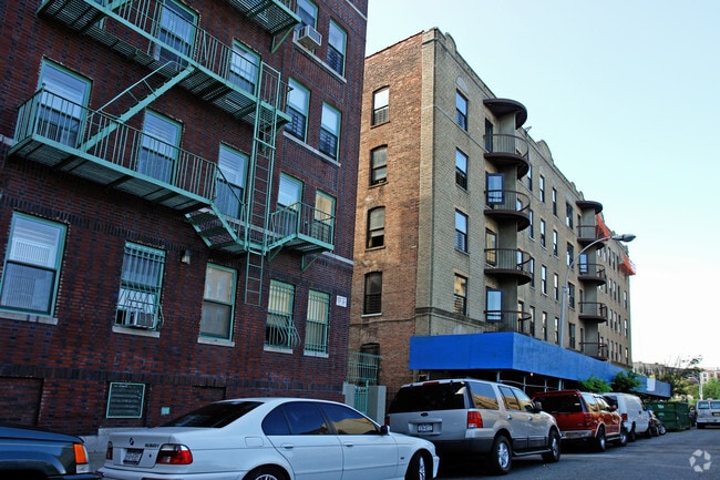
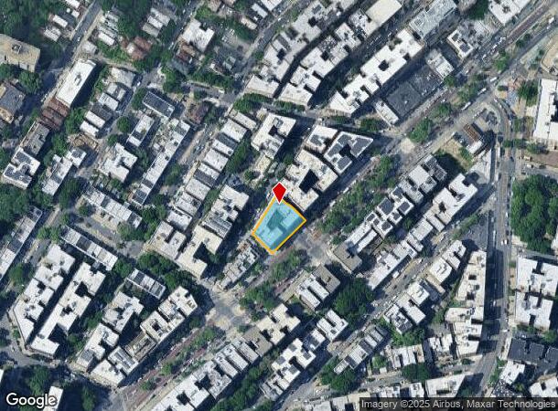
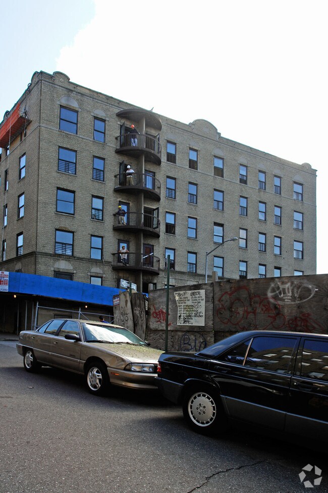
1633 Univ Ave, Bronx, NY 10453

NEARBY LISTINGS FOR SALE OR LEASE
Property Detail
1633 Univ Ave
02878-0083
Bronx
Apartment
New York
X
83
3604970081F
0.35 AC
2024
Morris Heights
2025
Westchester/So Connecticut
021501
New York-Jersey City-White Plains, NY-NJ
65,765 SF
DEMOGRAPHICS near 1633 Univ Ave
1 Mile
3 Mile
5 Mile
2024 Total Population
244,336
1,269,797
2,105,300
2029 Population
228,017
1,188,348
1,958,933
Pop Growth 2024-2029
(6.68%)
(6.41%)
(6.95%)
Average Age
38
38
39
2024 Total Households
83,294
464,425
792,842
HH Growth 2024-2029
(7.32%)
(6.92%)
(7.40%)
Median Household Inc
$40,436
$42,249
$49,241
Avg Household Size
2.80
2.60
2.50
2024 Avg HH Vehicles
.00
.00
1.00
Median Home Value
$420,304
$465,755
$603,298
Median Year Built
1948
1950
1952
Nearby Places
- Restaurants
- Banks
- Shops
- Fitness
- Groceries
PUBLIC TRANSPORTATION
TRANSIT/SUBWAY
176 Street (4 - New York MTA Subway (The Subway))
DRIVE
WALK
Distance
176 Street (4 - New York MTA Subway (The Subway))
3 min
9 min
0.5 mi
Mt Eden Avenue (4 - New York MTA Subway (The Subway))
DRIVE
WALK
Distance
Mt Eden Avenue (4 - New York MTA Subway (The Subway))
3 min
12 min
0.7 mi
174-175 Streets (B - New York MTA Subway (The Subway), D - New York MTA Subway (The Subway))
DRIVE
WALK
Distance
174-175 Streets (B - New York MTA Subway (The Subway), D - New York MTA Subway (The Subway))
4 min
14 min
0.7 mi
Burnside Avenue (4 - New York MTA Subway (The Subway))
DRIVE
WALK
Distance
Burnside Avenue (4 - New York MTA Subway (The Subway))
2 min
15 min
0.8 mi
170 Street (4 Line) (4 - New York MTA Subway (The Subway))
DRIVE
WALK
Distance
170 Street (4 Line) (4 - New York MTA Subway (The Subway))
2 min
16 min
0.8 mi
COMMUTER RAIL
Morris Heights Station (Hudson Line - Metro-North Commuter Railroad Company (Metro-North))
DRIVE
WALK
Distance
Morris Heights Station (Hudson Line - Metro-North Commuter Railroad Company (Metro-North))
5 min
10 min
0.6 mi
University Heights Station (Hudson Line - Metro-North Commuter Railroad Company (Metro-North))
DRIVE
WALK
Distance
University Heights Station (Hudson Line - Metro-North Commuter Railroad Company (Metro-North))
5 min
1.5 mi
AIRPORT
LaGuardia
DRIVE
WALK
Distance
LaGuardia
18 min
9.3 mi
John F Kennedy International
DRIVE
WALK
Distance
John F Kennedy International
30 min
20.3 mi
Newark Liberty International
DRIVE
WALK
Distance
Newark Liberty International
26 min
21.5 mi
Freight Ports
NY - Red Hook Container Terminal
DRIVE
WALK
Distance
NY - Red Hook Container Terminal
31 min
17.5 mi
Nearby Properties
Address
Land Use
TOTAL SIZE
Lot Size
Zoning
Address
Land Use
TOTAL SIZE
Lot Size
Zoning
3,693,539 SF
8.37 AC
R8
Address
Land Use
TOTAL SIZE
Lot Size
Zoning
400,160 SF
10.96 AC
R7-2
Address
Land Use
TOTAL SIZE
Lot Size
Zoning
1,299,700 SF
29.82 AC
R6
Address
Land Use
TOTAL SIZE
Lot Size
Zoning
1,743,584 SF
77.87 AC
R6
Address
Land Use
TOTAL SIZE
Lot Size
Zoning
26.93 AC
R8
Address
Land Use
TOTAL SIZE
Lot Size
Zoning
2,278,432 SF
5.99 AC
R7-2
Address
Land Use
TOTAL SIZE
Lot Size
Zoning
24.08 AC
B2-A
Address
Land Use
TOTAL SIZE
Lot Size
Zoning
4.87 AC
R11
Address
Land Use
TOTAL SIZE
Lot Size
Zoning
873,000 SF
9.95 AC
R7-2
Address
Land Use
TOTAL SIZE
Lot Size
Zoning
1,651,267 SF
1.23 AC
R8
Address
Land Use
TOTAL SIZE
Lot Size
Zoning
Address
Land Use
TOTAL SIZE
Lot Size
Zoning
2.61 AC
D5
Address
Land Use
TOTAL SIZE
Lot Size
Zoning
481,172 SF
205.58 AC
PARK
Address
Land Use
TOTAL SIZE
Lot Size
Zoning
478,842 SF
3.56 AC
C6-1
Address
Land Use
TOTAL SIZE
Lot Size
Zoning
895,256 SF
8.32 AC
R7-1
Address
Land Use
TOTAL SIZE
Lot Size
Zoning
0.36 AC
R8
Address
Land Use
TOTAL SIZE
Lot Size
Zoning
891,040 SF
5.63 AC
R8
Address
Land Use
TOTAL SIZE
Lot Size
Zoning
1,311,800 SF
9.89 AC
C4-4
Address
Land Use
TOTAL SIZE
Lot Size
Zoning
23.12 AC
PARK
Address
Land Use
TOTAL SIZE
Lot Size
Zoning
1,237,424 SF
21.25 AC
R6
Address
Land Use
TOTAL SIZE
Lot Size
Zoning
1,390,324 SF
6.87 AC
R8
Address
Land Use
TOTAL SIZE
Lot Size
Zoning
204,200 SF
1.68 AC
R7-1
Address
Land Use
TOTAL SIZE
Lot Size
Zoning
42.68 AC
P1
Address
Land Use
TOTAL SIZE
Lot Size
Zoning
2 AC
R11
Address
Land Use
TOTAL SIZE
Lot Size
Zoning
2.55 AC
D5
Address
Land Use
TOTAL SIZE
Lot Size
Zoning
807,327 SF
0.60 AC
R8
Address
Land Use
TOTAL SIZE
Lot Size
Zoning
892,550 SF
2.93 AC
M13R8
Address
Land Use
TOTAL SIZE
Lot Size
Zoning
39 AC
P1
Address
Land Use
TOTAL SIZE
Lot Size
Zoning
5.87 AC
R10
Address
Land Use
TOTAL SIZE
Lot Size
Zoning
2,531,670 SF
17.15 AC
R7-2
The World's #1 Commercial Real Estate Marketplace
Connect with us
© 2025 CoStar Group
The information above has been obtained from sources believed reliable. While we do not doubt its accuracy we have not verified it and make no guarantee, warranty or representation about it. It is your responsibility to independently confirm its accuracy and completeness. Any projections, opinions, assumptions, or estimates used are for example only and do not represent the current or future performance of the property. The value of this transaction to you depends on tax and other factors which should be evaluated by your tax, financial, and legal advisors. You and your advisors should conduct a careful, independent investigation of the property to determine to your satisfaction the suitability of the property for your needs.