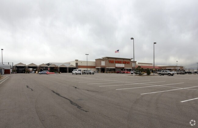
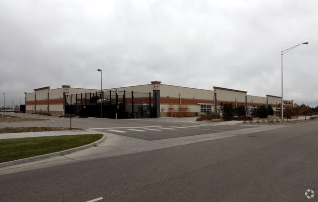
Property Record
16420 Washington St, Thornton, CO 80023

Property Detail
16420 Washington St
Denver-Aurora-Centennial, CO
SUB:LARKRIDGE SUBD FILING NO 1 LOT:3
1573-02-2-07-003
Adams
Storebuilding
Colorado
B and X Area of moderate flood hazard, usually the area between the limits of the 100-year and 500-year floods.
3
2024
12.98 AC
2025
Northeast
061200
Denver
117,946 SF
NEARBY LISTINGS FOR SALE OR LEASE
DEMOGRAPHICS near 16420 Washington St
1 mile
3 mile
5 mile
2025 Total Population
2,527
26,288
104,872
2030 Population
2,743
28,308
110,922
Pop Growth 2025-2030
+ 8.55%
+ 7.68%
+ 5.77%
Average Age
35
37
39
2025 Total Households
756
9,069
36,604
HH Growth 2025-2030
+ 8.73%
+ 8.05%
+ 6.00%
Median Household Inc
$137,999
$162,028
$150,908
Avg Household Size
3.30
2.90
2.80
2025 Avg HH Vehicles
3.00
2.00
2.00
Median Home Value
$727,500
$764,628
$739,490
Median Year Built
2010
2010
2006
Nearby Places
Map Layers
Map Styles
 Street
 Aerial
Transit
 Traffic
 Biking
Places
Listings with unknown addresses are not visible on the map
- Restaurants
- Banks
- Shops
- Fitness
- Groceries
PUBLIC TRANSPORTATION
COMMUTER RAIL
Eastlake - 124Th Station Track 2 (Union Station to Eastlake & 124th Station - Regional Transportation District)
Drive
Walk
Distance
Eastlake - 124Th Station Track 2 (Union Station to Eastlake & 124th Station - Regional Transportation District)
11 min
5.8 mi
Northglenn - 112Th Station Track 2 (Union Station to Eastlake & 124th Station - Regional Transportation District)
Drive
Walk
Distance
Northglenn - 112Th Station Track 2 (Union Station to Eastlake & 124th Station - Regional Transportation District)
15 min
8.0 mi
AIRPORT
Denver International
Drive
Walk
Distance
Denver International
30 min
24.8 mi
Freight Ports
Tulsa Port Of Catoosa
Drive
Walk
Distance
Tulsa Port Of Catoosa
736 min
718.9 mi
Nearby Properties
Address
Land Use
TOTAL SIZE
Lot Size
Zoning
Address
Land Use
TOTAL SIZE
Lot Size
Zoning
385,623 SF
32.77 AC
Address
Land Use
TOTAL SIZE
Lot Size
Zoning
355,866 SF
16.17 AC
Address
Land Use
TOTAL SIZE
Lot Size
Zoning
538,595 SF
87.92 AC
Address
Land Use
TOTAL SIZE
Lot Size
Zoning
177,730 SF
17.82 AC
PUD
Address
Land Use
TOTAL SIZE
Lot Size
Zoning
712,276 SF
72.16 AC
Address
Land Use
TOTAL SIZE
Lot Size
Zoning
869,000 SF
61.97 AC
Address
Land Use
TOTAL SIZE
Lot Size
Zoning
190,387 SF
106.32 AC
PUD
Address
Land Use
TOTAL SIZE
Lot Size
Zoning
202,491 SF
52.56 AC
PUD
Address
Land Use
TOTAL SIZE
Lot Size
Zoning
333,686 SF
19.68 AC
PUD
Address
Land Use
TOTAL SIZE
Lot Size
Zoning
253,459 SF
34.63 AC
Address
Land Use
TOTAL SIZE
Lot Size
Zoning
119,427 SF
12.75 AC
PUD
Address
Land Use
TOTAL SIZE
Lot Size
Zoning
284,997 SF
13.55 AC
PUD
Address
Land Use
TOTAL SIZE
Lot Size
Zoning
176,000 SF
12.03 AC
Address
Land Use
TOTAL SIZE
Lot Size
Zoning
164,372 SF
11.58 AC
PUD
Address
Land Use
TOTAL SIZE
Lot Size
Zoning
39.44 AC
PUD
Address
Land Use
TOTAL SIZE
Lot Size
Zoning
297,895 SF
6.77 AC
Address
Land Use
TOTAL SIZE
Lot Size
Zoning
146,300 SF
9 AC
Address
Land Use
TOTAL SIZE
Lot Size
Zoning
386,513 SF
4.89 AC
Address
Land Use
TOTAL SIZE
Lot Size
Zoning
130,628 SF
12.13 AC
PUD
Address
Land Use
TOTAL SIZE
Lot Size
Zoning
268,040 SF
17.59 AC
Address
Land Use
TOTAL SIZE
Lot Size
Zoning
152,841 SF
9.30 AC
PUD
Address
Land Use
TOTAL SIZE
Lot Size
Zoning
152,841 SF
7.74 AC
PUD
Address
Land Use
TOTAL SIZE
Lot Size
Zoning
152,841 SF
7.74 AC
PUD
Address
Land Use
TOTAL SIZE
Lot Size
Zoning
152,841 SF
7.74 AC
PUD
Address
Land Use
TOTAL SIZE
Lot Size
Zoning
124,446 SF
14.31 AC
Address
Land Use
TOTAL SIZE
Lot Size
Zoning
128,656 SF
6.27 AC
Address
Land Use
TOTAL SIZE
Lot Size
Zoning
112,594 SF
12.35 AC
Address
Land Use
TOTAL SIZE
Lot Size
Zoning
214,684 SF
11.24 AC
Address
Land Use
TOTAL SIZE
Lot Size
Zoning
180,159 SF
14.93 AC
Address
Land Use
TOTAL SIZE
Lot Size
Zoning
114,700 SF
9.99 AC
The World's #1 Commercial Real Estate Marketplace
Connect with us
© 2026 CoStar Group
The information above has been obtained from sources believed reliable. While we do not doubt its accuracy we have not verified it and make no guarantee, warranty or representation about it. It is your responsibility to independently confirm its accuracy and completeness. Any projections, opinions, assumptions, or estimates used are for example only and do not represent the current or future performance of the property. The value of this transaction to you depends on tax and other factors which should be evaluated by your tax, financial, and legal advisors. You and your advisors should conduct a careful, independent investigation of the property to determine to your satisfaction the suitability of the property for your needs.