Property Record
1643 E Hanna Ave, Indianapolis, IN 46227


NEARBY LISTINGS FOR SALE OR LEASE
Property Detail
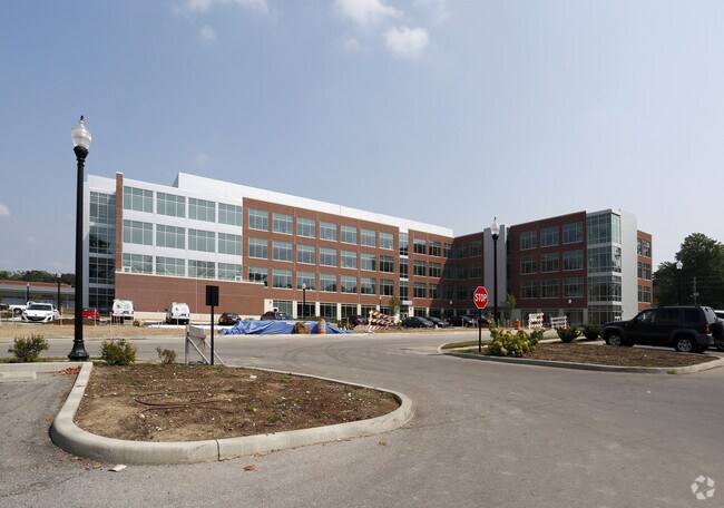
1643 E Hanna Ave
Indianapolis-Carmel-Anderson, IN
Martin Burtons Sub Pt
49-10-31-106-001.030-501
MARTIN BURTONS SUB PT L1 BEGIN 217 S & 34 W OF NE CORNER THENCE S 117 W 480 N 332 E 175 S 36.2 E 308 SE 17.47 S 170 TO BEG 3.515 ACRES
Privateschool
Marion
X
Indiana
18097C0234F
1
0
3.52 AC
2024
Edgewood/South County
380502
Indianapolis
117,874 SF
DEMOGRAPHICS near 1643 E Hanna Ave
1 Mile
3 Mile
5 Mile
2024 Total Population
13,081
82,681
221,608
2029 Population
13,077
81,983
220,248
Pop Growth 2024-2029
(0.03%)
(0.84%)
(0.61%)
Average Age
33
37
37
2024 Total Households
4,504
32,745
89,812
HH Growth 2024-2029
(0.07%)
(0.94%)
(0.59%)
Median Household Inc
$43,666
$54,261
$59,436
Avg Household Size
2.40
2.40
2.40
2024 Avg HH Vehicles
2.00
2.00
2.00
Median Home Value
$135,392
$160,654
$176,312
Median Year Built
1964
1960
1967
Nearby Places
Map Layers
Map Styles
 Street
 Aerial
- Restaurants
- Banks
- Shops
- Fitness
- Groceries
PUBLIC TRANSPORTATION
COMMUTER RAIL
Indianapolis (Cardinal - Amtrak)
DRIVE
WALK
Distance
Indianapolis (Cardinal - Amtrak)
9 min
4.8 mi
AIRPORT
Indianapolis International
DRIVE
WALK
Distance
Indianapolis International
28 min
15.7 mi
Freight Ports
Port of Toledo
DRIVE
WALK
Distance
Port of Toledo
276 min
230.4 mi
Nearby Properties
Address
Land Use
TOTAL SIZE
Lot Size
Zoning
Address
Land Use
TOTAL SIZE
Lot Size
Zoning
19,927 SF
28.82 AC
ZO01
Address
Land Use
TOTAL SIZE
Lot Size
Zoning
405,888 SF
19.56 AC
ZO01
Address
Land Use
TOTAL SIZE
Lot Size
Zoning
80,348 SF
2.95 AC
ZO01
Address
Land Use
TOTAL SIZE
Lot Size
Zoning
1,812 SF
11.08 AC
ZO01
Address
Land Use
TOTAL SIZE
Lot Size
Zoning
51,196 SF
50.61 AC
ZO01
Address
Land Use
TOTAL SIZE
Lot Size
Zoning
4,476 SF
12.18 AC
Address
Land Use
TOTAL SIZE
Lot Size
Zoning
5,665 SF
25.25 AC
ZO01
Address
Land Use
TOTAL SIZE
Lot Size
Zoning
39,618 SF
8.17 AC
ZO01
Address
Land Use
TOTAL SIZE
Lot Size
Zoning
405 SF
23.81 AC
ZO01
Address
Land Use
TOTAL SIZE
Lot Size
Zoning
1,932 SF
19.63 AC
ZO01
Address
Land Use
TOTAL SIZE
Lot Size
Zoning
4,179 SF
28.11 AC
ZO01
Address
Land Use
TOTAL SIZE
Lot Size
Zoning
2,928 SF
17.76 AC
Address
Land Use
TOTAL SIZE
Lot Size
Zoning
4,212 SF
16 AC
Address
Land Use
TOTAL SIZE
Lot Size
Zoning
208,224 SF
23.41 AC
ZO01
Address
Land Use
TOTAL SIZE
Lot Size
Zoning
4,872 SF
12.37 AC
Address
Land Use
TOTAL SIZE
Lot Size
Zoning
1,040 SF
15.62 AC
ZO01
Address
Land Use
TOTAL SIZE
Lot Size
Zoning
9,160 SF
2.54 AC
ZO01
Address
Land Use
TOTAL SIZE
Lot Size
Zoning
220,708 SF
26.81 AC
ZO01
Address
Land Use
TOTAL SIZE
Lot Size
Zoning
101,122 SF
16.44 AC
Address
Land Use
TOTAL SIZE
Lot Size
Zoning
1,372 SF
25.27 AC
Address
Land Use
TOTAL SIZE
Lot Size
Zoning
38,598 SF
2.83 AC
ZO01
Address
Land Use
TOTAL SIZE
Lot Size
Zoning
87,807 SF
9.04 AC
ZO01
Address
Land Use
TOTAL SIZE
Lot Size
Zoning
151,946 SF
15.04 AC
Address
Land Use
TOTAL SIZE
Lot Size
Zoning
121,055 SF
12.71 AC
ZO01
Address
Land Use
TOTAL SIZE
Lot Size
Zoning
5,075 SF
8 AC
ZO01
Address
Land Use
TOTAL SIZE
Lot Size
Zoning
3,208 SF
5.22 AC
ZO01
Address
Land Use
TOTAL SIZE
Lot Size
Zoning
20,944 SF
8.27 AC
ZO01
Address
Land Use
TOTAL SIZE
Lot Size
Zoning
13,876 SF
28.93 AC
ZO01
Address
Land Use
TOTAL SIZE
Lot Size
Zoning
24,808 SF
6.90 AC
ZO01
The World's #1 Commercial Real Estate Marketplace
Connect with us
© 2025 CoStar Group
The information above has been obtained from sources believed reliable. While we do not doubt its accuracy we have not verified it and make no guarantee, warranty or representation about it. It is your responsibility to independently confirm its accuracy and completeness. Any projections, opinions, assumptions, or estimates used are for example only and do not represent the current or future performance of the property. The value of this transaction to you depends on tax and other factors which should be evaluated by your tax, financial, and legal advisors. You and your advisors should conduct a careful, independent investigation of the property to determine to your satisfaction the suitability of the property for your needs.