Property Record
1644 N Broadway, Walnut Creek, CA 94596
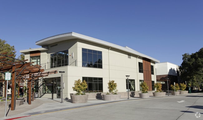

Property Detail
1644 N Broadway
178-300-039-9
POR OAK PARK SUB & TRS ADJ
Federalproperty
CONTRA COSTA
AE The base floodplain where base flood elevations are provided. AE Zones are now used on new format FIRMs instead of A1-A30 Zones.
California
0
2.20 AC
2025
Walnut Creek-BART/DT
339003
East Bay/Oakland
43,169 SF
Oakland-Fremont-Berkeley, CA
NEARBY LISTINGS FOR SALE OR LEASE
DEMOGRAPHICS near 1644 N Broadway
1 mile
3 mile
5 mile
2025 Total Population
20,342
109,989
219,078
2030 Population
20,848
111,452
221,026
Pop Growth 2025-2030
+ 2.49%
+ 1.33%
+ 0.89%
Average Age
41
45
44
2025 Total Households
9,788
48,394
88,944
HH Growth 2025-2030
+ 2.73%
+ 1.51%
+ 1.05%
Median Household Inc
$138,770
$142,912
$138,981
Avg Household Size
2.00
2.20
2.40
2025 Avg HH Vehicles
1.00
2.00
2.00
Median Home Value
$956,060
$1,049,850
$1,043,118
Median Year Built
1976
1972
1972
Nearby Places
Map Layers
Map Styles
 Street
 Aerial
Layers
 Traffic
 Biking
Places
Listings with unknown addresses are not visible on the map
- Restaurants
- Banks
- Shops
- Fitness
- Groceries
PUBLIC TRANSPORTATION
TRANSIT/SUBWAY
Walnut Creek (Antioch to SFIA/Millbrae - Bay Area Rapid Transit (BART), Millbrae/SFIA to Antioch - Bay Area Rapid Transit (BART))
Drive
Walk
Distance
Walnut Creek (Antioch to SFIA/Millbrae - Bay Area Rapid Transit (BART), Millbrae/SFIA to Antioch - Bay Area Rapid Transit (BART))
2 min
14 min
0.7 mi
AIRPORT
Metro Oakland International
Drive
Walk
Distance
Metro Oakland International
33 min
24.0 mi
San Francisco International
Drive
Walk
Distance
San Francisco International
51 min
35.9 mi
Freight Ports
Port of Oakland
Drive
Walk
Distance
Port of Oakland
23 min
16.8 mi
Nearby Properties
Address
Land Use
TOTAL SIZE
Lot Size
Zoning
Address
Land Use
TOTAL SIZE
Lot Size
Zoning
Address
Land Use
TOTAL SIZE
Lot Size
Zoning
13.66 AC
Address
Land Use
TOTAL SIZE
Lot Size
Zoning
428,476 SF
3.56 AC
Address
Land Use
TOTAL SIZE
Lot Size
Zoning
155,176 SF
3.34 AC
Address
Land Use
TOTAL SIZE
Lot Size
Zoning
295,561 SF
3.80 AC
Address
Land Use
TOTAL SIZE
Lot Size
Zoning
213,500 SF
3.02 AC
Address
Land Use
TOTAL SIZE
Lot Size
Zoning
337,980 SF
5.08 AC
Address
Land Use
TOTAL SIZE
Lot Size
Zoning
254,940 SF
1.61 AC
P1
Address
Land Use
TOTAL SIZE
Lot Size
Zoning
77,286 SF
3.68 AC
Address
Land Use
TOTAL SIZE
Lot Size
Zoning
232,529 SF
3.76 AC
M12
Address
Land Use
TOTAL SIZE
Lot Size
Zoning
174,951 SF
1.82 AC
Address
Land Use
TOTAL SIZE
Lot Size
Zoning
264,873 SF
2.19 AC
P1
Address
Land Use
TOTAL SIZE
Lot Size
Zoning
203,454 SF
2.33 AC
Address
Land Use
TOTAL SIZE
Lot Size
Zoning
5.52 AC
P1
Address
Land Use
TOTAL SIZE
Lot Size
Zoning
235,495 SF
2.51 AC
P1
Address
Land Use
TOTAL SIZE
Lot Size
Zoning
250,032 SF
7.95 AC
P1
Address
Land Use
TOTAL SIZE
Lot Size
Zoning
153,137 SF
1.22 AC
Address
Land Use
TOTAL SIZE
Lot Size
Zoning
393,680 SF
2.29 AC
Address
Land Use
TOTAL SIZE
Lot Size
Zoning
157,352 SF
0.98 AC
Address
Land Use
TOTAL SIZE
Lot Size
Zoning
249,628 SF
3.64 AC
P1
Address
Land Use
TOTAL SIZE
Lot Size
Zoning
118,596 SF
1.20 AC
Address
Land Use
TOTAL SIZE
Lot Size
Zoning
800,764 SF
3.66 AC
Address
Land Use
TOTAL SIZE
Lot Size
Zoning
192,387 SF
17.42 AC
M17
Address
Land Use
TOTAL SIZE
Lot Size
Zoning
12,864 SF
5.62 AC
Address
Land Use
TOTAL SIZE
Lot Size
Zoning
187,156 SF
5.92 AC
P1
Address
Land Use
TOTAL SIZE
Lot Size
Zoning
24,392 SF
2.29 AC
Address
Land Use
TOTAL SIZE
Lot Size
Zoning
321,000 SF
3.26 AC
Address
Land Use
TOTAL SIZE
Lot Size
Zoning
38,027 SF
2.86 AC
Address
Land Use
TOTAL SIZE
Lot Size
Zoning
237,656 SF
7.16 AC
P1
Address
Land Use
TOTAL SIZE
Lot Size
Zoning
166,144 SF
19.22 AC
The World's #1 Commercial Real Estate Marketplace
Connect with us
© 2026 CoStar Group
The information above has been obtained from sources believed reliable. While we do not doubt its accuracy we have not verified it and make no guarantee, warranty or representation about it. It is your responsibility to independently confirm its accuracy and completeness. Any projections, opinions, assumptions, or estimates used are for example only and do not represent the current or future performance of the property. The value of this transaction to you depends on tax and other factors which should be evaluated by your tax, financial, and legal advisors. You and your advisors should conduct a careful, independent investigation of the property to determine to your satisfaction the suitability of the property for your needs.