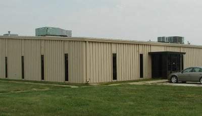
Property Record
165 N 10Th St, Waukee, IA 50263

NEARBY LISTINGS FOR SALE OR LEASE
Property Detail
165 N 10Th St
Des Moines-West Des Moines, IA
Waukee Development Plat 1
12-28-300-034
WAUKEE DEVELOPMENT PLAT 1 LOT 5 /EX PARCEL A/
Lightindustrial
Dallas
X
Iowa
19049C0335F
5
2024
8.06 AC
2025
Western Suburbs
050902
Des Moines
71,700 SF
DEMOGRAPHICS near 165 N 10Th St
1 Mile
3 Mile
5 Mile
2024 Total Population
4,127
37,142
70,243
2029 Population
5,019
45,253
84,657
Pop Growth 2024-2029
+ 21.61%
+ 21.84%
+ 20.52%
Average Age
38
35
36
2024 Total Households
1,639
13,750
26,228
HH Growth 2024-2029
+ 22.45%
+ 22.68%
+ 21.29%
Median Household Inc
$88,815
$103,316
$107,797
Avg Household Size
2.50
2.70
2.70
2024 Avg HH Vehicles
2.00
2.00
2.00
Median Home Value
$257,977
$293,849
$323,562
Median Year Built
1994
2010
2009
Nearby Places
Map Layers
Map Styles
 Street
 Aerial
- Restaurants
- Banks
- Shops
- Fitness
- Groceries
PUBLIC TRANSPORTATION
AIRPORT
Des Moines International
DRIVE
WALK
Distance
Des Moines International
31 min
17.6 mi
Nearby Properties
Address
Land Use
TOTAL SIZE
Lot Size
Zoning
Address
Land Use
TOTAL SIZE
Lot Size
Zoning
218.93 AC
Address
Land Use
TOTAL SIZE
Lot Size
Zoning
48,937 SF
76.01 AC
Address
Land Use
TOTAL SIZE
Lot Size
Zoning
72,372 SF
74.45 AC
Address
Land Use
TOTAL SIZE
Lot Size
Zoning
37,325 SF
Address
Land Use
TOTAL SIZE
Lot Size
Zoning
2,864 SF
21.03 AC
Address
Land Use
TOTAL SIZE
Lot Size
Zoning
101,097 SF
30 AC
Address
Land Use
TOTAL SIZE
Lot Size
Zoning
123,722 SF
64.36 AC
Address
Land Use
TOTAL SIZE
Lot Size
Zoning
3,358 SF
21 AC
Address
Land Use
TOTAL SIZE
Lot Size
Zoning
11.91 AC
Address
Land Use
TOTAL SIZE
Lot Size
Zoning
24,499 SF
5.75 AC
Address
Land Use
TOTAL SIZE
Lot Size
Zoning
39,505 SF
4.94 AC
Address
Land Use
TOTAL SIZE
Lot Size
Zoning
17.73 AC
Address
Land Use
TOTAL SIZE
Lot Size
Zoning
12.44 AC
Address
Land Use
TOTAL SIZE
Lot Size
Zoning
175,860 SF
40.72 AC
Address
Land Use
TOTAL SIZE
Lot Size
Zoning
17.76 AC
Address
Land Use
TOTAL SIZE
Lot Size
Zoning
87,362 SF
16.87 AC
Address
Land Use
TOTAL SIZE
Lot Size
Zoning
32,439 SF
7.89 AC
Address
Land Use
TOTAL SIZE
Lot Size
Zoning
Address
Land Use
TOTAL SIZE
Lot Size
Zoning
Address
Land Use
TOTAL SIZE
Lot Size
Zoning
66.16 AC
Address
Land Use
TOTAL SIZE
Lot Size
Zoning
14.16 AC
Address
Land Use
TOTAL SIZE
Lot Size
Zoning
30,943 SF
2.98 AC
Address
Land Use
TOTAL SIZE
Lot Size
Zoning
5.14 AC
Address
Land Use
TOTAL SIZE
Lot Size
Zoning
71,483 SF
8.26 AC
Address
Land Use
TOTAL SIZE
Lot Size
Zoning
14.31 AC
Address
Land Use
TOTAL SIZE
Lot Size
Zoning
66,997 SF
8.95 AC
Address
Land Use
TOTAL SIZE
Lot Size
Zoning
89,765 SF
9.73 AC
Address
Land Use
TOTAL SIZE
Lot Size
Zoning
21,009 SF
12.64 AC
Address
Land Use
TOTAL SIZE
Lot Size
Zoning
36,396 SF
9.22 AC
Address
Land Use
TOTAL SIZE
Lot Size
Zoning
17.50 AC
The World's #1 Commercial Real Estate Marketplace
Connect with us
© 2026 CoStar Group
The information above has been obtained from sources believed reliable. While we do not doubt its accuracy we have not verified it and make no guarantee, warranty or representation about it. It is your responsibility to independently confirm its accuracy and completeness. Any projections, opinions, assumptions, or estimates used are for example only and do not represent the current or future performance of the property. The value of this transaction to you depends on tax and other factors which should be evaluated by your tax, financial, and legal advisors. You and your advisors should conduct a careful, independent investigation of the property to determine to your satisfaction the suitability of the property for your needs.