Property Record
165 State Rt 23, Franklin, NJ 07416
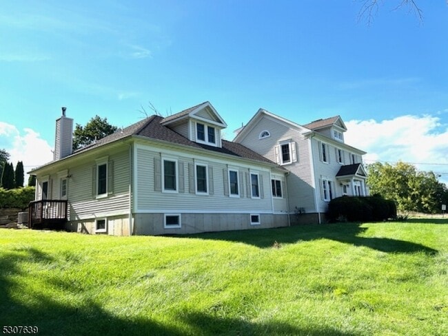

Property Detail
165 State Rt 23
06-01504-0000-00018
SUSSEX
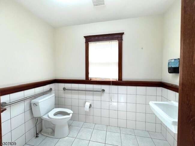
Commercialofficeresidentialmixeduse
New Jersey
HC-2
18
B and X Area of moderate flood hazard, usually the area between the limits of the 100-year and 500-year floods.
1.01 AC
2024
Sussex County
2025
Northern New Jersey
372900
Newark, NJ
3,356 SF
NEARBY LISTINGS FOR SALE OR LEASE
DEMOGRAPHICS near 165 State Rt 23
1 mile
3 mile
5 mile
2025 Total Population
3,554
16,190
27,375
2030 Population
3,614
16,611
28,115
Pop Growth 2025-2030
+ 1.69%
+ 2.60%
+ 2.70%
Average Age
44
44
44
2025 Total Households
1,476
6,636
10,916
HH Growth 2025-2030
+ 1.69%
+ 2.59%
+ 2.71%
Median Household Inc
$82,427
$95,723
$108,508
Avg Household Size
2.40
2.40
2.50
2025 Avg HH Vehicles
2.00
2.00
2.00
Median Home Value
$287,570
$325,231
$359,459
Median Year Built
1956
1973
1977
Nearby Places
Map Layers
Map Styles
 Street
 Aerial
Transit
 Traffic
 Biking
Places
Listings with unknown addresses are not visible on the map
- Restaurants
- Banks
- Shops
- Fitness
- Groceries
PUBLIC TRANSPORTATION
AIRPORT
New York Stewart International
Drive
Walk
Distance
New York Stewart International
74 min
44.9 mi
Newark Liberty International
Drive
Walk
Distance
Newark Liberty International
60 min
48.2 mi
Freight Ports
Maher Terminal
Drive
Walk
Distance
Maher Terminal
66 min
48.3 mi
SALE & LEASE HISTORY
LISTING DATE
SALE/LEASE

Oct 21, 2025
For Lease
Nearby Properties
Address
Land Use
TOTAL SIZE
Lot Size
Zoning
Address
Land Use
TOTAL SIZE
Lot Size
Zoning
68.74 AC
R-C
Address
Land Use
TOTAL SIZE
Lot Size
Zoning
66.06 AC
GC
Address
Land Use
TOTAL SIZE
Lot Size
Zoning
10.83 AC
OSGU
Address
Land Use
TOTAL SIZE
Lot Size
Zoning
18.69 AC
R-4
Address
Land Use
TOTAL SIZE
Lot Size
Zoning
83.51 AC
TCSC
Address
Land Use
TOTAL SIZE
Lot Size
Zoning
Address
Land Use
TOTAL SIZE
Lot Size
Zoning
52,776 SF
7.53 AC
R40
Address
Land Use
TOTAL SIZE
Lot Size
Zoning
12.80 AC
R-4
Address
Land Use
TOTAL SIZE
Lot Size
Zoning
16.88 AC
HC-1
Address
Land Use
TOTAL SIZE
Lot Size
Zoning
1,166.18 AC
MID5
Address
Land Use
TOTAL SIZE
Lot Size
Zoning
10.37 AC
I
Address
Land Use
TOTAL SIZE
Lot Size
Zoning
1,150.36 AC
MD10
Address
Land Use
TOTAL SIZE
Lot Size
Zoning
10.02 AC
HC-1
Address
Land Use
TOTAL SIZE
Lot Size
Zoning
21.48 AC
R-1
Address
Land Use
TOTAL SIZE
Lot Size
Zoning
1,001.49 AC
B-1
Address
Land Use
TOTAL SIZE
Lot Size
Zoning
0.90 AC
Address
Land Use
TOTAL SIZE
Lot Size
Zoning
10 AC
P
Address
Land Use
TOTAL SIZE
Lot Size
Zoning
38.17 AC
HC-1
Address
Land Use
TOTAL SIZE
Lot Size
Zoning
3,048 SF
51 AC
I-2
Address
Land Use
TOTAL SIZE
Lot Size
Zoning
836 SF
10 AC
I-1
Address
Land Use
TOTAL SIZE
Lot Size
Zoning
Address
Land Use
TOTAL SIZE
Lot Size
Zoning
5.62 AC
HC-1
Address
Land Use
TOTAL SIZE
Lot Size
Zoning
Address
Land Use
TOTAL SIZE
Lot Size
Zoning
10.29 AC
MID3
Address
Land Use
TOTAL SIZE
Lot Size
Zoning
2.20 AC
BAR
Address
Land Use
TOTAL SIZE
Lot Size
Zoning
960 SF
3.38 AC
B-1
Address
Land Use
TOTAL SIZE
Lot Size
Zoning
9.02 AC
B-1
Address
Land Use
TOTAL SIZE
Lot Size
Zoning
6 AC
GC
Address
Land Use
TOTAL SIZE
Lot Size
Zoning
1,920 SF
1.59 AC
HC-1
Address
Land Use
TOTAL SIZE
Lot Size
Zoning
The World's #1 Commercial Real Estate Marketplace
Connect with us
© 2026 CoStar Group
The information above has been obtained from sources believed reliable. While we do not doubt its accuracy we have not verified it and make no guarantee, warranty or representation about it. It is your responsibility to independently confirm its accuracy and completeness. Any projections, opinions, assumptions, or estimates used are for example only and do not represent the current or future performance of the property. The value of this transaction to you depends on tax and other factors which should be evaluated by your tax, financial, and legal advisors. You and your advisors should conduct a careful, independent investigation of the property to determine to your satisfaction the suitability of the property for your needs.