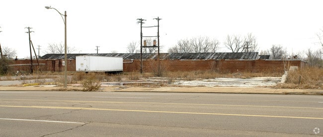
Property Record
166 E Eh Crump Blvd, Memphis, TN 38106

NEARBY LISTINGS FOR SALE OR LEASE
Property Detail
166 E Eh Crump Blvd
Memphis, TN-MS-AR
Williams
01-3002-0-0014
NS EH CRUMP BLVD 340 FT W OF THIRD
Vacantlandnec
Shelby
X
Tennessee
05035C0475E
108
2024
0.70 AC
2025
Downtown/Midtown
011700
Memphis
DEMOGRAPHICS near 166 E Eh Crump Blvd
1 Mile
3 Mile
5 Mile
2024 Total Population
11,174
67,055
139,338
2029 Population
11,457
67,960
140,634
Pop Growth 2024-2029
+ 2.53%
+ 1.35%
+ 0.93%
Average Age
38
40
39
2024 Total Households
5,864
31,801
64,199
HH Growth 2024-2029
+ 1.84%
+ 1.08%
+ 0.74%
Median Household Inc
$51,501
$36,399
$39,758
Avg Household Size
1.90
2.00
2.10
2024 Avg HH Vehicles
1.00
1.00
1.00
Median Home Value
$311,111
$117,719
$155,238
Median Year Built
2002
1961
1957
Nearby Places
- Restaurants
- Banks
- Shops
- Fitness
- Groceries
PUBLIC TRANSPORTATION
COMMUTER RAIL
Central Station (Riverfront Loop - Memphis Area Transit Authority Trolley (MataTrolley))
DRIVE
WALK
Distance
Central Station (Riverfront Loop - Memphis Area Transit Authority Trolley (MataTrolley))
1 min
15 min
0.8 mi
AIRPORT
Memphis International
DRIVE
WALK
Distance
Memphis International
15 min
9.5 mi
Freight Ports
Port of Shreveport
DRIVE
WALK
Distance
Port of Shreveport
396 min
367.9 mi
Nearby Properties
Address
Land Use
TOTAL SIZE
Lot Size
Zoning
Address
Land Use
TOTAL SIZE
Lot Size
Zoning
409,950 SF
5.16 AC
CMP-1
Address
Land Use
TOTAL SIZE
Lot Size
Zoning
660,788 SF
8.28 AC
CMP-1
Address
Land Use
TOTAL SIZE
Lot Size
Zoning
61,983 SF
3.95 AC
U
Address
Land Use
TOTAL SIZE
Lot Size
Zoning
237,575 SF
2.34 AC
SE
Address
Land Use
TOTAL SIZE
Lot Size
Zoning
413,375 SF
33.87 AC
U
Address
Land Use
TOTAL SIZE
Lot Size
Zoning
60,363 SF
1.33 AC
SM
Address
Land Use
TOTAL SIZE
Lot Size
Zoning
300,225 SF
9.61 AC
U
Address
Land Use
TOTAL SIZE
Lot Size
Zoning
182,595 SF
3.17 AC
SE
Address
Land Use
TOTAL SIZE
Lot Size
Zoning
131,803 SF
1.33 AC
CBD
Address
Land Use
TOTAL SIZE
Lot Size
Zoning
233,547 SF
16.70 AC
SM
Address
Land Use
TOTAL SIZE
Lot Size
Zoning
71,987 SF
2.26 AC
SM
Address
Land Use
TOTAL SIZE
Lot Size
Zoning
516,768 SF
6.11 AC
CMP-1
Address
Land Use
TOTAL SIZE
Lot Size
Zoning
357,917 SF
2.66 AC
SE
Address
Land Use
TOTAL SIZE
Lot Size
Zoning
79,200 SF
1.91 AC
CMP-1
Address
Land Use
TOTAL SIZE
Lot Size
Zoning
99,590 SF
1.73 AC
SE
Address
Land Use
TOTAL SIZE
Lot Size
Zoning
105,244 SF
0.59 AC
CBD
Address
Land Use
TOTAL SIZE
Lot Size
Zoning
116,399 SF
4.30 AC
SDR
Address
Land Use
TOTAL SIZE
Lot Size
Zoning
113,416 SF
3.35 AC
SDR
Address
Land Use
TOTAL SIZE
Lot Size
Zoning
74,369 SF
0.78 AC
SM
Address
Land Use
TOTAL SIZE
Lot Size
Zoning
56,716 SF
0.49 AC
SE
Address
Land Use
TOTAL SIZE
Lot Size
Zoning
237,434 SF
1.99 AC
CBD
Address
Land Use
TOTAL SIZE
Lot Size
Zoning
57,424 SF
0.83 AC
SM
Address
Land Use
TOTAL SIZE
Lot Size
Zoning
2.20 AC
U
Address
Land Use
TOTAL SIZE
Lot Size
Zoning
109,000 SF
1.18 AC
SE
Address
Land Use
TOTAL SIZE
Lot Size
Zoning
47,430 SF
1.01 AC
CBD
Address
Land Use
TOTAL SIZE
Lot Size
Zoning
76,917 SF
0.60 AC
CBD
Address
Land Use
TOTAL SIZE
Lot Size
Zoning
43,779 SF
2.11 AC
RU-3
Address
Land Use
TOTAL SIZE
Lot Size
Zoning
67,221 SF
0.51 AC
CBD
Address
Land Use
TOTAL SIZE
Lot Size
Zoning
42,351 SF
0.95 AC
SE
Address
Land Use
TOTAL SIZE
Lot Size
Zoning
82,064 SF
3.53 AC
CMP-1
The World's #1 Commercial Real Estate Marketplace
Connect with us
© 2025 CoStar Group
The information above has been obtained from sources believed reliable. While we do not doubt its accuracy we have not verified it and make no guarantee, warranty or representation about it. It is your responsibility to independently confirm its accuracy and completeness. Any projections, opinions, assumptions, or estimates used are for example only and do not represent the current or future performance of the property. The value of this transaction to you depends on tax and other factors which should be evaluated by your tax, financial, and legal advisors. You and your advisors should conduct a careful, independent investigation of the property to determine to your satisfaction the suitability of the property for your needs.