Property Record
1677 Greenlea Blvd, Gallatin, TN 37066

This Property Is For Sale
NEARBY LISTINGS FOR SALE OR LEASE
Property Detail
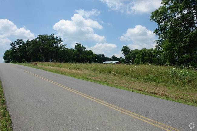
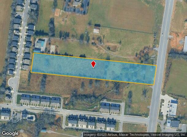
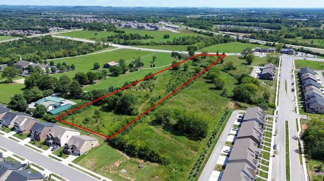
1677 Greenlea Blvd
125-020.02
DISTRICT: 04 TRACT 3, COUNTY AREA: D00
Residentialacreage
Sumner
X
Tennessee
47165C0295G
5.54 AC
2024
Rivergate/Hendersonville
2025
Nashville
020905
Nashville-Davidson--Murfreesboro--Franklin, TN
DEMOGRAPHICS near 1677 Greenlea Blvd
1 Mile
3 Mile
5 Mile
2024 Total Population
3,527
33,915
67,332
2029 Population
4,009
38,274
75,635
Pop Growth 2024-2029
+ 13.67%
+ 12.85%
+ 12.33%
Average Age
38
40
40
2024 Total Households
1,440
13,577
25,921
HH Growth 2024-2029
+ 14.10%
+ 13.18%
+ 12.63%
Median Household Inc
$85,035
$69,308
$69,087
Avg Household Size
2.40
2.50
2.50
2024 Avg HH Vehicles
2.00
2.00
2.00
Median Home Value
$378,757
$376,619
$365,438
Median Year Built
2009
2004
2002
Nearby Places
- Restaurants
- Banks
- Shops
- Fitness
- Groceries
PUBLIC TRANSPORTATION
AIRPORT
Nashville International
DRIVE
WALK
Distance
Nashville International
41 min
34.1 mi
Freight Ports
Port of Toledo
DRIVE
WALK
Distance
Port of Toledo
526 min
460.8 mi
Nearby Properties
Address
Land Use
TOTAL SIZE
Lot Size
Zoning
Address
Land Use
TOTAL SIZE
Lot Size
Zoning
2,109 SF
1.30 AC
Address
Land Use
TOTAL SIZE
Lot Size
Zoning
1,055,495 SF
126.40 AC
Address
Land Use
TOTAL SIZE
Lot Size
Zoning
47,729 SF
28.52 AC
Address
Land Use
TOTAL SIZE
Lot Size
Zoning
58,184 SF
26.27 AC
Address
Land Use
TOTAL SIZE
Lot Size
Zoning
10,208 SF
29.53 AC
ESTATEA
Address
Land Use
TOTAL SIZE
Lot Size
Zoning
27,317 SF
22.74 AC
Address
Land Use
TOTAL SIZE
Lot Size
Zoning
30,149 SF
21.02 AC
Address
Land Use
TOTAL SIZE
Lot Size
Zoning
29,438 SF
6.53 AC
Address
Land Use
TOTAL SIZE
Lot Size
Zoning
101,672 SF
16.53 AC
Address
Land Use
TOTAL SIZE
Lot Size
Zoning
27,816 SF
10.76 AC
MU
Address
Land Use
TOTAL SIZE
Lot Size
Zoning
29,160 SF
20.02 AC
Address
Land Use
TOTAL SIZE
Lot Size
Zoning
31,764 SF
MU
Address
Land Use
TOTAL SIZE
Lot Size
Zoning
18,734 SF
12.33 AC
MU
Address
Land Use
TOTAL SIZE
Lot Size
Zoning
81,584 SF
5.99 AC
Address
Land Use
TOTAL SIZE
Lot Size
Zoning
15,189 SF
7.84 AC
Address
Land Use
TOTAL SIZE
Lot Size
Zoning
16,736 SF
14.10 AC
Address
Land Use
TOTAL SIZE
Lot Size
Zoning
21,126 SF
7.67 AC
Address
Land Use
TOTAL SIZE
Lot Size
Zoning
5,992 SF
15.38 AC
Address
Land Use
TOTAL SIZE
Lot Size
Zoning
205,182 SF
21.90 AC
CG
Address
Land Use
TOTAL SIZE
Lot Size
Zoning
131,339 SF
18.22 AC
Address
Land Use
TOTAL SIZE
Lot Size
Zoning
9,568 SF
16.50 AC
Address
Land Use
TOTAL SIZE
Lot Size
Zoning
99,333 SF
1.73 AC
ESTATEA
Address
Land Use
TOTAL SIZE
Lot Size
Zoning
156,213 SF
14.80 AC
PGC
Address
Land Use
TOTAL SIZE
Lot Size
Zoning
35,569 SF
6.99 AC
Address
Land Use
TOTAL SIZE
Lot Size
Zoning
50,964 SF
8.05 AC
Address
Land Use
TOTAL SIZE
Lot Size
Zoning
73,567 SF
9.99 AC
MRO
Address
Land Use
TOTAL SIZE
Lot Size
Zoning
1.27 AC
Address
Land Use
TOTAL SIZE
Lot Size
Zoning
18,016 SF
17.90 AC
Address
Land Use
TOTAL SIZE
Lot Size
Zoning
63,334 SF
2.45 AC
Address
Land Use
TOTAL SIZE
Lot Size
Zoning
34,548 SF
5.11 AC
MU
The World's #1 Commercial Real Estate Marketplace
Connect with us
© 2025 CoStar Group
The information above has been obtained from sources believed reliable. While we do not doubt its accuracy we have not verified it and make no guarantee, warranty or representation about it. It is your responsibility to independently confirm its accuracy and completeness. Any projections, opinions, assumptions, or estimates used are for example only and do not represent the current or future performance of the property. The value of this transaction to you depends on tax and other factors which should be evaluated by your tax, financial, and legal advisors. You and your advisors should conduct a careful, independent investigation of the property to determine to your satisfaction the suitability of the property for your needs.