Property Record
16802 Barker Springs Rd, Houston, TX 77084


NEARBY LISTINGS FOR SALE OR LEASE
Property Detail
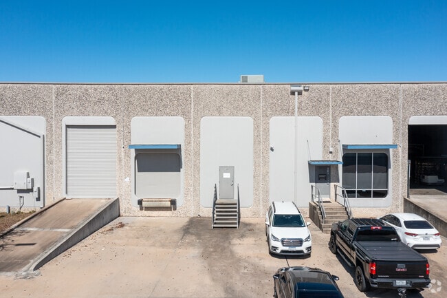
16802 Barker Springs Rd
1075220000033
Park Ten Sec 1
Warehouse
RES A5 BLK 1 PARK TEN SEC 1
X
Harris
48201C0620M
Texas
2024
14.74 AC
2025
Northwest Outliers
541702
Houston
249,270 SF
Houston-Pasadena-The Woodlands, TX
DEMOGRAPHICS near 16802 Barker Springs Rd
1 Mile
3 Mile
5 Mile
2024 Total Population
4,881
57,852
254,461
2029 Population
4,990
59,057
259,054
Pop Growth 2024-2029
+ 2.23%
+ 2.08%
+ 1.80%
Average Age
33
37
36
2024 Total Households
2,163
21,036
91,253
HH Growth 2024-2029
+ 2.13%
+ 2.15%
+ 1.76%
Median Household Inc
$75,162
$82,065
$73,083
Avg Household Size
2.30
2.70
2.70
2024 Avg HH Vehicles
2.00
2.00
2.00
Median Home Value
$251,807
$281,338
$242,484
Median Year Built
1993
1997
1995
Nearby Places
Map Layers
Map Styles
 Street
 Aerial
- Restaurants
- Banks
- Shops
- Fitness
- Groceries
PUBLIC TRANSPORTATION
AIRPORT
William P Hobby
DRIVE
WALK
Distance
William P Hobby
49 min
32.9 mi
George Bush Intcntl/Houston
DRIVE
WALK
Distance
George Bush Intcntl/Houston
44 min
34.2 mi
Freight Ports
Port of Houston
DRIVE
WALK
Distance
Port of Houston
43 min
29.7 mi
SALE & LEASE HISTORY
LISTING DATE
SALE/LEASE

Sep 24, 2016
For Lease
May 23, 2023
For Lease
Mar 14, 2022
For Lease
Jun 13, 2017
For Lease
Jan 05, 2021
For Lease
Dec 14, 2020
For Lease
Nearby Properties
Address
Land Use
TOTAL SIZE
Lot Size
Zoning
Address
Land Use
TOTAL SIZE
Lot Size
Zoning
759,908 SF
4.54 AC
Address
Land Use
TOTAL SIZE
Lot Size
Zoning
953,143 SF
63.82 AC
Address
Land Use
TOTAL SIZE
Lot Size
Zoning
1,543,856 SF
10.03 AC
Address
Land Use
TOTAL SIZE
Lot Size
Zoning
695,923 SF
6.63 AC
Address
Land Use
TOTAL SIZE
Lot Size
Zoning
764,429 SF
6.78 AC
Address
Land Use
TOTAL SIZE
Lot Size
Zoning
1,045,896 SF
11.14 AC
Address
Land Use
TOTAL SIZE
Lot Size
Zoning
681,561 SF
7.98 AC
Address
Land Use
TOTAL SIZE
Lot Size
Zoning
451,973 SF
19.47 AC
Address
Land Use
TOTAL SIZE
Lot Size
Zoning
439,347 SF
13.50 AC
Address
Land Use
TOTAL SIZE
Lot Size
Zoning
417,092 SF
17.58 AC
Address
Land Use
TOTAL SIZE
Lot Size
Zoning
375,486 SF
12.36 AC
Address
Land Use
TOTAL SIZE
Lot Size
Zoning
341,844 SF
16.71 AC
Address
Land Use
TOTAL SIZE
Lot Size
Zoning
343,605 SF
11.90 AC
Address
Land Use
TOTAL SIZE
Lot Size
Zoning
319,717 SF
10.45 AC
Address
Land Use
TOTAL SIZE
Lot Size
Zoning
359,116 SF
15.35 AC
Address
Land Use
TOTAL SIZE
Lot Size
Zoning
460,786 SF
9 AC
Address
Land Use
TOTAL SIZE
Lot Size
Zoning
538,027 SF
30.06 AC
Address
Land Use
TOTAL SIZE
Lot Size
Zoning
534,796 SF
Address
Land Use
TOTAL SIZE
Lot Size
Zoning
467,663 SF
7.30 AC
Address
Land Use
TOTAL SIZE
Lot Size
Zoning
284,321 SF
10.54 AC
Address
Land Use
TOTAL SIZE
Lot Size
Zoning
458,613 SF
19.50 AC
Address
Land Use
TOTAL SIZE
Lot Size
Zoning
214,347 SF
30.70 AC
Address
Land Use
TOTAL SIZE
Lot Size
Zoning
272,659 SF
12.30 AC
Address
Land Use
TOTAL SIZE
Lot Size
Zoning
334,724 SF
21.23 AC
Address
Land Use
TOTAL SIZE
Lot Size
Zoning
489,188 SF
5.99 AC
Address
Land Use
TOTAL SIZE
Lot Size
Zoning
572,060 SF
23.77 AC
Address
Land Use
TOTAL SIZE
Lot Size
Zoning
294,642 SF
14.47 AC
Address
Land Use
TOTAL SIZE
Lot Size
Zoning
370,329 SF
5 AC
Address
Land Use
TOTAL SIZE
Lot Size
Zoning
363,880 SF
17.32 AC
Address
Land Use
TOTAL SIZE
Lot Size
Zoning
305,624 SF
The World's #1 Commercial Real Estate Marketplace
Connect with us
© 2026 CoStar Group
The information above has been obtained from sources believed reliable. While we do not doubt its accuracy we have not verified it and make no guarantee, warranty or representation about it. It is your responsibility to independently confirm its accuracy and completeness. Any projections, opinions, assumptions, or estimates used are for example only and do not represent the current or future performance of the property. The value of this transaction to you depends on tax and other factors which should be evaluated by your tax, financial, and legal advisors. You and your advisors should conduct a careful, independent investigation of the property to determine to your satisfaction the suitability of the property for your needs.