Property Record
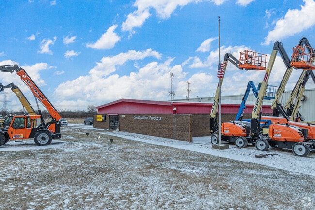
16822 E Laraway Rd, Joliet, IL 60433


NEARBY LISTINGS FOR SALE OR LEASE
Property Detail
16822 E Laraway Rd
30-07-25-400-012
ASSESSMENT DESCRIPTION: THAT PRT OF THE E1/2 OF THE SE1/4 OF SEC 25, T35N-R10E, DAF: BEG AT THE SE COR OF SD SEC 25; THC N 01
Commercialnec
Will
X
Illinois
17197C0285G
22.31 AC
2024
Joliet Area
2024
Chicago
883100
Chicago-Naperville-Elgin, IL-IN
DEMOGRAPHICS near 16822 E Laraway Rd
1 mile
3 mile
5 mile
2024 Total Population
338
22,195
93,241
2029 Population
338
22,214
93,502
Pop Growth 2024-2029
0.00%
+ 0.09%
+ 0.28%
Average Age
42
40
37
2024 Total Households
131
7,736
31,560
HH Growth 2024-2029
0.00%
+ 0.04%
+ 0.25%
Median Household Inc
$102,778
$86,526
$73,968
Avg Household Size
2.50
2.80
2.80
2024 Avg HH Vehicles
2.00
2.00
2.00
Median Home Value
$164,034
$266,003
$250,811
Median Year Built
1960
1977
1973
Nearby Places
Map Layers
Map Styles
 Street
 Aerial
Transit
 Traffic
 Biking
Places
Listings with unknown addresses are not visible on the map
- Restaurants
- Banks
- Shops
- Fitness
- Groceries
PUBLIC TRANSPORTATION
COMMUTER RAIL
New Lenox Laraway Road (SouthWest Service - Northeast Illinois Regional Commuter Railroad (Metra))
Drive
Walk
Distance
New Lenox Laraway Road (SouthWest Service - Northeast Illinois Regional Commuter Railroad (Metra))
7 min
3.8 mi
New Lenox Station (Rock Island District Line - Northeast Illinois Regional Commuter Railroad (Metra))
Drive
Walk
Distance
New Lenox Station (Rock Island District Line - Northeast Illinois Regional Commuter Railroad (Metra))
11 min
5.4 mi
AIRPORT
Chicago Midway International
Drive
Walk
Distance
Chicago Midway International
48 min
35.7 mi
Freight Ports
Port Milwaukee
Drive
Walk
Distance
Port Milwaukee
146 min
118.8 mi
Nearby Properties
Address
Land Use
TOTAL SIZE
Lot Size
Zoning
Address
Land Use
TOTAL SIZE
Lot Size
Zoning
27.63 AC
Address
Land Use
TOTAL SIZE
Lot Size
Zoning
67.82 AC
Address
Land Use
TOTAL SIZE
Lot Size
Zoning
53.05 AC
Address
Land Use
TOTAL SIZE
Lot Size
Zoning
59.92 AC
Address
Land Use
TOTAL SIZE
Lot Size
Zoning
128.88 AC
Address
Land Use
TOTAL SIZE
Lot Size
Zoning
49.35 AC
Address
Land Use
TOTAL SIZE
Lot Size
Zoning
45.09 AC
Address
Land Use
TOTAL SIZE
Lot Size
Zoning
34.48 AC
Address
Land Use
TOTAL SIZE
Lot Size
Zoning
52.25 AC
Address
Land Use
TOTAL SIZE
Lot Size
Zoning
26.04 AC
Address
Land Use
TOTAL SIZE
Lot Size
Zoning
Address
Land Use
TOTAL SIZE
Lot Size
Zoning
36.54 AC
Address
Land Use
TOTAL SIZE
Lot Size
Zoning
17.49 AC
Address
Land Use
TOTAL SIZE
Lot Size
Zoning
30.99 AC
Address
Land Use
TOTAL SIZE
Lot Size
Zoning
22.77 AC
Address
Land Use
TOTAL SIZE
Lot Size
Zoning
Address
Land Use
TOTAL SIZE
Lot Size
Zoning
20.66 AC
Address
Land Use
TOTAL SIZE
Lot Size
Zoning
38.40 AC
Address
Land Use
TOTAL SIZE
Lot Size
Zoning
26.83 AC
Address
Land Use
TOTAL SIZE
Lot Size
Zoning
12.03 AC
Address
Land Use
TOTAL SIZE
Lot Size
Zoning
11.04 AC
Address
Land Use
TOTAL SIZE
Lot Size
Zoning
12.08 AC
Address
Land Use
TOTAL SIZE
Lot Size
Zoning
13.14 AC
Address
Land Use
TOTAL SIZE
Lot Size
Zoning
10.28 AC
Address
Land Use
TOTAL SIZE
Lot Size
Zoning
16.31 AC
Address
Land Use
TOTAL SIZE
Lot Size
Zoning
19.41 AC
Address
Land Use
TOTAL SIZE
Lot Size
Zoning
78.91 AC
Address
Land Use
TOTAL SIZE
Lot Size
Zoning
8.79 AC
Address
Land Use
TOTAL SIZE
Lot Size
Zoning
16.77 AC
Address
Land Use
TOTAL SIZE
Lot Size
Zoning
The World's #1 Commercial Real Estate Marketplace
Connect with us
© 2026 CoStar Group
The information above has been obtained from sources believed reliable. While we do not doubt its accuracy we have not verified it and make no guarantee, warranty or representation about it. It is your responsibility to independently confirm its accuracy and completeness. Any projections, opinions, assumptions, or estimates used are for example only and do not represent the current or future performance of the property. The value of this transaction to you depends on tax and other factors which should be evaluated by your tax, financial, and legal advisors. You and your advisors should conduct a careful, independent investigation of the property to determine to your satisfaction the suitability of the property for your needs.