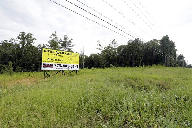
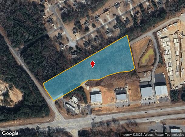
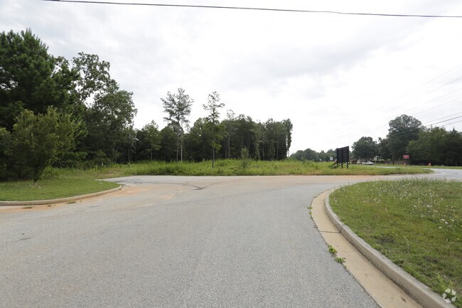
Property Record
1687 78 Hwy, Monroe, GA 30656
NEARBY LISTINGS FOR SALE OR LEASE
Property Detail
1687 78 Hwy
Atlanta-Sandy Springs-Roswell, GA
09092-Ac-78/Troy Smith Business
C075000000159000
TR#1 8.54AC
Commercialacreage
Walton
X
Georgia
13297C0125E
10
2024
8.54 AC
2024
Walton County
110702
Atlanta
DEMOGRAPHICS near 1687 78 Hwy
1 Mile
3 Mile
5 Mile
2024 Total Population
1,075
12,631
41,403
2029 Population
1,242
14,566
47,900
Pop Growth 2024-2029
+ 15.53%
+ 15.32%
+ 15.69%
Average Age
41
41
40
2024 Total Households
374
4,502
15,034
HH Growth 2024-2029
+ 15.78%
+ 15.66%
+ 16.08%
Median Household Inc
$88,928
$69,977
$63,199
Avg Household Size
2.90
2.70
2.70
2024 Avg HH Vehicles
2.00
2.00
2.00
Median Home Value
$270,143
$283,948
$268,600
Median Year Built
2003
1997
1993
Nearby Places
- Restaurants
- Banks
- Shops
- Fitness
- Groceries
SALE & LEASE HISTORY
LISTING DATE
SALE/LEASE

Oct 18, 2016
For Sale
Aug 07, 2017
For Sale
Nearby Properties
Address
Land Use
TOTAL SIZE
Lot Size
Zoning
Address
Land Use
TOTAL SIZE
Lot Size
Zoning
117,471 SF
65.68 AC
B3
Address
Land Use
TOTAL SIZE
Lot Size
Zoning
35,900 SF
44.30 AC
B3
Address
Land Use
TOTAL SIZE
Lot Size
Zoning
174,303 SF
26.22 AC
PCD
Address
Land Use
TOTAL SIZE
Lot Size
Zoning
319.22 AC
B3 R1
Address
Land Use
TOTAL SIZE
Lot Size
Zoning
188,663 SF
25.40 AC
B3
Address
Land Use
TOTAL SIZE
Lot Size
Zoning
96,107 SF
58.49 AC
R1
Address
Land Use
TOTAL SIZE
Lot Size
Zoning
29,161 SF
42.44 AC
B2 R1 R2
Address
Land Use
TOTAL SIZE
Lot Size
Zoning
78,644 SF
9.90 AC
B3
Address
Land Use
TOTAL SIZE
Lot Size
Zoning
96,129 SF
32.74 AC
A1
Address
Land Use
TOTAL SIZE
Lot Size
Zoning
104,716 SF
11.70 AC
B3
Address
Land Use
TOTAL SIZE
Lot Size
Zoning
45,428 SF
8.11 AC
B3
Address
Land Use
TOTAL SIZE
Lot Size
Zoning
90,557 SF
11.46 AC
B3
Address
Land Use
TOTAL SIZE
Lot Size
Zoning
12,240 SF
7.16 AC
B3
Address
Land Use
TOTAL SIZE
Lot Size
Zoning
3,321 SF
9.58 AC
M1
Address
Land Use
TOTAL SIZE
Lot Size
Zoning
6.60 AC
PCD
Address
Land Use
TOTAL SIZE
Lot Size
Zoning
15,522 SF
2.05 AC
B3
Address
Land Use
TOTAL SIZE
Lot Size
Zoning
3.83 AC
PCD
Address
Land Use
TOTAL SIZE
Lot Size
Zoning
31,618 SF
4.22 AC
B3
Address
Land Use
TOTAL SIZE
Lot Size
Zoning
105.57 AC
B3 PCD
Address
Land Use
TOTAL SIZE
Lot Size
Zoning
18,200 SF
4.55 AC
B3
Address
Land Use
TOTAL SIZE
Lot Size
Zoning
8,640 SF
53 AC
A1
Address
Land Use
TOTAL SIZE
Lot Size
Zoning
15,984 SF
4.86 AC
B3
Address
Land Use
TOTAL SIZE
Lot Size
Zoning
2,216 SF
7.60 AC
R2
Address
Land Use
TOTAL SIZE
Lot Size
Zoning
50,968 SF
6.51 AC
B3
Address
Land Use
TOTAL SIZE
Lot Size
Zoning
11.59 AC
PCD
Address
Land Use
TOTAL SIZE
Lot Size
Zoning
25,340 SF
7.59 AC
B1
Address
Land Use
TOTAL SIZE
Lot Size
Zoning
21,600 SF
7.24 AC
B3
Address
Land Use
TOTAL SIZE
Lot Size
Zoning
199.96 AC
R1
Address
Land Use
TOTAL SIZE
Lot Size
Zoning
336.93 AC
A1 WP2
Address
Land Use
TOTAL SIZE
Lot Size
Zoning
188.42 AC
B2 R1
The World's #1 Commercial Real Estate Marketplace
Connect with us
© 2025 CoStar Group
The information above has been obtained from sources believed reliable. While we do not doubt its accuracy we have not verified it and make no guarantee, warranty or representation about it. It is your responsibility to independently confirm its accuracy and completeness. Any projections, opinions, assumptions, or estimates used are for example only and do not represent the current or future performance of the property. The value of this transaction to you depends on tax and other factors which should be evaluated by your tax, financial, and legal advisors. You and your advisors should conduct a careful, independent investigation of the property to determine to your satisfaction the suitability of the property for your needs.