Property Record
16911 E 32Nd Ave, Aurora, CO 80011


Property Detail
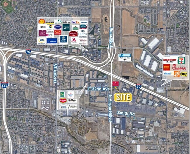
16911 E 32Nd Ave
Denver-Aurora-Centennial, CO
D I A Idea Inn
1821-28-0-02-008
DESC: LOT 2 TOG WITH LOT 3 EXC PART DEEDED TO CITY OF AURORA IN BOOK 5124 PAGE 818 AND EXC PARC FOR FASTRACKS (REC NO 2012000036758) BLK 1 D.I.A. IDEAL INN SUBD FILING NO 1
Commercialacreage
Adams
ARE
Colorado
08005C0043K
2,3
2024
1.12 AC
2025
East I-70/Montbello
008309
Denver
NEARBY LISTINGS FOR SALE OR LEASE
DEMOGRAPHICS near 16911 E 32Nd Ave
1 mile
3 mile
5 mile
2024 Total Population
206
102,351
232,604
2029 Population
214
104,067
236,342
Pop Growth 2024-2029
+ 3.88%
+ 1.68%
+ 1.61%
Average Age
34
34
35
2024 Total Households
32
31,754
76,898
HH Growth 2024-2029
+ 3.13%
+ 1.92%
+ 1.74%
Median Household Inc
$84,615
$72,522
$67,253
Avg Household Size
3.50
3.00
2.90
2024 Avg HH Vehicles
3.00
2.00
2.00
Median Home Value
$750,000
$357,148
$365,000
Median Year Built
1984
1995
1987
Nearby Places
Map Layers
Map Styles
 Street
 Aerial
Transit
 Traffic
 Biking
Places
Listings with unknown addresses are not visible on the map
- Restaurants
- Banks
- Shops
- Fitness
- Groceries
PUBLIC TRANSPORTATION
COMMUTER RAIL
40Th Ave & Airport Blvd - Gateway Park Station Track 2 (Union Station to Denver Airport Station - Regional Transportation District)
Drive
Walk
Distance
40Th Ave & Airport Blvd - Gateway Park Station Track 2 (Union Station to Denver Airport Station - Regional Transportation District)
4 min
1.6 mi
61St & Pena Station Track 2 (Union Station to Denver Airport Station - Regional Transportation District)
Drive
Walk
Distance
61St & Pena Station Track 2 (Union Station to Denver Airport Station - Regional Transportation District)
8 min
4.5 mi
AIRPORT
Denver International
Drive
Walk
Distance
Denver International
15 min
12.1 mi
Freight Ports
Tulsa Port Of Catoosa
Drive
Walk
Distance
Tulsa Port Of Catoosa
712 min
697.1 mi
SALE & LEASE HISTORY
LISTING DATE
SALE/LEASE

Sep 24, 2016
For Sale
May 10, 2022
For Sale
Nearby Properties
Address
Land Use
TOTAL SIZE
Lot Size
Zoning
Address
Land Use
TOTAL SIZE
Lot Size
Zoning
368,450 SF
48.59 AC
Address
Land Use
TOTAL SIZE
Lot Size
Zoning
353,829 SF
4.51 AC
Address
Land Use
TOTAL SIZE
Lot Size
Zoning
244,271 SF
15.30 AC
Address
Land Use
TOTAL SIZE
Lot Size
Zoning
87,346 SF
1.76 AC
RFBAD
Address
Land Use
TOTAL SIZE
Lot Size
Zoning
868,780 SF
105.02 AC
Address
Land Use
TOTAL SIZE
Lot Size
Zoning
876,549 SF
46.65 AC
Address
Land Use
TOTAL SIZE
Lot Size
Zoning
200,105 SF
34.54 AC
C-MU-20
Address
Land Use
TOTAL SIZE
Lot Size
Zoning
335,757 SF
36.88 AC
CMP-EI2
Address
Land Use
TOTAL SIZE
Lot Size
Zoning
704,978 SF
36.17 AC
Address
Land Use
TOTAL SIZE
Lot Size
Zoning
102,444 SF
3.76 AC
GTWY
Address
Land Use
TOTAL SIZE
Lot Size
Zoning
691,200 SF
38.09 AC
Address
Land Use
TOTAL SIZE
Lot Size
Zoning
273,184 SF
1.89 AC
Address
Land Use
TOTAL SIZE
Lot Size
Zoning
140.42 AC
Address
Land Use
TOTAL SIZE
Lot Size
Zoning
111,077 SF
3.06 AC
Address
Land Use
TOTAL SIZE
Lot Size
Zoning
550,031 SF
37.73 AC
Address
Land Use
TOTAL SIZE
Lot Size
Zoning
185,812 SF
20.93 AC
C-MU-20
Address
Land Use
TOTAL SIZE
Lot Size
Zoning
545,010 SF
35.35 AC
Address
Land Use
TOTAL SIZE
Lot Size
Zoning
512,720 SF
42.32 AC
Address
Land Use
TOTAL SIZE
Lot Size
Zoning
522,120 SF
27.70 AC
Address
Land Use
TOTAL SIZE
Lot Size
Zoning
500,358 SF
23.59 AC
Address
Land Use
TOTAL SIZE
Lot Size
Zoning
593,928 SF
32.25 AC
Address
Land Use
TOTAL SIZE
Lot Size
Zoning
548,510 SF
27.26 AC
Address
Land Use
TOTAL SIZE
Lot Size
Zoning
452,400 SF
20.99 AC
Address
Land Use
TOTAL SIZE
Lot Size
Zoning
432,600 SF
30.98 AC
Address
Land Use
TOTAL SIZE
Lot Size
Zoning
461,580 SF
23.56 AC
Address
Land Use
TOTAL SIZE
Lot Size
Zoning
419,630 SF
24.34 AC
Address
Land Use
TOTAL SIZE
Lot Size
Zoning
58,997 SF
2.05 AC
S-CC-5X
Address
Land Use
TOTAL SIZE
Lot Size
Zoning
410,000 SF
31.97 AC
Address
Land Use
TOTAL SIZE
Lot Size
Zoning
217,995 SF
12.31 AC
S-SU-D
Address
Land Use
TOTAL SIZE
Lot Size
Zoning
178,235 SF
1.38 AC
RFBAD
The World's #1 Commercial Real Estate Marketplace
Connect with us
© 2026 CoStar Group
The information above has been obtained from sources believed reliable. While we do not doubt its accuracy we have not verified it and make no guarantee, warranty or representation about it. It is your responsibility to independently confirm its accuracy and completeness. Any projections, opinions, assumptions, or estimates used are for example only and do not represent the current or future performance of the property. The value of this transaction to you depends on tax and other factors which should be evaluated by your tax, financial, and legal advisors. You and your advisors should conduct a careful, independent investigation of the property to determine to your satisfaction the suitability of the property for your needs.