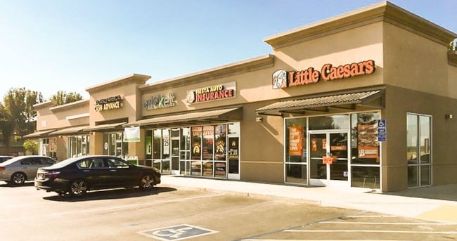
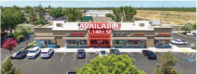
Property Record
170 N Madera Ave, Kerman, CA 93630


Property Detail
170 N Madera Ave
025-130-94
1.22 AC IN PAR 1 & 2 P/M NO 03-02 BK 63 PG 19-20
Restaurantbuilding
Fresno
AL20
California
B and X Area of moderate flood hazard, usually the area between the limits of the 100-year and 500-year floods.
1.22 AC
2025
W Outlying Fresno Cnty
2025
Fresno
004006
Fresno, CA
10,748 SF
NEARBY LISTINGS FOR SALE OR LEASE
DEMOGRAPHICS near 170 N Madera Ave
1 mile
3 mile
5 mile
2025 Total Population
9,689
18,716
20,937
2030 Population
9,953
19,083
21,239
Pop Growth 2025-2030
+ 2.72%
+ 1.96%
+ 1.44%
Average Age
35
35
35
2025 Total Households
2,771
5,208
5,876
HH Growth 2025-2030
+ 2.71%
+ 1.98%
+ 1.41%
Median Household Inc
$50,146
$60,021
$61,119
Avg Household Size
3.50
3.60
3.60
2025 Avg HH Vehicles
2.00
2.00
2.00
Median Home Value
$355,833
$375,493
$382,127
Median Year Built
1988
1993
1992
Nearby Places
Map Layers
Map Styles
 Street
 Aerial
Layers
 Traffic
 Biking
Places
Listings with unknown addresses are not visible on the map
- Restaurants
- Banks
- Shops
- Fitness
- Groceries
PUBLIC TRANSPORTATION
AIRPORT
Fresno Yosemite International
Drive
Walk
Distance
Fresno Yosemite International
27 min
22.0 mi
Freight Ports
Port of Redwood City
Drive
Walk
Distance
Port of Redwood City
1 min
129.9 mi
SALE & LEASE HISTORY
LISTING DATE
SALE/LEASE

Nov 21, 2017
For Lease
Jul 13, 2021
For Lease
Aug 21, 2020
For Lease
Nearby Properties
Address
Land Use
TOTAL SIZE
Lot Size
Zoning
Address
Land Use
TOTAL SIZE
Lot Size
Zoning
477,340 SF
21.45 AC
Address
Land Use
TOTAL SIZE
Lot Size
Zoning
151,227 SF
17.22 AC
C6
Address
Land Use
TOTAL SIZE
Lot Size
Zoning
29,746 SF
39.10 AC
AE20
Address
Land Use
TOTAL SIZE
Lot Size
Zoning
65,017 SF
4.38 AC
R2
Address
Land Use
TOTAL SIZE
Lot Size
Zoning
82,656 SF
6.76 AC
R2
Address
Land Use
TOTAL SIZE
Lot Size
Zoning
63,187 SF
3.87 AC
R3
Address
Land Use
TOTAL SIZE
Lot Size
Zoning
63,187 SF
3.90 AC
R3
Address
Land Use
TOTAL SIZE
Lot Size
Zoning
92,979 SF
5.73 AC
R1
Address
Land Use
TOTAL SIZE
Lot Size
Zoning
90,082 SF
9.12 AC
C2
Address
Land Use
TOTAL SIZE
Lot Size
Zoning
70,786 SF
5.46 AC
SDR2
Address
Land Use
TOTAL SIZE
Lot Size
Zoning
16,000 SF
2.08 AC
Address
Land Use
TOTAL SIZE
Lot Size
Zoning
28.36 AC
M2
Address
Land Use
TOTAL SIZE
Lot Size
Zoning
69,820 SF
19.72 AC
Address
Land Use
TOTAL SIZE
Lot Size
Zoning
16,834 SF
0.96 AC
CG
Address
Land Use
TOTAL SIZE
Lot Size
Zoning
18,340 SF
1.21 AC
CG
Address
Land Use
TOTAL SIZE
Lot Size
Zoning
64,484 SF
13.62 AC
M1
Address
Land Use
TOTAL SIZE
Lot Size
Zoning
129,750 SF
12.52 AC
M2
Address
Land Use
TOTAL SIZE
Lot Size
Zoning
13,225 SF
1.67 AC
C5
Address
Land Use
TOTAL SIZE
Lot Size
Zoning
99.62 AC
Address
Land Use
TOTAL SIZE
Lot Size
Zoning
166,410 SF
9.80 AC
M2
Address
Land Use
TOTAL SIZE
Lot Size
Zoning
35,160 SF
3.45 AC
RM
Address
Land Use
TOTAL SIZE
Lot Size
Zoning
31,484 SF
3.03 AC
R2
Address
Land Use
TOTAL SIZE
Lot Size
Zoning
15,447 SF
1.95 AC
Address
Land Use
TOTAL SIZE
Lot Size
Zoning
1,189 SF
29.71 AC
AE20
Address
Land Use
TOTAL SIZE
Lot Size
Zoning
1.02 AC
C5
Address
Land Use
TOTAL SIZE
Lot Size
Zoning
1,720 SF
20 AC
AE20
Address
Land Use
TOTAL SIZE
Lot Size
Zoning
5,161 SF
79.01 AC
AE20
Address
Land Use
TOTAL SIZE
Lot Size
Zoning
4,416 SF
80 AC
AE20
Address
Land Use
TOTAL SIZE
Lot Size
Zoning
10,186 SF
8.19 AC
R1
The World's #1 Commercial Real Estate Marketplace
Connect with us
© 2026 CoStar Group
The information above has been obtained from sources believed reliable. While we do not doubt its accuracy we have not verified it and make no guarantee, warranty or representation about it. It is your responsibility to independently confirm its accuracy and completeness. Any projections, opinions, assumptions, or estimates used are for example only and do not represent the current or future performance of the property. The value of this transaction to you depends on tax and other factors which should be evaluated by your tax, financial, and legal advisors. You and your advisors should conduct a careful, independent investigation of the property to determine to your satisfaction the suitability of the property for your needs.