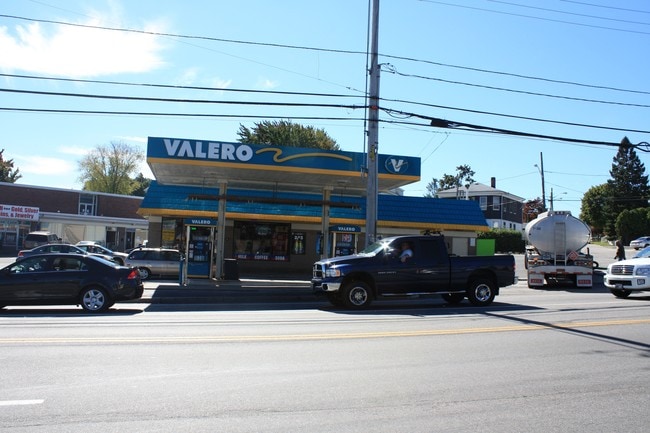
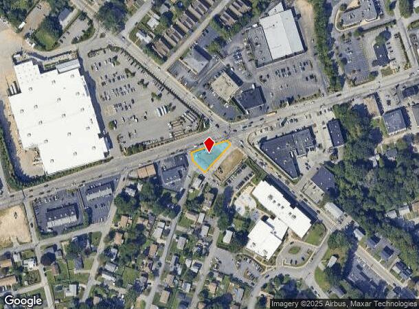
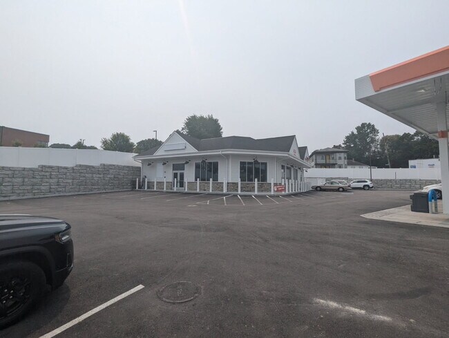
Property Record
1700 Mineral Spring Ave, North Providence, RI 02904
NEARBY LISTINGS FOR SALE OR LEASE
Property Detail
1700 Mineral Spring Ave
NPRO-000019-000000-000436
Providence
Commercialbuilding
Rhode Island
X
436
44007C0302H
0.55 AC
2025
North Providence
2025
Providence
011901
Providence-Warwick, RI-MA
4,278 SF
DEMOGRAPHICS near 1700 Mineral Spring Ave
1 Mile
3 Mile
5 Mile
2024 Total Population
18,120
140,885
354,739
2029 Population
18,091
139,880
351,189
Pop Growth 2024-2029
(0.16%)
(0.71%)
(1.00%)
Average Age
44
39
38
2024 Total Households
8,231
56,443
139,891
HH Growth 2024-2029
(0.16%)
(0.80%)
(0.95%)
Median Household Inc
$72,931
$66,891
$62,643
Avg Household Size
2.10
2.40
2.40
2024 Avg HH Vehicles
2.00
2.00
1.00
Median Home Value
$291,996
$283,615
$299,727
Median Year Built
1976
1956
1951
Nearby Places
Map Layers
Map Styles
 Street
 Aerial
- Restaurants
- Banks
- Shops
- Fitness
- Groceries
PUBLIC TRANSPORTATION
COMMUTER RAIL
Pawtucket/Central Falls (Foxboro Event Service - MBTA, Providence/Stoughton Line - MBTA)
DRIVE
WALK
Distance
Pawtucket/Central Falls (Foxboro Event Service - MBTA, Providence/Stoughton Line - MBTA)
6 min
3.6 mi
Providence (Providence/Stoughton Line - Massachusetts Bay Transportation Authority Commuter Rail (Purple Line))
DRIVE
WALK
Distance
Providence (Providence/Stoughton Line - Massachusetts Bay Transportation Authority Commuter Rail (Purple Line))
7 min
4.3 mi
AIRPORT
Rhode Island Tf Green International
DRIVE
WALK
Distance
Rhode Island Tf Green International
22 min
12.5 mi
Freight Ports
Port of Davisville, RI
DRIVE
WALK
Distance
Port of Davisville, RI
38 min
24.8 mi
Nearby Properties
Address
Land Use
TOTAL SIZE
Lot Size
Zoning
Address
Land Use
TOTAL SIZE
Lot Size
Zoning
162,816 SF
16.52 AC
D-1-10
Address
Land Use
TOTAL SIZE
Lot Size
Zoning
268,679 SF
8.64 AC
I-1-75
Address
Land Use
TOTAL SIZE
Lot Size
Zoning
12.90 AC
I-2
Address
Land Use
TOTAL SIZE
Lot Size
Zoning
20.05 AC
I-2
Address
Land Use
TOTAL SIZE
Lot Size
Zoning
254,488 SF
17.50 AC
IS
Address
Land Use
TOTAL SIZE
Lot Size
Zoning
28.92 AC
PS
Address
Land Use
TOTAL SIZE
Lot Size
Zoning
277,453 SF
1.83 AC
M-MU-9
Address
Land Use
TOTAL SIZE
Lot Size
Zoning
200.05 AC
RA40
Address
Land Use
TOTAL SIZE
Lot Size
Zoning
1,274 SF
99.20 AC
OS
Address
Land Use
TOTAL SIZE
Lot Size
Zoning
301,035 SF
21.69 AC
15
Address
Land Use
TOTAL SIZE
Lot Size
Zoning
38.50 AC
RA40
Address
Land Use
TOTAL SIZE
Lot Size
Zoning
159,028 SF
12.09 AC
RG
Address
Land Use
TOTAL SIZE
Lot Size
Zoning
161,714 SF
1.48 AC
M-MU-9
Address
Land Use
TOTAL SIZE
Lot Size
Zoning
3.88 AC
M-MU-7
Address
Land Use
TOTAL SIZE
Lot Size
Zoning
288,736 SF
11.99 AC
RG
Address
Land Use
TOTAL SIZE
Lot Size
Zoning
11.43 AC
I-2
Address
Land Use
TOTAL SIZE
Lot Size
Zoning
15.57 AC
M-MU-7
Address
Land Use
TOTAL SIZE
Lot Size
Zoning
252,597 SF
0.23 AC
D-1-10
Address
Land Use
TOTAL SIZE
Lot Size
Zoning
63.33 AC
OS
Address
Land Use
TOTAL SIZE
Lot Size
Zoning
8.96 AC
I-2
Address
Land Use
TOTAL SIZE
Lot Size
Zoning
237,440 SF
19.31 AC
IS
Address
Land Use
TOTAL SIZE
Lot Size
Zoning
175,231 SF
9.37 AC
Address
Land Use
TOTAL SIZE
Lot Size
Zoning
3.07 AC
M-MU-7
Address
Land Use
TOTAL SIZE
Lot Size
Zoning
96,300 SF
3.79 AC
RM
Address
Land Use
TOTAL SIZE
Lot Size
Zoning
4.45 AC
RM
Address
Land Use
TOTAL SIZE
Lot Size
Zoning
153,075 SF
I-1-75
Address
Land Use
TOTAL SIZE
Lot Size
Zoning
139,630 SF
5.24 AC
PS
Address
Land Use
TOTAL SIZE
Lot Size
Zoning
21.74 AC
I-2
Address
Land Use
TOTAL SIZE
Lot Size
Zoning
5.31 AC
C-3
Address
Land Use
TOTAL SIZE
Lot Size
Zoning
3.34 AC
C-2
The World's #1 Commercial Real Estate Marketplace
Connect with us
© 2025 CoStar Group
The information above has been obtained from sources believed reliable. While we do not doubt its accuracy we have not verified it and make no guarantee, warranty or representation about it. It is your responsibility to independently confirm its accuracy and completeness. Any projections, opinions, assumptions, or estimates used are for example only and do not represent the current or future performance of the property. The value of this transaction to you depends on tax and other factors which should be evaluated by your tax, financial, and legal advisors. You and your advisors should conduct a careful, independent investigation of the property to determine to your satisfaction the suitability of the property for your needs.