Property Record
1700 Shaw Ave, Cleveland, OH 44112


Current Lease Availabilities
NEARBY LISTINGS FOR SALE OR LEASE
Property Detail
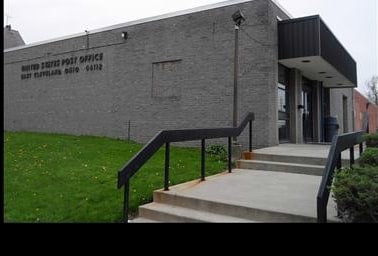
1700 Shaw Ave
Cleveland-Elyria, OH
Vac Finley Pl
673-05-037
3-4 BAKER HERRICK S/L5 TO 8 21 TO 35 VAC FINLEY PL & NP ALLEY LOT 16 & BLK B NP
Uspostalservice
Cuyahoga
X
Ohio
39035C0087E
16
2024
1.91 AC
2024
Euclid
199300
Cleveland
23,529 SF
DEMOGRAPHICS near 1700 Shaw Ave
1 Mile
3 Mile
5 Mile
2024 Total Population
19,948
137,864
272,826
2029 Population
20,598
137,350
269,382
Pop Growth 2024-2029
+ 3.26%
(0.37%)
(1.26%)
Average Age
43
40
41
2024 Total Households
9,480
62,683
121,625
HH Growth 2024-2029
+ 3.08%
(0.44%)
(1.32%)
Median Household Inc
$24,503
$34,271
$40,537
Avg Household Size
2.00
2.00
2.10
2024 Avg HH Vehicles
1.00
1.00
1.00
Median Home Value
$75,591
$99,979
$137,001
Median Year Built
1949
1948
1949
Nearby Places
Map Layers
Map Styles
 Street
 Aerial
- Restaurants
- Banks
- Shops
- Fitness
- Groceries
PUBLIC TRANSPORTATION
TRANSIT/SUBWAY
Louis Stokes Station At Windermere (Red Line - Greater Cleveland Regional Transit Authority Rapid Transit (The Rapid))
DRIVE
WALK
Distance
Louis Stokes Station At Windermere (Red Line - Greater Cleveland Regional Transit Authority Rapid Transit (The Rapid))
2 min
18 min
1.0 mi
COMMUTER RAIL
Cleveland Lakefront Station (Blue Line - Greater Cleveland Regional Transit Authority Rapid Transit (The Rapid), Green Line - Greater Cleveland Regional Transit Authority Rapid Transit (The Rapid))
DRIVE
WALK
Distance
Cleveland Lakefront Station (Blue Line - Greater Cleveland Regional Transit Authority Rapid Transit (The Rapid), Green Line - Greater Cleveland Regional Transit Authority Rapid Transit (The Rapid))
16 min
8.0 mi
AIRPORT
Cleveland-Hopkins International
DRIVE
WALK
Distance
Cleveland-Hopkins International
34 min
21.5 mi
Freight Ports
Port of Toledo
DRIVE
WALK
Distance
Port of Toledo
148 min
121.9 mi
Nearby Properties
Address
Land Use
TOTAL SIZE
Lot Size
Zoning
Address
Land Use
TOTAL SIZE
Lot Size
Zoning
1,211,519 SF
13.57 AC
GR
Address
Land Use
TOTAL SIZE
Lot Size
Zoning
2,064,168 SF
17.90 AC
GR
Address
Land Use
TOTAL SIZE
Lot Size
Zoning
63.59 AC
1F
Address
Land Use
TOTAL SIZE
Lot Size
Zoning
370,230 SF
4.08 AC
GR
Address
Land Use
TOTAL SIZE
Lot Size
Zoning
1,151,581 SF
10.13 AC
L1F
Address
Land Use
TOTAL SIZE
Lot Size
Zoning
500,042 SF
1.34 AC
1F
Address
Land Use
TOTAL SIZE
Lot Size
Zoning
595,671 SF
14.98 AC
MF3+
Address
Land Use
TOTAL SIZE
Lot Size
Zoning
707,658 SF
17.57 AC
2F
Address
Land Use
TOTAL SIZE
Lot Size
Zoning
243,720 SF
0.20 AC
GR
Address
Land Use
TOTAL SIZE
Lot Size
Zoning
435,964 SF
55.03 AC
1F
Address
Land Use
TOTAL SIZE
Lot Size
Zoning
395,625 SF
0.74 AC
Address
Land Use
TOTAL SIZE
Lot Size
Zoning
745,953 SF
14.34 AC
MF3+
Address
Land Use
TOTAL SIZE
Lot Size
Zoning
767,400 SF
0.27 AC
GR
Address
Land Use
TOTAL SIZE
Lot Size
Zoning
143,000 SF
2.68 AC
MF3+
Address
Land Use
TOTAL SIZE
Lot Size
Zoning
252,736 SF
3.71 AC
GR
Address
Land Use
TOTAL SIZE
Lot Size
Zoning
282,498 SF
0.71 AC
GR
Address
Land Use
TOTAL SIZE
Lot Size
Zoning
277,792 SF
1.65 AC
Address
Land Use
TOTAL SIZE
Lot Size
Zoning
147,851 SF
2.22 AC
MF3+
Address
Land Use
TOTAL SIZE
Lot Size
Zoning
228,057 SF
6.56 AC
MF3+
Address
Land Use
TOTAL SIZE
Lot Size
Zoning
257,048 SF
17.93 AC
S1
Address
Land Use
TOTAL SIZE
Lot Size
Zoning
440,004 SF
4.25 AC
S2
Address
Land Use
TOTAL SIZE
Lot Size
Zoning
112,657 SF
19.88 AC
U3
Address
Land Use
TOTAL SIZE
Lot Size
Zoning
36,098 SF
0.50 AC
GR
Address
Land Use
TOTAL SIZE
Lot Size
Zoning
413,626 SF
21.95 AC
S2
Address
Land Use
TOTAL SIZE
Lot Size
Zoning
572,307 SF
2.91 AC
GR
Address
Land Use
TOTAL SIZE
Lot Size
Zoning
88,946 SF
1.84 AC
MF3+
Address
Land Use
TOTAL SIZE
Lot Size
Zoning
129,725 SF
4.35 AC
MF3+
Address
Land Use
TOTAL SIZE
Lot Size
Zoning
88,405 SF
2.15 AC
MF3+
Address
Land Use
TOTAL SIZE
Lot Size
Zoning
126,670 SF
2.57 AC
MF3+
Address
Land Use
TOTAL SIZE
Lot Size
Zoning
160,171 SF
9.14 AC
MF3+
The World's #1 Commercial Real Estate Marketplace
Connect with us
© 2025 CoStar Group
The information above has been obtained from sources believed reliable. While we do not doubt its accuracy we have not verified it and make no guarantee, warranty or representation about it. It is your responsibility to independently confirm its accuracy and completeness. Any projections, opinions, assumptions, or estimates used are for example only and do not represent the current or future performance of the property. The value of this transaction to you depends on tax and other factors which should be evaluated by your tax, financial, and legal advisors. You and your advisors should conduct a careful, independent investigation of the property to determine to your satisfaction the suitability of the property for your needs.