Property Record
1701 N 13Th St, Rogers, AR 72756


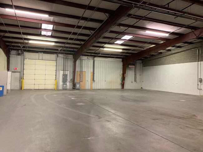

Property Detail
1701 N 13Th St
02-00758-000
PART OF THE SW 1/4 OF THE NW 1/4 OF SECTION 1, TOWNSHIP 19 NORTH, RANGE 30 WEST OF THE FIFTH PRINCIPAL MERIDIAN, BENTON COUNTY, ARKANSAS, BEING MORE PARTICULARLY DESCRIBED AS FOLLOWS: COMMENCING AT THE SW CORNER OF THE SW 1/4 OF THE NW 1/4 OF SECTION
Lightindustrial
Benton
B and X Area of moderate flood hazard, usually the area between the limits of the 100-year and 500-year floods.
Arkansas
2025
3.13 AC
2025
East Rogers
020301
Fayetteville/Springdale/Rogers
19,904 SF
Fayetteville-Springdale-Rogers, AR
NEARBY LISTINGS FOR SALE OR LEASE
-
-
-
Northeast of the N 13th Street & W Easy Street Int
Rogers, AR 72756
$14.00 SF/YR
4,716 - 51,699 SF
Industrial
-
-
-
-
-
View all Rogers listings for lease on LoopNet.com
DEMOGRAPHICS near 1701 N 13Th St
1 mile
3 mile
5 mile
2025 Total Population
8,168
49,329
99,500
2030 Population
8,907
54,147
110,030
Pop Growth 2025-2030
+ 9.05%
+ 9.77%
+ 10.58%
Average Age
36
37
37
2025 Total Households
3,039
18,101
37,377
HH Growth 2025-2030
+ 9.41%
+ 10.10%
+ 11.01%
Median Household Inc
$52,591
$70,742
$78,319
Avg Household Size
2.50
2.60
2.60
2025 Avg HH Vehicles
2.00
2.00
2.00
Median Home Value
$268,012
$284,197
$338,048
Median Year Built
1988
1990
1995
Nearby Places
Map Layers
Map Styles
 Street
 Aerial
Layers
 Traffic
 Biking
Places
Listings with unknown addresses are not visible on the map
- Restaurants
- Banks
- Shops
- Fitness
- Groceries
PUBLIC TRANSPORTATION
AIRPORT
Northwest Arkansas Ntl
Drive
Walk
Distance
Northwest Arkansas Ntl
32 min
15.6 mi
Freight Ports
Tulsa Port of Inola
Drive
Walk
Distance
Tulsa Port of Inola
118 min
100.9 mi
SALE & LEASE HISTORY
LISTING DATE
SALE/LEASE

Oct 29, 2018
For Lease
Aug 07, 2019
For Lease
Nearby Properties
Address
Land Use
TOTAL SIZE
Lot Size
Zoning
Address
Land Use
TOTAL SIZE
Lot Size
Zoning
117,522 SF
0.12 AC
Address
Land Use
TOTAL SIZE
Lot Size
Zoning
675,465 SF
37.34 AC
Address
Land Use
TOTAL SIZE
Lot Size
Zoning
746,783 SF
77.03 AC
Address
Land Use
TOTAL SIZE
Lot Size
Zoning
17,340 SF
14.15 AC
Address
Land Use
TOTAL SIZE
Lot Size
Zoning
542,873 SF
16.52 AC
Address
Land Use
TOTAL SIZE
Lot Size
Zoning
6,545 SF
29.19 AC
Address
Land Use
TOTAL SIZE
Lot Size
Zoning
97,660 SF
5.35 AC
Address
Land Use
TOTAL SIZE
Lot Size
Zoning
184,614 SF
5.04 AC
Address
Land Use
TOTAL SIZE
Lot Size
Zoning
573,476 SF
57.80 AC
Address
Land Use
TOTAL SIZE
Lot Size
Zoning
213,552 SF
20.20 AC
Address
Land Use
TOTAL SIZE
Lot Size
Zoning
249,843 SF
19.21 AC
Address
Land Use
TOTAL SIZE
Lot Size
Zoning
128,374 SF
10.94 AC
Address
Land Use
TOTAL SIZE
Lot Size
Zoning
214,791 SF
9.13 AC
Address
Land Use
TOTAL SIZE
Lot Size
Zoning
156,100 SF
7.89 AC
Address
Land Use
TOTAL SIZE
Lot Size
Zoning
274,312 SF
12.24 AC
Address
Land Use
TOTAL SIZE
Lot Size
Zoning
152,759 SF
12.01 AC
Address
Land Use
TOTAL SIZE
Lot Size
Zoning
114,250 SF
7.54 AC
Address
Land Use
TOTAL SIZE
Lot Size
Zoning
172,672 SF
11.09 AC
Address
Land Use
TOTAL SIZE
Lot Size
Zoning
117,522 SF
13.66 AC
Address
Land Use
TOTAL SIZE
Lot Size
Zoning
231,576 SF
15.18 AC
Address
Land Use
TOTAL SIZE
Lot Size
Zoning
102,477 SF
7.15 AC
Address
Land Use
TOTAL SIZE
Lot Size
Zoning
46,851 SF
4.28 AC
Address
Land Use
TOTAL SIZE
Lot Size
Zoning
94,189 SF
2.98 AC
Address
Land Use
TOTAL SIZE
Lot Size
Zoning
74,243 SF
14.03 AC
Address
Land Use
TOTAL SIZE
Lot Size
Zoning
205,851 SF
20.13 AC
Address
Land Use
TOTAL SIZE
Lot Size
Zoning
263,095 SF
13.17 AC
Address
Land Use
TOTAL SIZE
Lot Size
Zoning
402,500 SF
19.54 AC
Address
Land Use
TOTAL SIZE
Lot Size
Zoning
191,610 SF
43 AC
Address
Land Use
TOTAL SIZE
Lot Size
Zoning
112,935 SF
6.75 AC
Address
Land Use
TOTAL SIZE
Lot Size
Zoning
195,563 SF
15.49 AC
The World's #1 Commercial Real Estate Marketplace
Connect with us
© 2026 CoStar Group
The information above has been obtained from sources believed reliable. While we do not doubt its accuracy we have not verified it and make no guarantee, warranty or representation about it. It is your responsibility to independently confirm its accuracy and completeness. Any projections, opinions, assumptions, or estimates used are for example only and do not represent the current or future performance of the property. The value of this transaction to you depends on tax and other factors which should be evaluated by your tax, financial, and legal advisors. You and your advisors should conduct a careful, independent investigation of the property to determine to your satisfaction the suitability of the property for your needs.