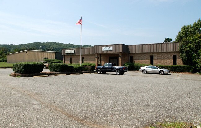
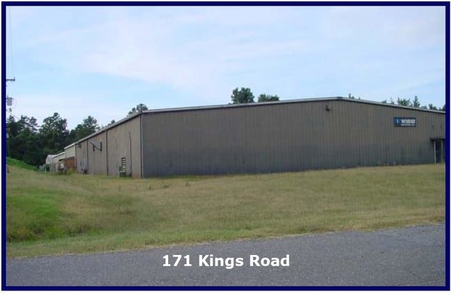
Property Record
171 Kings Rd, Kings Mountain, NC 28086


NEARBY LISTINGS FOR SALE OR LEASE
-
-
View all Kings Mountain listings for sale on LoopNet.com
Property Detail
171 Kings Rd
152521
Kings Mountain Industrial Park
Industrialgeneral
KINGS MTN IND PARK L 3 11 026 006 02 000
X
Gaston
3710350600J
North Carolina
2025
5.34 AC
2025
Gaston County
030801
Charlotte
5,000 SF
Charlotte-Concord-Gastonia, NC-SC
DEMOGRAPHICS near 171 Kings Rd
1 Mile
3 Mile
5 Mile
2024 Total Population
1,890
14,628
32,230
2029 Population
2,006
15,470
34,113
Pop Growth 2024-2029
+ 6.14%
+ 5.76%
+ 5.84%
Average Age
39
40
41
2024 Total Households
733
5,906
12,824
HH Growth 2024-2029
+ 6.28%
+ 5.82%
+ 5.93%
Median Household Inc
$51,396
$44,087
$48,816
Avg Household Size
2.50
2.40
2.50
2024 Avg HH Vehicles
2.00
2.00
2.00
Median Home Value
$117,391
$142,005
$160,591
Median Year Built
1974
1974
1977
Nearby Places
Map Layers
Map Styles
 Street
 Aerial
- Restaurants
- Banks
- Shops
- Fitness
- Groceries
PUBLIC TRANSPORTATION
AIRPORT
Charlotte/Douglas International
DRIVE
WALK
Distance
Charlotte/Douglas International
44 min
28.4 mi
Freight Ports
North Charleston Terminal
DRIVE
WALK
Distance
North Charleston Terminal
248 min
210.0 mi
Nearby Properties
Address
Land Use
TOTAL SIZE
Lot Size
Zoning
Address
Land Use
TOTAL SIZE
Lot Size
Zoning
163 AC
Address
Land Use
TOTAL SIZE
Lot Size
Zoning
536,116 SF
45.22 AC
HI
Address
Land Use
TOTAL SIZE
Lot Size
Zoning
469,498 SF
35.38 AC
STOR2
Address
Land Use
TOTAL SIZE
Lot Size
Zoning
12,183 SF
78.45 AC
INDS3
Address
Land Use
TOTAL SIZE
Lot Size
Zoning
Address
Land Use
TOTAL SIZE
Lot Size
Zoning
1,200 SF
487.79 AC
I2
Address
Land Use
TOTAL SIZE
Lot Size
Zoning
12.52 AC
RO
Address
Land Use
TOTAL SIZE
Lot Size
Zoning
19,360 SF
5.17 AC
INDS1
Address
Land Use
TOTAL SIZE
Lot Size
Zoning
32.87 AC
Address
Land Use
TOTAL SIZE
Lot Size
Zoning
32,880 SF
2.88 AC
R08
Address
Land Use
TOTAL SIZE
Lot Size
Zoning
4,935 SF
13.07 AC
LI
Address
Land Use
TOTAL SIZE
Lot Size
Zoning
149,927 SF
5 AC
LI
Address
Land Use
TOTAL SIZE
Lot Size
Zoning
111,034 SF
39.75 AC
OFF01
Address
Land Use
TOTAL SIZE
Lot Size
Zoning
9,968 SF
18.38 AC
PUB01
Address
Land Use
TOTAL SIZE
Lot Size
Zoning
32,926 SF
4.40 AC
RO
Address
Land Use
TOTAL SIZE
Lot Size
Zoning
902 SF
8.23 AC
APT01
Address
Land Use
TOTAL SIZE
Lot Size
Zoning
1,500 SF
10.02 AC
INDS1
Address
Land Use
TOTAL SIZE
Lot Size
Zoning
8,052 SF
1.94 AC
APT01
Address
Land Use
TOTAL SIZE
Lot Size
Zoning
233,000 SF
20.87 AC
INDS2
Address
Land Use
TOTAL SIZE
Lot Size
Zoning
1 SF
25.86 AC
GB
Address
Land Use
TOTAL SIZE
Lot Size
Zoning
2,700 SF
21.20 AC
GB
Address
Land Use
TOTAL SIZE
Lot Size
Zoning
5,291 SF
4 AC
RO
Address
Land Use
TOTAL SIZE
Lot Size
Zoning
187,920 SF
14.51 AC
LI
Address
Land Use
TOTAL SIZE
Lot Size
Zoning
48,324 SF
14.91 AC
LI
Address
Land Use
TOTAL SIZE
Lot Size
Zoning
22,012 SF
7.35 AC
LI
Address
Land Use
TOTAL SIZE
Lot Size
Zoning
62,799 SF
5.33 AC
R8
Address
Land Use
TOTAL SIZE
Lot Size
Zoning
2,132 SF
6.47 AC
APT01
Address
Land Use
TOTAL SIZE
Lot Size
Zoning
30,000 SF
10.67 AC
LI
Address
Land Use
TOTAL SIZE
Lot Size
Zoning
98,112 SF
6.50 AC
LI
Address
Land Use
TOTAL SIZE
Lot Size
Zoning
30,900 SF
48.82 AC
The World's #1 Commercial Real Estate Marketplace
Connect with us
© 2025 CoStar Group
The information above has been obtained from sources believed reliable. While we do not doubt its accuracy we have not verified it and make no guarantee, warranty or representation about it. It is your responsibility to independently confirm its accuracy and completeness. Any projections, opinions, assumptions, or estimates used are for example only and do not represent the current or future performance of the property. The value of this transaction to you depends on tax and other factors which should be evaluated by your tax, financial, and legal advisors. You and your advisors should conduct a careful, independent investigation of the property to determine to your satisfaction the suitability of the property for your needs.