Property Record
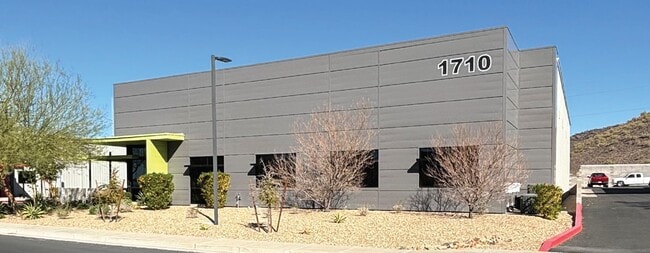
1710 E Robin Ln, Phoenix, AZ 85024


Property Detail
1710 E Robin Ln
213-32-413
TTR BUSINESS PARK MCR 1278-39
Warehouse
Maricopa
A1
Arizona
C and X Area of minimal flood hazard, usually depicted on FIRMs as above the 500-year flood level.
2
2025
0.65 AC
2025
Deer Vly/Pinnacle Pk
614700
Phoenix
10,022 SF
Phoenix-Mesa-Chandler, AZ
NEARBY LISTINGS FOR SALE OR LEASE
DEMOGRAPHICS near 1710 E Robin Ln
1 mile
3 mile
5 mile
2025 Total Population
4,023
55,734
206,176
2030 Population
4,115
57,571
213,449
Pop Growth 2025-2030
+ 2.29%
+ 3.30%
+ 3.53%
Average Age
37
40
39
2025 Total Households
1,413
22,825
84,073
HH Growth 2025-2030
+ 2.34%
+ 3.33%
+ 3.67%
Median Household Inc
$124,730
$97,716
$87,563
Avg Household Size
2.80
2.40
2.40
2025 Avg HH Vehicles
2.00
2.00
2.00
Median Home Value
$597,991
$455,221
$456,749
Median Year Built
1995
1994
1992
Nearby Places
Map Layers
Map Styles
 Street
 Aerial
Transit
 Traffic
 Biking
Places
Listings with unknown addresses are not visible on the map
- Restaurants
- Banks
- Shops
- Fitness
- Groceries
PUBLIC TRANSPORTATION
AIRPORT
Phoenix Sky Harbor International
Drive
Walk
Distance
Phoenix Sky Harbor International
35 min
23.7 mi
Phoenix-Mesa Gateway
Drive
Walk
Distance
Phoenix-Mesa Gateway
65 min
48.0 mi
SALE & LEASE HISTORY
LISTING DATE
SALE/LEASE

Mar 03, 2025
For Sale
Jan 19, 2017
For Sale
Nearby Properties
Address
Land Use
TOTAL SIZE
Lot Size
Zoning
Address
Land Use
TOTAL SIZE
Lot Size
Zoning
267,397 SF
108.70 AC
R-43AG
Address
Land Use
TOTAL SIZE
Lot Size
Zoning
429,168 SF
9.52 AC
R-8
Address
Land Use
TOTAL SIZE
Lot Size
Zoning
289,901 SF
12.30 AC
A-1
Address
Land Use
TOTAL SIZE
Lot Size
Zoning
336,494 SF
55.06 AC
R-43AG
Address
Land Use
TOTAL SIZE
Lot Size
Zoning
389,967 SF
245.48 AC
I-1
Address
Land Use
TOTAL SIZE
Lot Size
Zoning
8,469 SF
215.03 AC
Address
Land Use
TOTAL SIZE
Lot Size
Zoning
264,909 SF
219.16 AC
I-1
Address
Land Use
TOTAL SIZE
Lot Size
Zoning
338,640 SF
10.39 AC
R-4A
Address
Land Use
TOTAL SIZE
Lot Size
Zoning
312,070 SF
20.04 AC
A1
Address
Land Use
TOTAL SIZE
Lot Size
Zoning
242,144 SF
29.78 AC
RE-43
Address
Land Use
TOTAL SIZE
Lot Size
Zoning
291,059 SF
16.54 AC
I-1
Address
Land Use
TOTAL SIZE
Lot Size
Zoning
240.86 AC
IND.PK.
Address
Land Use
TOTAL SIZE
Lot Size
Zoning
355,606 SF
11.35 AC
C-C
Address
Land Use
TOTAL SIZE
Lot Size
Zoning
45,487 SF
117.90 AC
S1
Address
Land Use
TOTAL SIZE
Lot Size
Zoning
255,482 SF
15.30 AC
M-H
Address
Land Use
TOTAL SIZE
Lot Size
Zoning
240,311 SF
14.42 AC
R-43AG
Address
Land Use
TOTAL SIZE
Lot Size
Zoning
328 SF
96.24 AC
R-43AG
Address
Land Use
TOTAL SIZE
Lot Size
Zoning
63,192 SF
94.91 AC
RE43
Address
Land Use
TOTAL SIZE
Lot Size
Zoning
254,079 SF
21.23 AC
Address
Land Use
TOTAL SIZE
Lot Size
Zoning
205,996 SF
20.50 AC
PAD-MD
Address
Land Use
TOTAL SIZE
Lot Size
Zoning
286,650 SF
13.89 AC
M-L
Address
Land Use
TOTAL SIZE
Lot Size
Zoning
145,485 SF
34.32 AC
Address
Land Use
TOTAL SIZE
Lot Size
Zoning
631 SF
83.59 AC
R-43AG
Address
Land Use
TOTAL SIZE
Lot Size
Zoning
247.81 AC
RE-43
Address
Land Use
TOTAL SIZE
Lot Size
Zoning
149,760 SF
16.13 AC
C-C
Address
Land Use
TOTAL SIZE
Lot Size
Zoning
260,497 SF
9.34 AC
R-8
Address
Land Use
TOTAL SIZE
Lot Size
Zoning
97,372 SF
17.51 AC
C-C
Address
Land Use
TOTAL SIZE
Lot Size
Zoning
194,282 SF
16.79 AC
I-1
Address
Land Use
TOTAL SIZE
Lot Size
Zoning
1.87 AC
I-P
Address
Land Use
TOTAL SIZE
Lot Size
Zoning
171,942 SF
10.24 AC
I-1
The World's #1 Commercial Real Estate Marketplace
Connect with us
© 2026 CoStar Group
The information above has been obtained from sources believed reliable. While we do not doubt its accuracy we have not verified it and make no guarantee, warranty or representation about it. It is your responsibility to independently confirm its accuracy and completeness. Any projections, opinions, assumptions, or estimates used are for example only and do not represent the current or future performance of the property. The value of this transaction to you depends on tax and other factors which should be evaluated by your tax, financial, and legal advisors. You and your advisors should conduct a careful, independent investigation of the property to determine to your satisfaction the suitability of the property for your needs.